STS068-205-19
| NASA Photo ID | STS068-205-19 |
| Focal Length | 250mm |
| Date taken | 1994.10.10 |
| Time taken | 17:16:16 GMT |
Resolutions offered for this image:
3904 x 3904 pixels 639 x 639 pixels 5700 x 5900 pixels 500 x 518 pixels 640 x 480 pixels
3904 x 3904 pixels 639 x 639 pixels 5700 x 5900 pixels 500 x 518 pixels 640 x 480 pixels

Cloud masks available for this image:
Spacecraft nadir point: 31.5° N, 92.8° W
Photo center point: 30.0° N, 94.0° W
Photo center point by machine learning:
Photo center point: 30.0° N, 94.0° W
Photo center point by machine learning:
Nadir to Photo Center: Southwest
Spacecraft Altitude: 111 nautical miles (206km)
Country or Geographic Name: | USA-TEXAS |
Features: | BEAUMONT, PORT ARTHUR, ORANGE |
| Features Found Using Machine Learning: | |
Cloud Cover Percentage: | 0 (no clouds present) |
Sun Elevation Angle: | 51° |
Sun Azimuth: | 163° |
Camera: | Hasselblad |
Focal Length: | 250mm |
Camera Tilt: | 46 degrees |
Format: | 2443: Kodak Aerochrome 2443, color IR, thin base, EA-5 process thru June 1999, E-6 process afterward |
Film Exposure: | Normal |
| Additional Information | |
| Width | Height | Annotated | Cropped | Purpose | Links |
|---|---|---|---|---|---|
| 3904 pixels | 3904 pixels | No | No | Earth From Space collection | Download Image |
| 639 pixels | 639 pixels | No | No | Earth From Space collection | Download Image |
| 5700 pixels | 5900 pixels | No | No | Download Image | |
| 500 pixels | 518 pixels | No | No | Download Image | |
| 640 pixels | 480 pixels | No | No | Download Image |
Download Packaged File
Download a Google Earth KML for this Image
View photo footprint information
Download a GeoTIFF for this photo
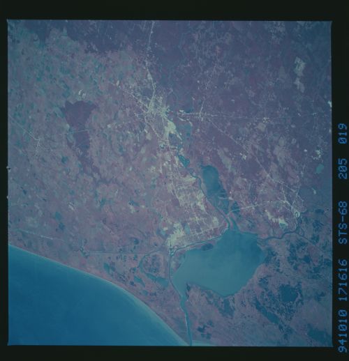
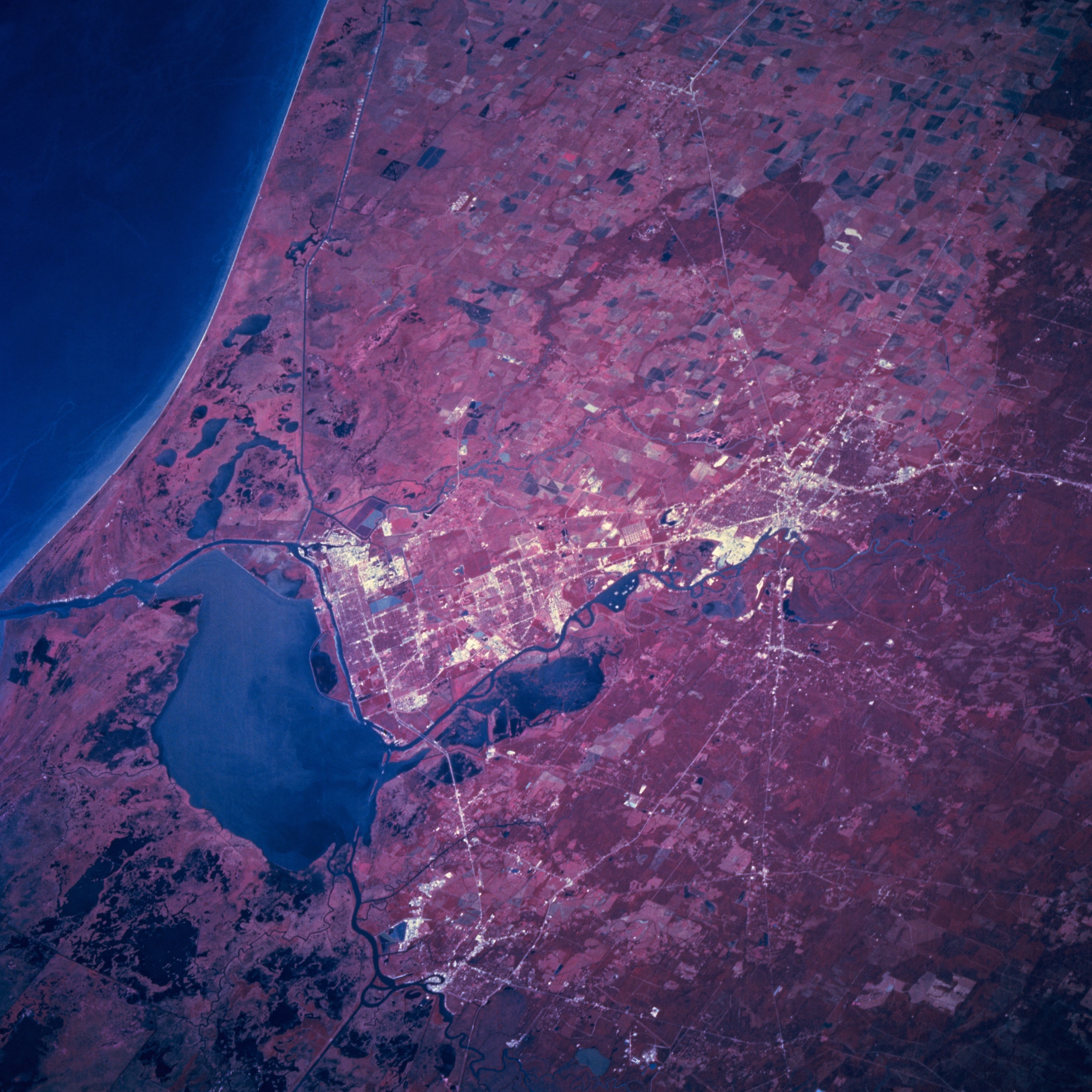
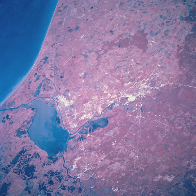
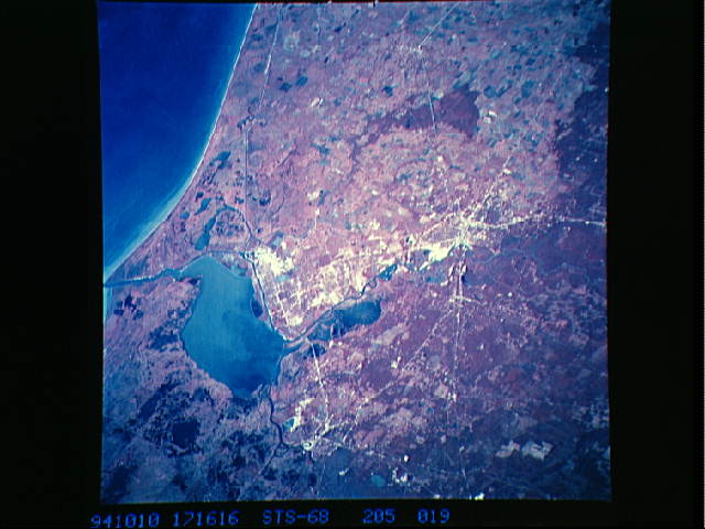
Image Caption: STS068-205-019 Beaumont and Port Arthur, Texas, U.S.A. October 1994
The flat coastal plain in southeast Texas is the setting for Beaumont, Port Arthur, and Orange. The color infrared film helps to discriminate such features as the swampy, coastal prairies; red concentrations of woodlands (primarily pine); and land-water boundaries. Visible are the Neches River and its floodplain immediately east of Beaumont and Port Arthur; part of the dredged Neches River (Beaumont Ship Channel) that allows oceangoing ships to navigate inland to the port of Beaumont; and part of the Intracoastal Waterway that roughly parallels the coastline. The lower Sabine River is apparent entering Sabine Lake, which connects with the Gulf of Mexico via a dredged channel. Discernible are some highways in Orange (bottom center of photograph), large rice fields west of Beaumont and Port Arthur, and Interstate Highway 10 traversing Beaumont (top to bottom of photograph).
The flat coastal plain in southeast Texas is the setting for Beaumont, Port Arthur, and Orange. The color infrared film helps to discriminate such features as the swampy, coastal prairies; red concentrations of woodlands (primarily pine); and land-water boundaries. Visible are the Neches River and its floodplain immediately east of Beaumont and Port Arthur; part of the dredged Neches River (Beaumont Ship Channel) that allows oceangoing ships to navigate inland to the port of Beaumont; and part of the Intracoastal Waterway that roughly parallels the coastline. The lower Sabine River is apparent entering Sabine Lake, which connects with the Gulf of Mexico via a dredged channel. Discernible are some highways in Orange (bottom center of photograph), large rice fields west of Beaumont and Port Arthur, and Interstate Highway 10 traversing Beaumont (top to bottom of photograph).
