STS068-202-90
| NASA Photo ID | STS068-202-90 |
| Focal Length | 250mm |
| Date taken | 1994.10.04 |
| Time taken | 17:49:27 GMT |
Resolutions offered for this image:
3904 x 3845 pixels 639 x 630 pixels 5700 x 5900 pixels 500 x 518 pixels 640 x 480 pixels
3904 x 3845 pixels 639 x 630 pixels 5700 x 5900 pixels 500 x 518 pixels 640 x 480 pixels
Cloud masks available for this image:
Spacecraft nadir point: 51.1° N, 96.2° W
Photo center point: 50.5° N, 97.0° W
Photo center point by machine learning:
Photo center point: 50.5° N, 97.0° W
Photo center point by machine learning:
Nadir to Photo Center: Southwest
Spacecraft Altitude: 116 nautical miles (215km)
Country or Geographic Name: | CANADA-M |
Features: | GIMLI, LAKE WINNIPEG, SEDIMENT |
| Features Found Using Machine Learning: | |
Cloud Cover Percentage: | 0 (no clouds present) |
Sun Elevation Angle: | 34° |
Sun Azimuth: | 173° |
Camera: | Hasselblad |
Focal Length: | 250mm |
Camera Tilt: | 27 degrees |
Format: | 2443: Kodak Aerochrome 2443, color IR, thin base, EA-5 process thru June 1999, E-6 process afterward |
Film Exposure: | Normal |
| Additional Information | |
| Width | Height | Annotated | Cropped | Purpose | Links |
|---|---|---|---|---|---|
| 3904 pixels | 3845 pixels | No | No | Earth From Space collection | Download Image |
| 639 pixels | 630 pixels | No | No | Earth From Space collection | Download Image |
| 5700 pixels | 5900 pixels | No | No | Download Image | |
| 500 pixels | 518 pixels | No | No | Download Image | |
| 640 pixels | 480 pixels | No | No | Download Image |
Download Packaged File
Download a Google Earth KML for this Image
View photo footprint information
Download a GeoTIFF for this photo
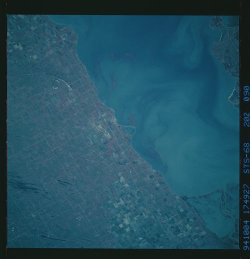
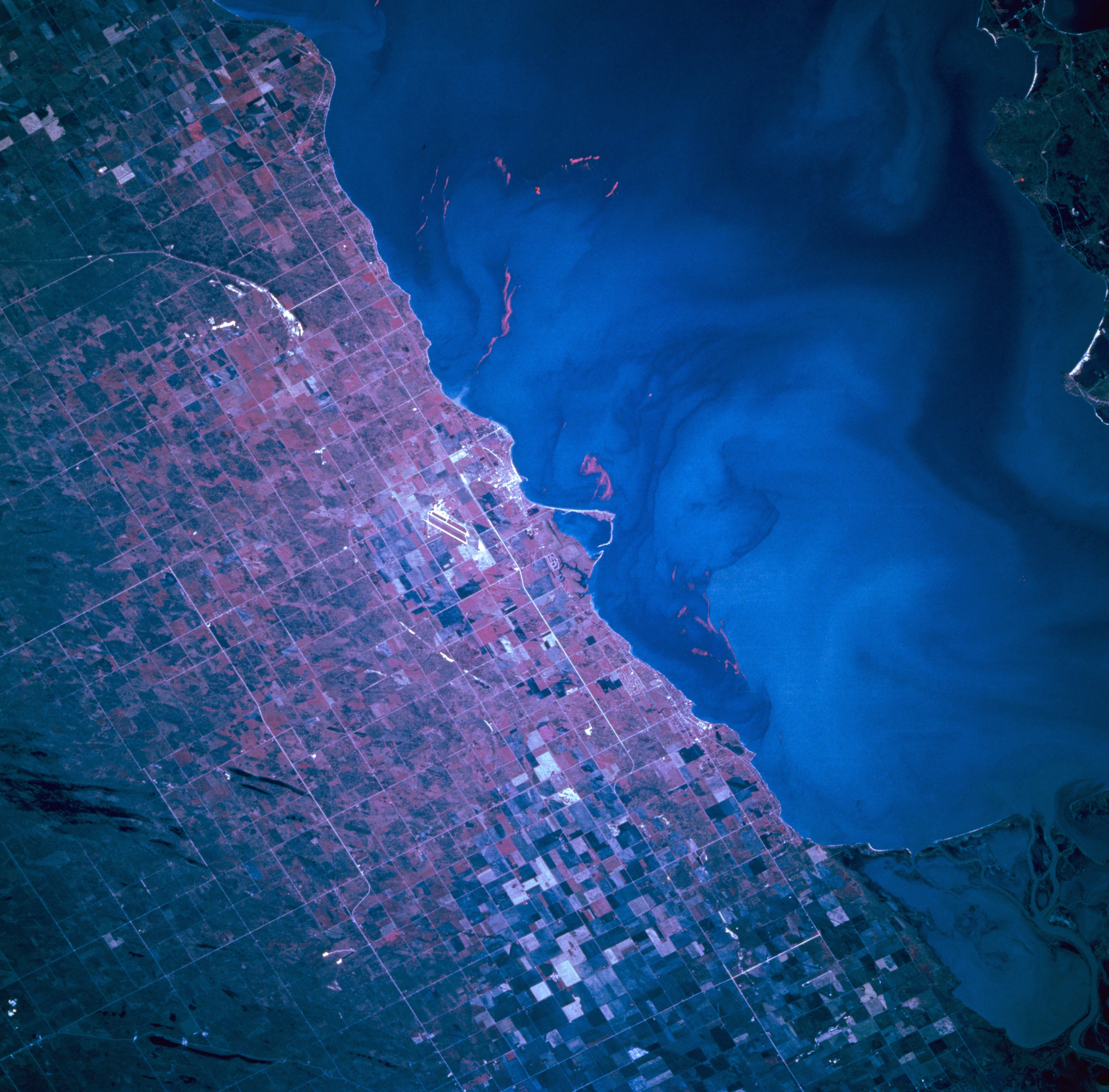
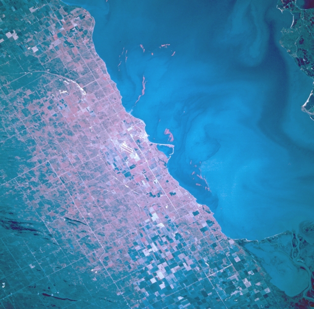
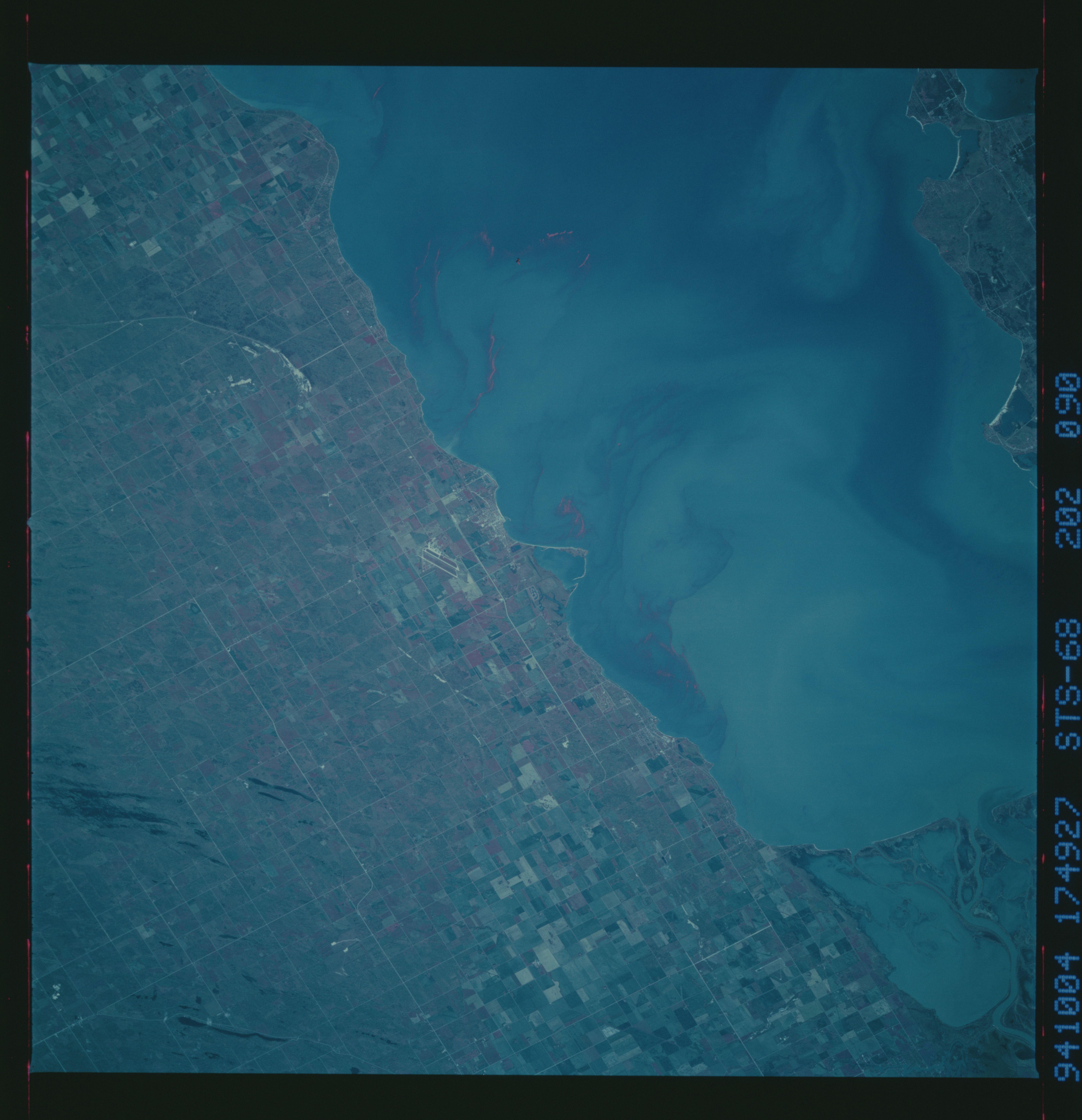
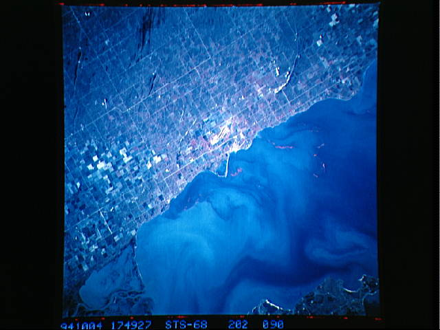
Image Caption: STS068-202-090 Gimli, Manitoba, Canada October 1994
The dual runways (paralleling linear feature) of Gimli Industrial Park Airport are visible slightly left of center and the resort community of Gimli (Rural Municipality) can be identified due east of the airport along the shoreline of Lake Winnipeg in this color infrared image. Gimli was founded by Icelanders and is home to a large fishing fleet. The fleet of over 150 vessels is based in the man-made harbor visible in the center of the photograph. Seagrams Corporation has a one million square foot distilling plant in the industrial park. It is visible to the right of the runways. Notice the definite gridded land use pattern that prevails throughout the entire region. Even the cultivated field patterns (upper left and lower center) are superimposed over the township and homestead survey pattern that is used in the prairie provinces of Canada. This particular scene only shows the extreme southwestern coastline off a much larger Lake Winnipeg. The lighter colored swirls in the water are actually sediment plumes. Part of the marshy delta, found at the southern end of Lake Winnipeg, that has been created by the north flowing Red River is visible in the lower right corner of the picture.
The dual runways (paralleling linear feature) of Gimli Industrial Park Airport are visible slightly left of center and the resort community of Gimli (Rural Municipality) can be identified due east of the airport along the shoreline of Lake Winnipeg in this color infrared image. Gimli was founded by Icelanders and is home to a large fishing fleet. The fleet of over 150 vessels is based in the man-made harbor visible in the center of the photograph. Seagrams Corporation has a one million square foot distilling plant in the industrial park. It is visible to the right of the runways. Notice the definite gridded land use pattern that prevails throughout the entire region. Even the cultivated field patterns (upper left and lower center) are superimposed over the township and homestead survey pattern that is used in the prairie provinces of Canada. This particular scene only shows the extreme southwestern coastline off a much larger Lake Winnipeg. The lighter colored swirls in the water are actually sediment plumes. Part of the marshy delta, found at the southern end of Lake Winnipeg, that has been created by the north flowing Red River is visible in the lower right corner of the picture.
