STS068-202-31
| NASA Photo ID | STS068-202-31 |
| Focal Length | 250mm |
| Date taken | 1994.10.04 |
| Time taken | 06:16:56 GMT |
Resolutions offered for this image:
4039 x 4052 pixels 637 x 639 pixels 5700 x 5900 pixels 500 x 518 pixels 640 x 480 pixels 524 x 519 pixels
4039 x 4052 pixels 637 x 639 pixels 5700 x 5900 pixels 500 x 518 pixels 640 x 480 pixels 524 x 519 pixels


Cloud masks available for this image:
Spacecraft nadir point: 3.6° S, 135.3° E
Photo center point: 3.5° S, 134.5° E
Photo center point by machine learning:
Photo center point: 3.5° S, 134.5° E
Photo center point by machine learning:
Nadir to Photo Center: West
Spacecraft Altitude: 118 nautical miles (219km)
Country or Geographic Name: | INDONESIA-WNG |
Features: | NEAR NABIRE |
| Features Found Using Machine Learning: | |
Cloud Cover Percentage: | 10 (1-10)% |
Sun Elevation Angle: | 38° |
Sun Azimuth: | 267° |
Camera: | Hasselblad |
Focal Length: | 250mm |
Camera Tilt: | 22 degrees |
Format: | 2443: Kodak Aerochrome 2443, color IR, thin base, EA-5 process thru June 1999, E-6 process afterward |
Film Exposure: | Normal |
| Additional Information | |
| Width | Height | Annotated | Cropped | Purpose | Links |
|---|---|---|---|---|---|
| 4039 pixels | 4052 pixels | No | No | Earth From Space collection | Download Image |
| 637 pixels | 639 pixels | No | No | Earth From Space collection | Download Image |
| 5700 pixels | 5900 pixels | No | No | Download Image | |
| 500 pixels | 518 pixels | No | No | Download Image | |
| 640 pixels | 480 pixels | No | No | Download Image | |
| 524 pixels | 519 pixels | Download Image |
Download Packaged File
Download a Google Earth KML for this Image
View photo footprint information
Download a GeoTIFF for this photo
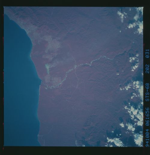
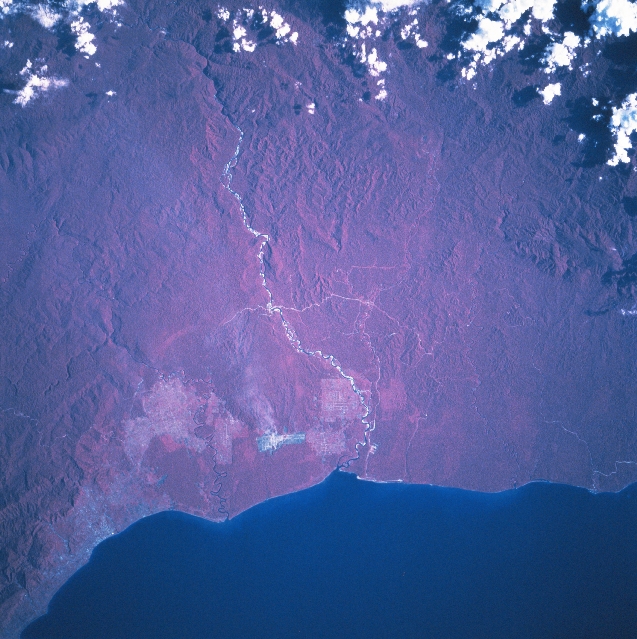
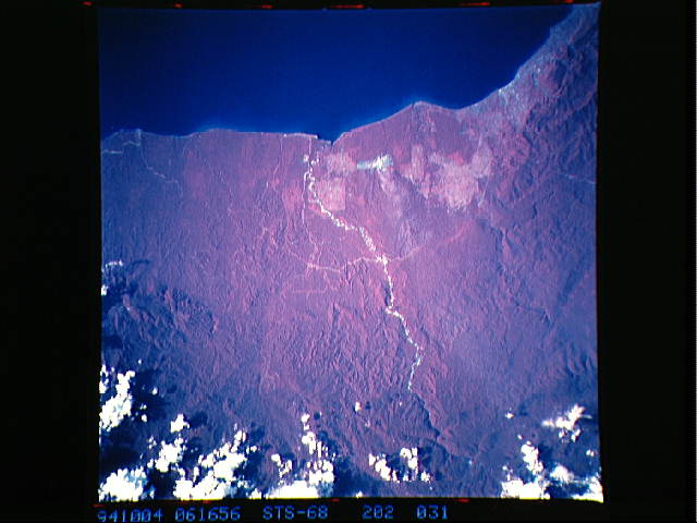
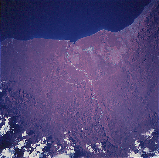
Image Caption: STS068-202-031 Irian Jaya, Indonesia October 1994
The color infrared image (where green vegetation is portrayed as reddish hues) helps to accentuate the dense jungle canopy that covers most of the landscape of Irian Jaya, the easternmost state of Indonesia. Irian Jaya shares the western half of the world's second largest island, New Guinea. The few exceptions to the otherwise uniform-looking tropical rainforest are the pinkish-looking areas near the coast where the rainforests have been replaced by agricultural sites. This particular section of the north coast is located along the southern extension of the Gulf of Cenderawasin. Nabire, a small port city, is visible near the lower left corner of the image. The linear feature with the highly reflective (whitish), intermittent surfaces, extending generally north to south, is the Wanggar River. The river disappears into a deep gorge near the upper edge of the image. Rugged, mountainous terrain can be discriminated in spite of the dense rainforest foliage. The angular feature near the coast and east of the river is an area where development is taking place. A few roads (light-colored lines) are visible as they cut through the forested coastal plain. STS068-202-032 provides overlapping coverage of the area northeast of this scene.
The color infrared image (where green vegetation is portrayed as reddish hues) helps to accentuate the dense jungle canopy that covers most of the landscape of Irian Jaya, the easternmost state of Indonesia. Irian Jaya shares the western half of the world's second largest island, New Guinea. The few exceptions to the otherwise uniform-looking tropical rainforest are the pinkish-looking areas near the coast where the rainforests have been replaced by agricultural sites. This particular section of the north coast is located along the southern extension of the Gulf of Cenderawasin. Nabire, a small port city, is visible near the lower left corner of the image. The linear feature with the highly reflective (whitish), intermittent surfaces, extending generally north to south, is the Wanggar River. The river disappears into a deep gorge near the upper edge of the image. Rugged, mountainous terrain can be discriminated in spite of the dense rainforest foliage. The angular feature near the coast and east of the river is an area where development is taking place. A few roads (light-colored lines) are visible as they cut through the forested coastal plain. STS068-202-032 provides overlapping coverage of the area northeast of this scene.
