STS068-201-65
| NASA Photo ID | STS068-201-65 |
| Focal Length | 250mm |
| Date taken | 1994.10.03 |
| Time taken | 18:10:56 GMT |
Resolutions offered for this image:
3869 x 3857 pixels 639 x 638 pixels 5700 x 5900 pixels 500 x 518 pixels 640 x 480 pixels
3869 x 3857 pixels 639 x 638 pixels 5700 x 5900 pixels 500 x 518 pixels 640 x 480 pixels
Cloud masks available for this image:
Spacecraft nadir point: 46.0° N, 84.6° W
Photo center point: 45.5° N, 85.0° W
Photo center point by machine learning:
Photo center point: 45.5° N, 85.0° W
Photo center point by machine learning:
Nadir to Photo Center: Southwest
Spacecraft Altitude: 117 nautical miles (217km)
Country or Geographic Name: | USA-MICHIGAN |
Features: | NEAR LITTLE TRAVERSE BAY |
| Features Found Using Machine Learning: | |
Cloud Cover Percentage: | 5 (1-10)% |
Sun Elevation Angle: | 39° |
Sun Azimuth: | 194° |
Camera: | Hasselblad |
Focal Length: | 250mm |
Camera Tilt: | 18 degrees |
Format: | 2443: Kodak Aerochrome 2443, color IR, thin base, EA-5 process thru June 1999, E-6 process afterward |
Film Exposure: | Normal |
| Additional Information | |
| Width | Height | Annotated | Cropped | Purpose | Links |
|---|---|---|---|---|---|
| 3869 pixels | 3857 pixels | No | No | Earth From Space collection | Download Image |
| 639 pixels | 638 pixels | No | No | Earth From Space collection | Download Image |
| 5700 pixels | 5900 pixels | No | No | Download Image | |
| 500 pixels | 518 pixels | No | No | Download Image | |
| 640 pixels | 480 pixels | No | No | Download Image |
Download Packaged File
Download a Google Earth KML for this Image
View photo footprint information
Download a GeoTIFF for this photo
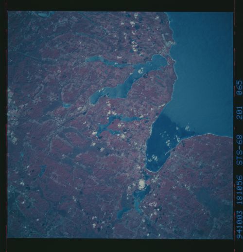
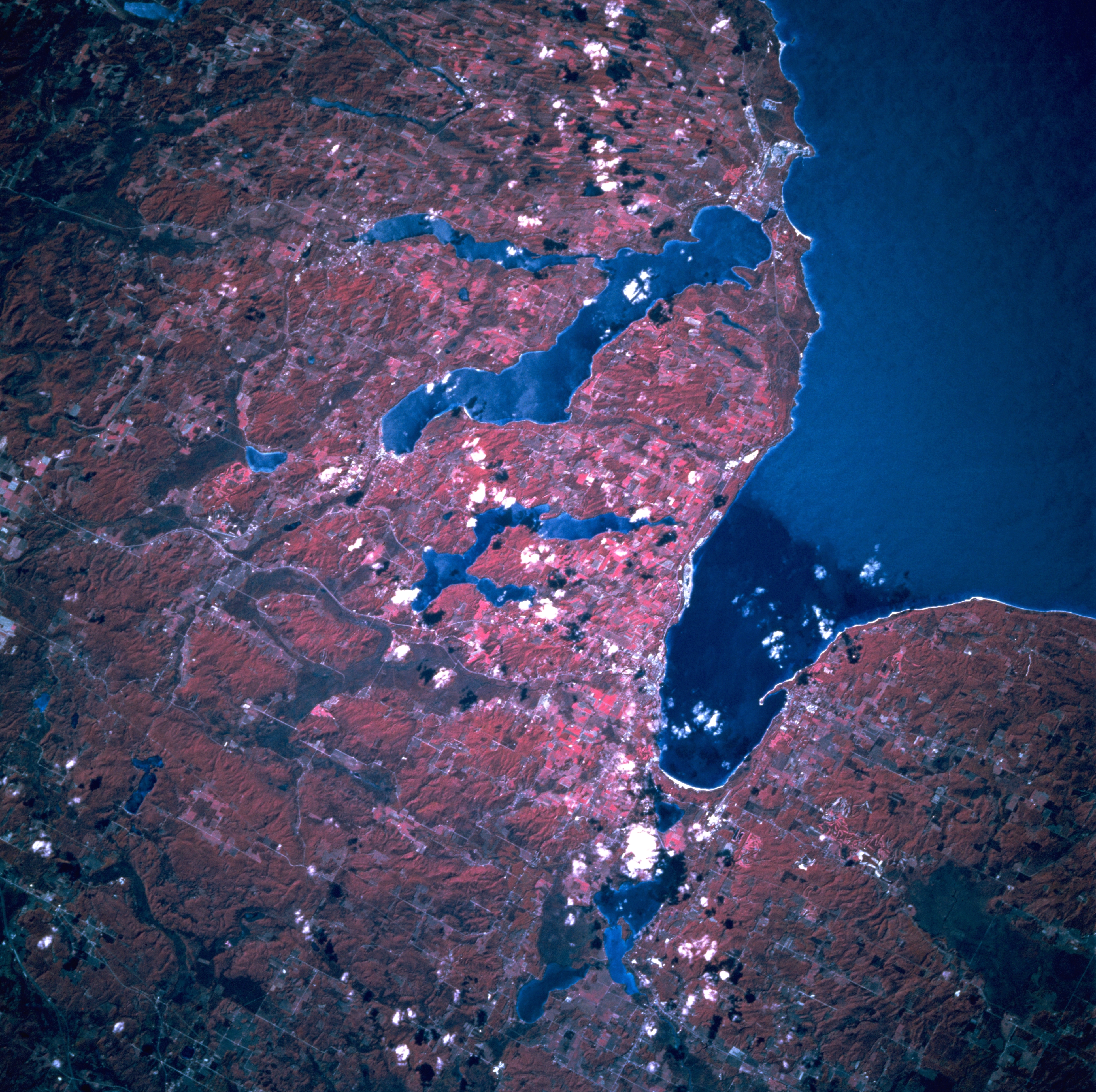
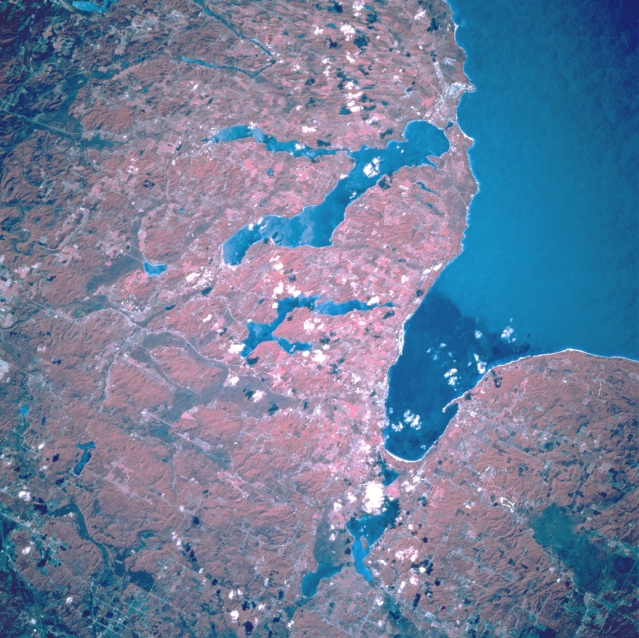
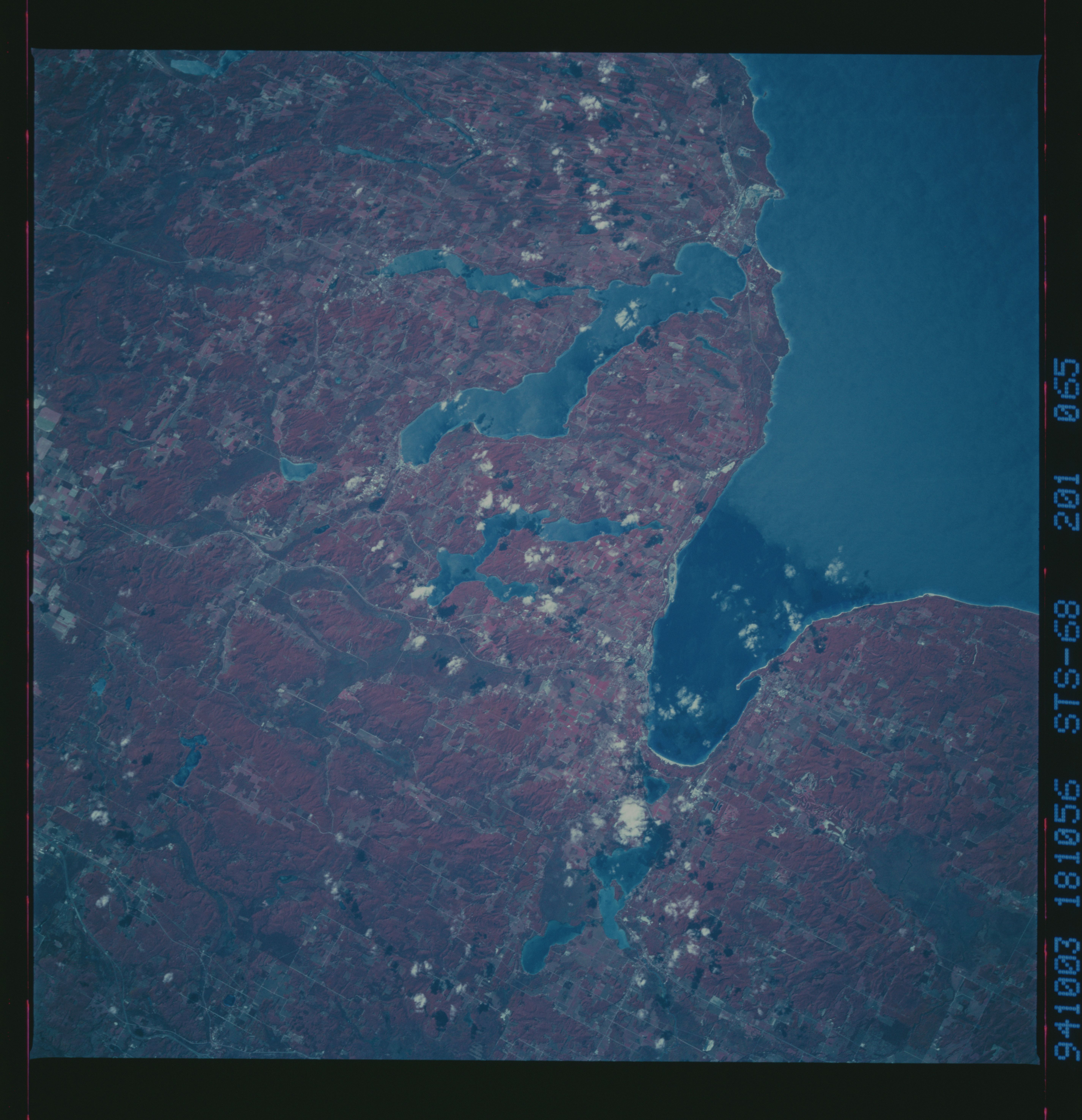
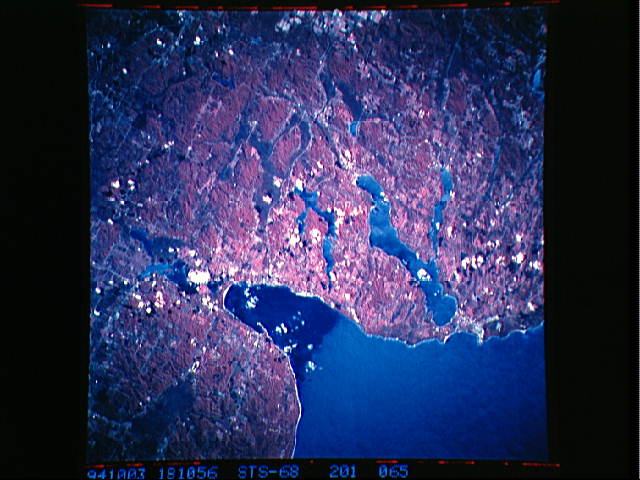
Image Caption: STS068-201-065 Little Traverse Bay and Lake Charlevoix, Michigan, U.S.A. October 1994
The lakes, forests, and agricultural lands surrounding Little Traverse Bay are featured in this southwest-looking, low-oblique, colored infrared photograph. Walloon Lake (center of photograph), Crooked Lake (bottom center), and large Lake Charlevoix lie south of Little Traverse Bay. Lake Michigan covers the upper right and right center of the photograph. Small Charlevoix, a summer resort area and winter sports center, is situated on the narrow spit of land between Lake Michigan and Lake Charlevoix. This portion of Michigan has dairying, agriculture, lumber mills, fisheries, and many recreational facilities.
The lakes, forests, and agricultural lands surrounding Little Traverse Bay are featured in this southwest-looking, low-oblique, colored infrared photograph. Walloon Lake (center of photograph), Crooked Lake (bottom center), and large Lake Charlevoix lie south of Little Traverse Bay. Lake Michigan covers the upper right and right center of the photograph. Small Charlevoix, a summer resort area and winter sports center, is situated on the narrow spit of land between Lake Michigan and Lake Charlevoix. This portion of Michigan has dairying, agriculture, lumber mills, fisheries, and many recreational facilities.
