STS068-201-64
| NASA Photo ID | STS068-201-64 |
| Focal Length | 250mm |
| Date taken | 1994.10.03 |
| Time taken | 18:10:52 GMT |
Resolutions offered for this image:
3904 x 3845 pixels 639 x 630 pixels 5700 x 5900 pixels 500 x 518 pixels 640 x 480 pixels
3904 x 3845 pixels 639 x 630 pixels 5700 x 5900 pixels 500 x 518 pixels 640 x 480 pixels

Cloud masks available for this image:
Spacecraft nadir point: 46.2° N, 84.9° W
Photo center point: 45.5° N, 85.0° W
Photo center point by machine learning:
Photo center point: 45.5° N, 85.0° W
Photo center point by machine learning:
Nadir to Photo Center: South
Spacecraft Altitude: 117 nautical miles (217km)
Country or Geographic Name: | USA-MICHIGAN |
Features: | NEAR LITTLE TRAVERSE BAY |
| Features Found Using Machine Learning: | |
Cloud Cover Percentage: | 5 (1-10)% |
Sun Elevation Angle: | 39° |
Sun Azimuth: | 194° |
Camera: | Hasselblad |
Focal Length: | 250mm |
Camera Tilt: | 20 degrees |
Format: | 2443: Kodak Aerochrome 2443, color IR, thin base, EA-5 process thru June 1999, E-6 process afterward |
Film Exposure: | Normal |
| Additional Information | |
| Width | Height | Annotated | Cropped | Purpose | Links |
|---|---|---|---|---|---|
| 3904 pixels | 3845 pixels | No | No | Earth From Space collection | Download Image |
| 639 pixels | 630 pixels | No | No | Earth From Space collection | Download Image |
| 5700 pixels | 5900 pixels | No | No | Download Image | |
| 500 pixels | 518 pixels | No | No | Download Image | |
| 640 pixels | 480 pixels | No | No | Download Image |
Download Packaged File
Download a Google Earth KML for this Image
View photo footprint information
Download a GeoTIFF for this photo
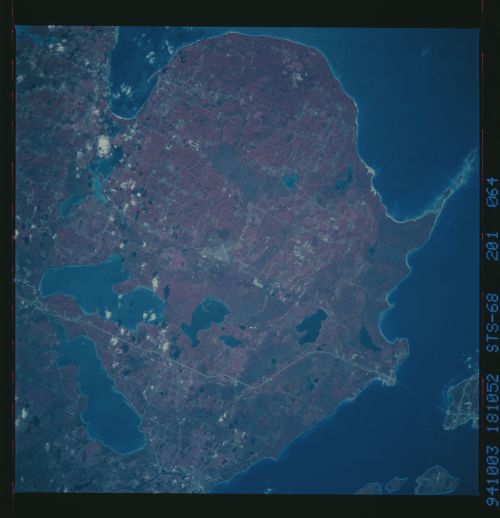
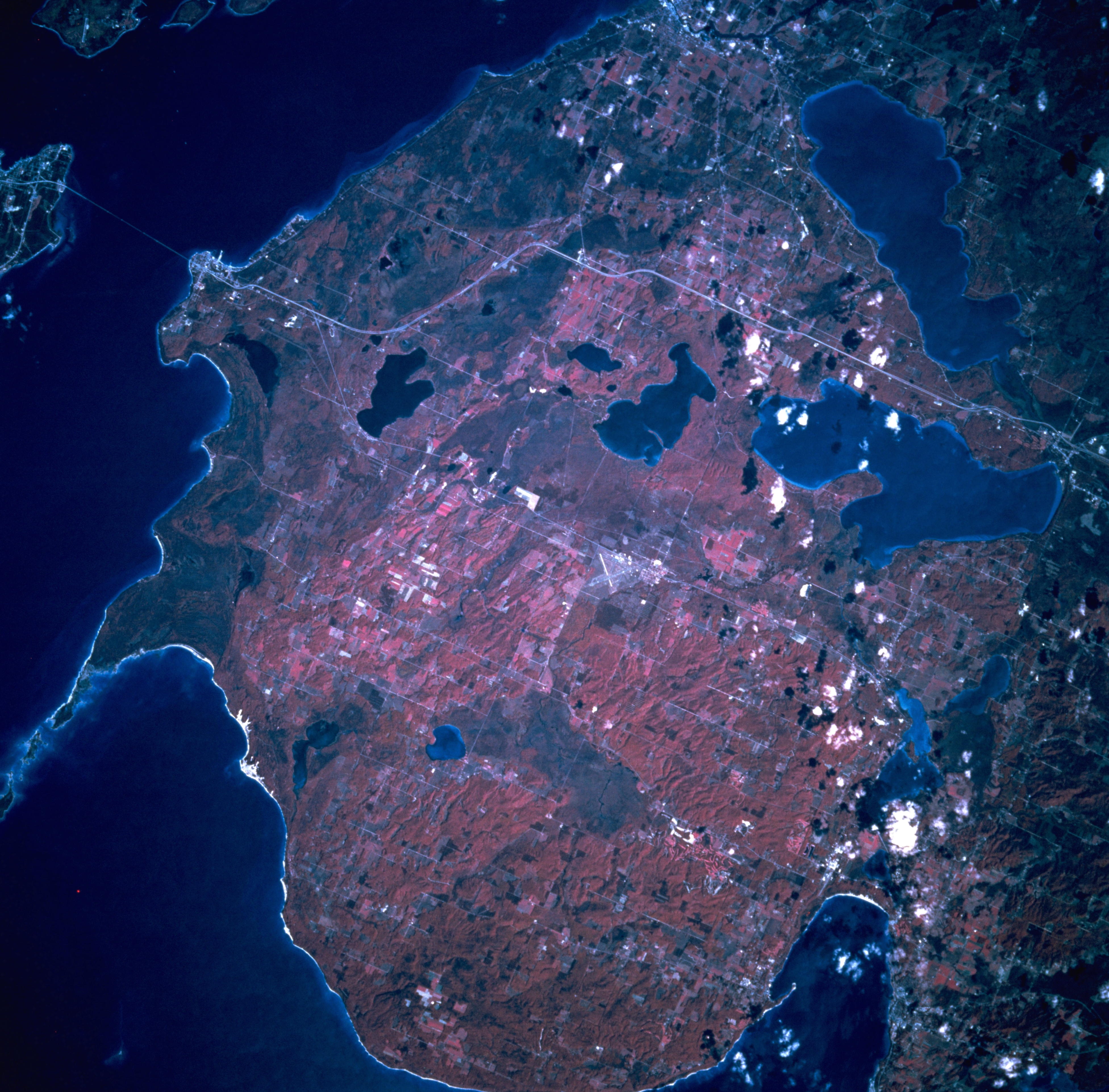
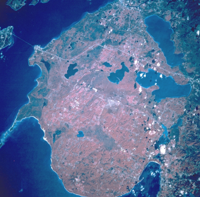
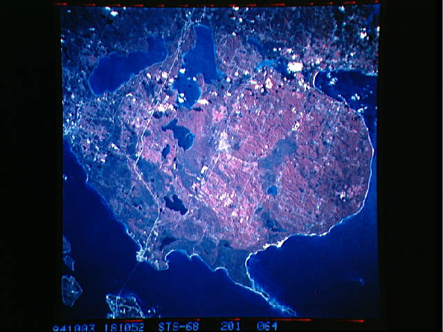
Image Caption: STS068-201-064 Northern Michigan, U.S.A. October 1994
This striking color infrared, northeast-looking, low-oblique photograph features the forests and lakes of northern Michigan from the Straits of Mackinac south to Mackinaw City, a popular year-round vacation and recreational area. Interstate Highway 75 traverses southward from Mackinaw City to Indian River (just above right center). Three large recreational lakes are visible--Mullett Lake east of Interstate Highway 75; larger Burt Lake west of Interstate Highway 75; and to the north, smallest Douglas Lake. Little Traverse Bay lies southwest of the lakes. Waugoshance Point is discernible just below left center of the photograph.
This striking color infrared, northeast-looking, low-oblique photograph features the forests and lakes of northern Michigan from the Straits of Mackinac south to Mackinaw City, a popular year-round vacation and recreational area. Interstate Highway 75 traverses southward from Mackinaw City to Indian River (just above right center). Three large recreational lakes are visible--Mullett Lake east of Interstate Highway 75; larger Burt Lake west of Interstate Highway 75; and to the north, smallest Douglas Lake. Little Traverse Bay lies southwest of the lakes. Waugoshance Point is discernible just below left center of the photograph.
