STS068-174-153
| NASA Photo ID | STS068-174-153 |
| Focal Length | 250mm |
| Date taken | 1994.10.06 |
| Time taken | 18:39:36 GMT |

Cloud masks available for this image:
Spacecraft nadir point: 48.7° N, 114.6° W
Photo center point: 46.5° N, 117.0° W
Photo center point by machine learning:
Photo center point: 46.5° N, 117.0° W
Photo center point by machine learning:
Nadir to Photo Center: Southwest
Spacecraft Altitude: 115 nautical miles (213km)
Country or Geographic Name: | USA-WASHINGTON |
Features: | SNAKE R, PULLMAN AREA |
| Features Found Using Machine Learning: | |
Cloud Cover Percentage: | 0 (no clouds present) |
Sun Elevation Angle: | 35° |
Sun Azimuth: | 166° |
Camera: | Linhof |
Focal Length: | 250mm |
Camera Tilt: | Low Oblique |
Format: | 5048: Kodak, natural color positive, Lumiere 100x/5048, ASA 100x, standard base |
Film Exposure: | Normal |
| Additional Information | |
| Width | Height | Annotated | Cropped | Purpose | Links |
|---|---|---|---|---|---|
| 5184 pixels | 4096 pixels | No | No | Earth From Space collection | Download Image |
| 640 pixels | 505 pixels | No | No | Earth From Space collection | Download Image |
| 640 pixels | 480 pixels | No | No | ISD 1 | Download Image |
Download Packaged File
Download a Google Earth KML for this Image
View photo footprint information
Download a GeoTIFF for this photo
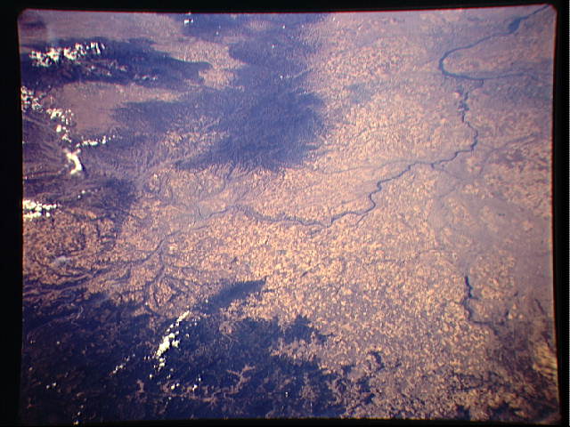
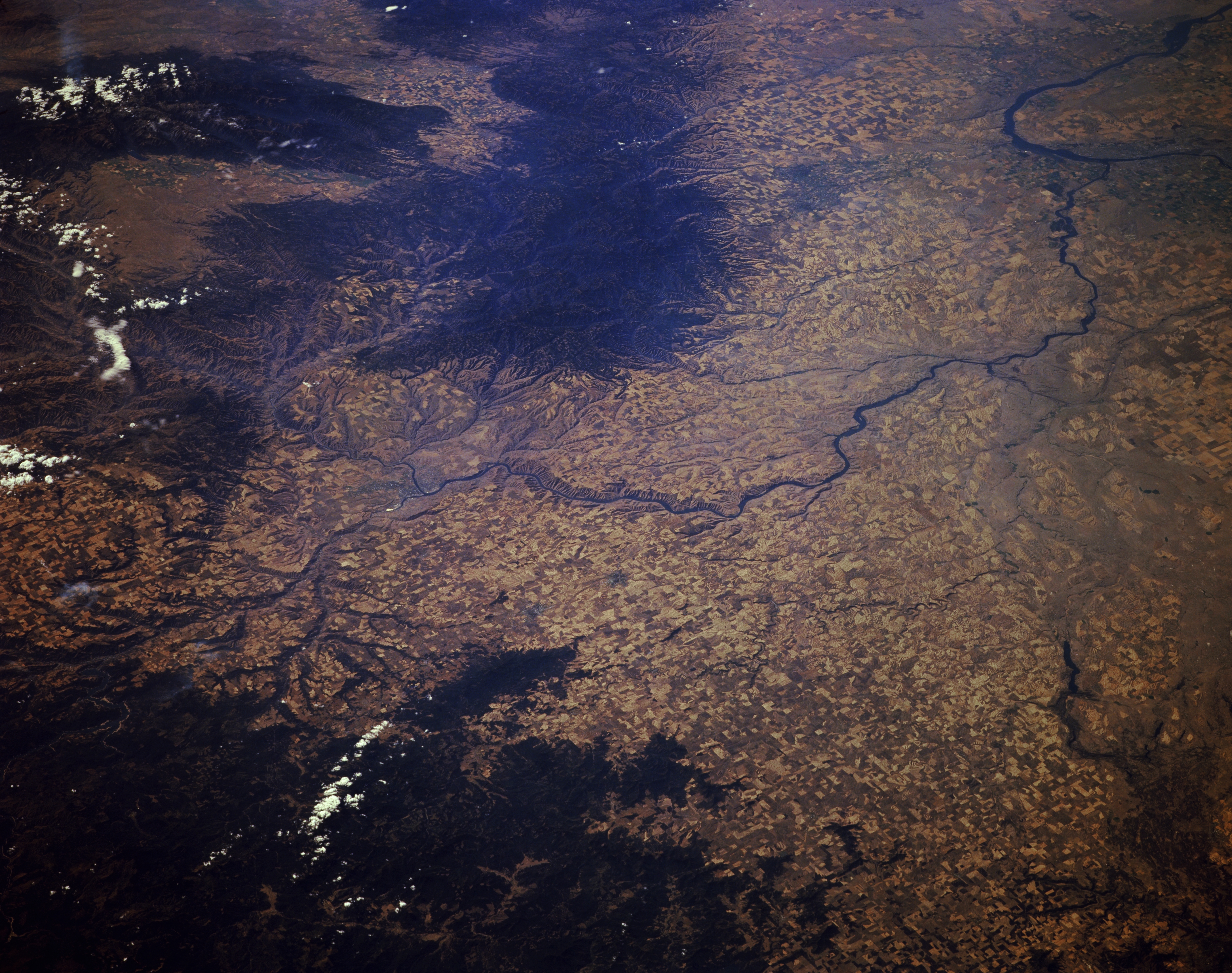
Image Caption: STS068-174-153 Snake River and Blue Mountains, Washington, U.S.A. October 1994
This low-oblique, south-southwest-looking photograph shows the Snake River as it winds westward to join the Columbia River. The small city of Lewiston, Idaho, is visible where the Snake River turns south, and the uplifted, eroded, basalt-covered Blue Mountains appear south of the Snake River. The rugged Wallowa Mountains are discernible at the upper left of the photograph. Because the Wallowa Mountains have many of the same characteristics as the Rockies further to the east, some scientists believe the Wallowas are a westward extension of the Rocky Mountains. Along the left edge of the photograph appears a portion of the Snake River's Hells Canyon National Recreation Area and to its east the rugged terrain of the western Clearwater Mountains. Scattered agricultural field patterns can be seen throughout the photograph.
This low-oblique, south-southwest-looking photograph shows the Snake River as it winds westward to join the Columbia River. The small city of Lewiston, Idaho, is visible where the Snake River turns south, and the uplifted, eroded, basalt-covered Blue Mountains appear south of the Snake River. The rugged Wallowa Mountains are discernible at the upper left of the photograph. Because the Wallowa Mountains have many of the same characteristics as the Rockies further to the east, some scientists believe the Wallowas are a westward extension of the Rocky Mountains. Along the left edge of the photograph appears a portion of the Snake River's Hells Canyon National Recreation Area and to its east the rugged terrain of the western Clearwater Mountains. Scattered agricultural field patterns can be seen throughout the photograph.
