STS068-174-152
| NASA Photo ID | STS068-174-152 |
| Focal Length | 250mm |
| Date taken | 1994.10.06 |
| Time taken | 18:39:26 GMT |

Cloud masks available for this image:
Spacecraft nadir point: 49.0° N, 115.4° W
Photo center point: 46.5° N, 118.5° W
Photo center point by machine learning:
Photo center point: 46.5° N, 118.5° W
Photo center point by machine learning:
Nadir to Photo Center: Southwest
Spacecraft Altitude: 115 nautical miles (213km)
Country or Geographic Name: | USA-WASHINGTON |
Features: | SNAKE R, NEAR RICHLAND |
| Features Found Using Machine Learning: | |
Cloud Cover Percentage: | 0 (no clouds present) |
Sun Elevation Angle: | 35° |
Sun Azimuth: | 165° |
Camera: | Linhof |
Focal Length: | 250mm |
Camera Tilt: | Low Oblique |
Format: | 5048: Kodak, natural color positive, Lumiere 100x/5048, ASA 100x, standard base |
Film Exposure: | Normal |
| Additional Information | |
| Width | Height | Annotated | Cropped | Purpose | Links |
|---|---|---|---|---|---|
| 5152 pixels | 4096 pixels | No | No | Earth From Space collection | Download Image |
| 640 pixels | 508 pixels | No | No | Earth From Space collection | Download Image |
| 640 pixels | 480 pixels | No | No | ISD 1 | Download Image |
Download Packaged File
Download a Google Earth KML for this Image
View photo footprint information
Download a GeoTIFF for this photo
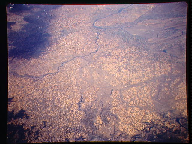
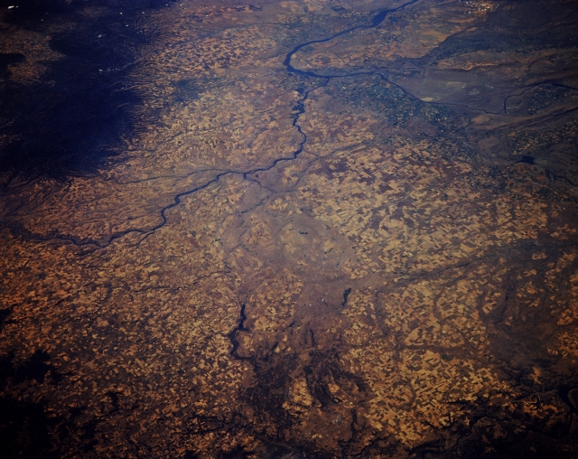
Image Caption: STS068-174-152 Columbia Plateau and Snake River, Washington, U.S.A. October 1994
The southeastern portion of the Columbia Plateau in Washington is visible in this west-southwest-looking, low-oblique photograph. The Snake River, the Columbia River's chief tributary, is visible as it travels westward to enter the Columbia River near Pasco, Washington. The Spokane River empties also into the Columbia River. Lava flows cover much of the Blue Mountains--the uplifted, eroded part of the Columbia Plateau. Scattered agricultural field patterns appear throughout the photograph.
The southeastern portion of the Columbia Plateau in Washington is visible in this west-southwest-looking, low-oblique photograph. The Snake River, the Columbia River's chief tributary, is visible as it travels westward to enter the Columbia River near Pasco, Washington. The Spokane River empties also into the Columbia River. Lava flows cover much of the Blue Mountains--the uplifted, eroded part of the Columbia Plateau. Scattered agricultural field patterns appear throughout the photograph.
