STS068-173-138
| NASA Photo ID | STS068-173-138 |
| Focal Length | 250mm |
| Date taken | 1994.10.07 |
| Time taken | 19:53:24 GMT |

Cloud masks available for this image:
Spacecraft nadir point: 32.1° N, 115.9° W
Photo center point: 33.0° N, 114.5° W
Photo center point by machine learning:
Photo center point: 33.0° N, 114.5° W
Photo center point by machine learning:
Nadir to Photo Center: Northeast
Spacecraft Altitude: 111 nautical miles (206km)
Country or Geographic Name: | USA-ARIZONA |
Features: | AGRICULTURE, COLORADO RIVER |
| Features Found Using Machine Learning: | |
Cloud Cover Percentage: | 0 (no clouds present) |
Sun Elevation Angle: | 52° |
Sun Azimuth: | 189° |
Camera: | Linhof |
Focal Length: | 250mm |
Camera Tilt: | 42 degrees |
Format: | 5048: Kodak, natural color positive, Lumiere 100x/5048, ASA 100x, standard base |
Film Exposure: | Normal |
| Additional Information | |
| Width | Height | Annotated | Cropped | Purpose | Links |
|---|---|---|---|---|---|
| 5184 pixels | 4032 pixels | No | No | Earth From Space collection | Download Image |
| 640 pixels | 497 pixels | No | No | Earth From Space collection | Download Image |
| 640 pixels | 480 pixels | No | No | ISD 1 | Download Image |
Download Packaged File
Download a Google Earth KML for this Image
View photo footprint information
Download a GeoTIFF for this photo
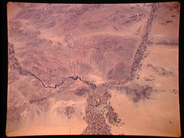
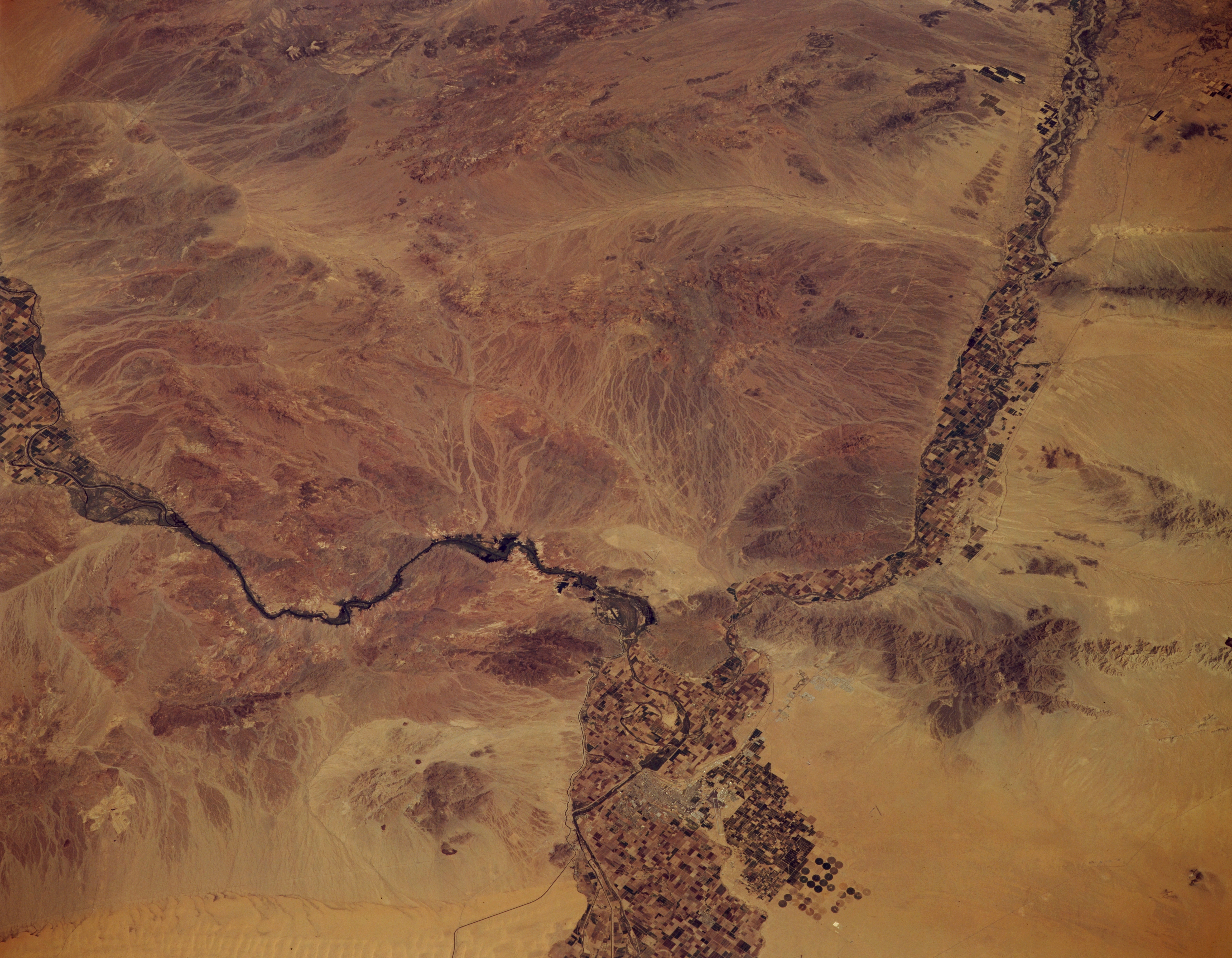
Image Caption: STS068-173-138 Sonoran Desert, Arizona, U.S.A. October 1994
The southwest corner of the sparsely vegetated Sonoran Desert is captured in this low-oblique, northeast-looking photograph. The only diversity in an otherwise arid region is created by the irrigated-field patterns along floodplains of the Colorado River (south-flowing) and the Gila River (southwest-flowing). Several circular center-point irrigation fields are visible south of Yuma (bottom center of the photograph). The Gila Mountains east of Yuma and several other ranges--the Chocolate, Kofa, and Eagle Tail Mountains--can be seen between the Colorado and Gila Rivers. The linear Sand Hills are discernible across the bottom of the photograph.
The southwest corner of the sparsely vegetated Sonoran Desert is captured in this low-oblique, northeast-looking photograph. The only diversity in an otherwise arid region is created by the irrigated-field patterns along floodplains of the Colorado River (south-flowing) and the Gila River (southwest-flowing). Several circular center-point irrigation fields are visible south of Yuma (bottom center of the photograph). The Gila Mountains east of Yuma and several other ranges--the Chocolate, Kofa, and Eagle Tail Mountains--can be seen between the Colorado and Gila Rivers. The linear Sand Hills are discernible across the bottom of the photograph.
