STS068-173-103
| NASA Photo ID | STS068-173-103 |
| Focal Length | 250mm |
| Date taken | 1994.10.07 |
| Time taken | 16:53:53 GMT |
Cloud masks available for this image:
Spacecraft nadir point: 39.3° N, 78.2° W
Photo center point: 41.0° N, 77.0° W
Photo center point by machine learning:
Photo center point: 41.0° N, 77.0° W
Photo center point by machine learning:
Nadir to Photo Center: Northeast
Spacecraft Altitude: 111 nautical miles (206km)
Country or Geographic Name: | USA-PENNSYLVANIA |
Features: | APPALACHIAN MTS., RIV, CY |
| Features Found Using Machine Learning: | |
Cloud Cover Percentage: | 0 (no clouds present) |
Sun Elevation Angle: | 45° |
Sun Azimuth: | 178° |
Camera: | Linhof |
Focal Length: | 250mm |
Camera Tilt: | 48 degrees |
Format: | 5048: Kodak, natural color positive, Lumiere 100x/5048, ASA 100x, standard base |
Film Exposure: | Normal |
| Additional Information | |
| Width | Height | Annotated | Cropped | Purpose | Links |
|---|---|---|---|---|---|
| 5120 pixels | 4096 pixels | No | No | Earth From Space collection | Download Image |
| 640 pixels | 512 pixels | No | No | Earth From Space collection | Download Image |
| 640 pixels | 480 pixels | No | No | ISD 1 | Download Image |
Download Packaged File
Download a Google Earth KML for this Image
View photo footprint information
Download a GeoTIFF for this photo
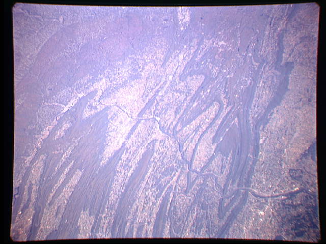
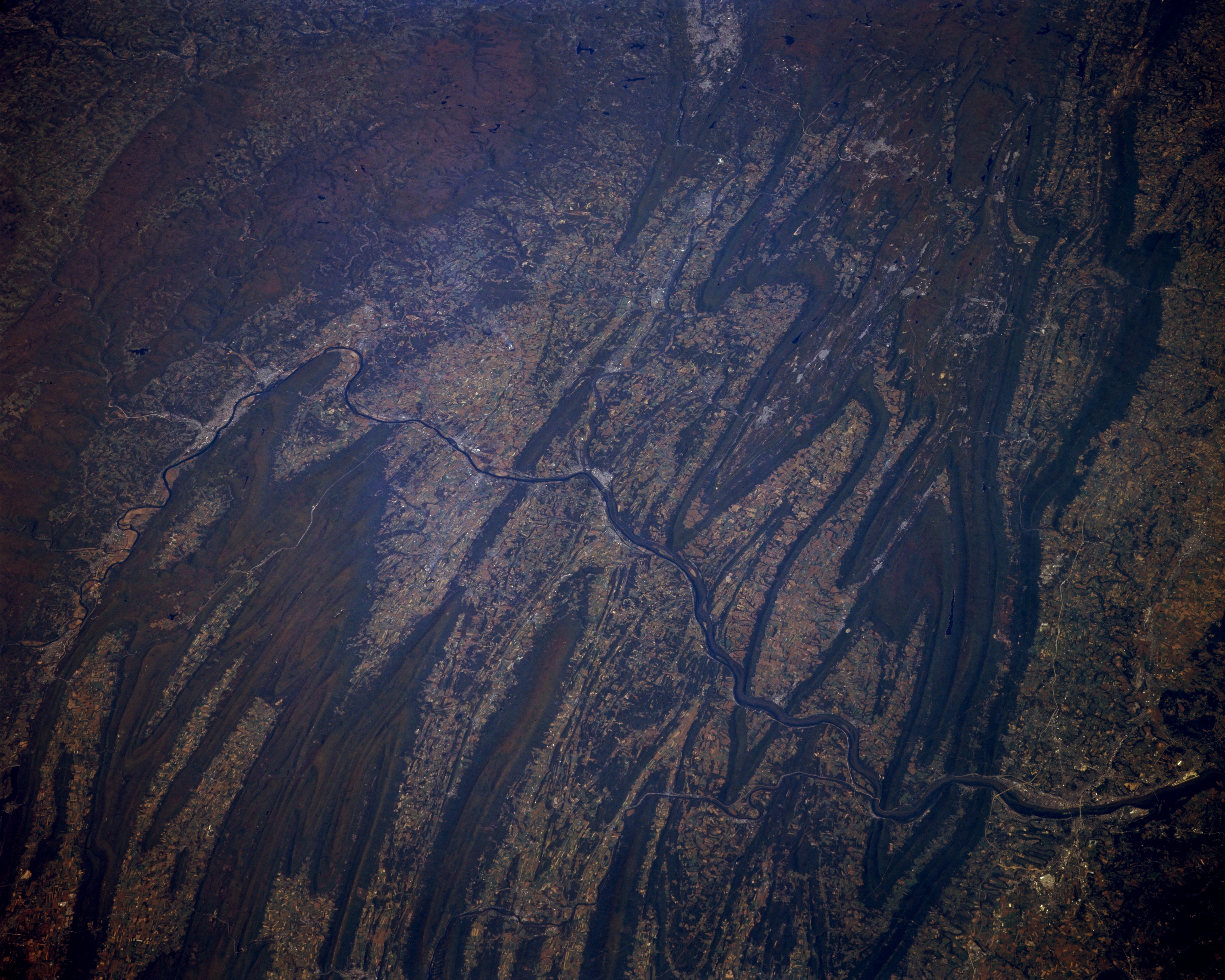
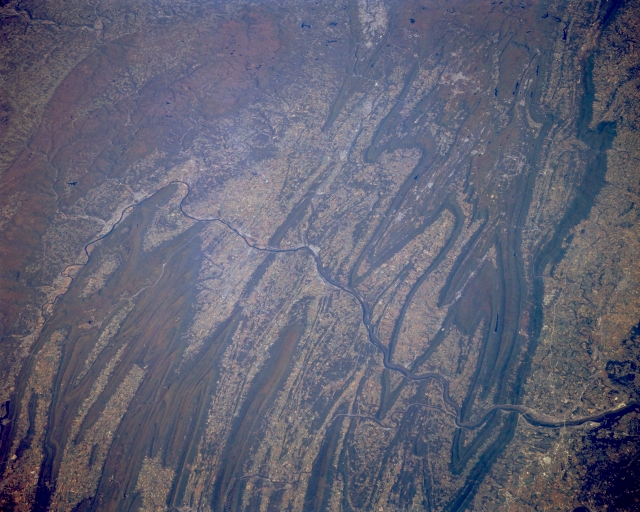
Image Caption: STS068-173-103 Susquehanna River Valley, Pennsylvania October 1994
The Susquehanna River winds it's way through and around several of the prominent ridges in this section of the folded Appalachian Mountains in central Pennsylvania. Harrisburg, the state capital, is located along the east side of the Susquehanna River (lower left corner). Part of the Juniata River is visible as it flows into the Susquehanna River north of the Harrisburg area and paralleling ridges of the Blue Mountains. Even though the mountain ridges and cultivated valley region is very much in evidence in this northeast view of the Susquehanna River Basin, North Mountain (upper left quadrant) presents a different type of mountainous terrain. The lighter colored areas in the valleys show agricultural lands and the darker landscape is predominately forested lands.
The Susquehanna River winds it's way through and around several of the prominent ridges in this section of the folded Appalachian Mountains in central Pennsylvania. Harrisburg, the state capital, is located along the east side of the Susquehanna River (lower left corner). Part of the Juniata River is visible as it flows into the Susquehanna River north of the Harrisburg area and paralleling ridges of the Blue Mountains. Even though the mountain ridges and cultivated valley region is very much in evidence in this northeast view of the Susquehanna River Basin, North Mountain (upper left quadrant) presents a different type of mountainous terrain. The lighter colored areas in the valleys show agricultural lands and the darker landscape is predominately forested lands.
