STS068-170-79
| NASA Photo ID | STS068-170-79 |
| Focal Length | 250mm |
| Date taken | 1994.10.04 |
| Time taken | 19:25:38 GMT |

Cloud masks available for this image:
Spacecraft nadir point: 31.0° N, 90.3° W
Photo center point: 30.0° N, 92.5° W
Photo center point by machine learning:
Photo center point: 30.0° N, 92.5° W
Photo center point by machine learning:
Nadir to Photo Center: West
Spacecraft Altitude: 117 nautical miles (217km)
Country or Geographic Name: | USA-LOUISIANA |
Features: | GRAND & WHITE L., AGRICULTURE |
| Features Found Using Machine Learning: | |
Cloud Cover Percentage: | 0 (no clouds present) |
Sun Elevation Angle: | 48° |
Sun Azimuth: | 217° |
Camera: | Linhof |
Focal Length: | 250mm |
Camera Tilt: | 51 degrees |
Format: | 5048: Kodak, natural color positive, Lumiere 100x/5048, ASA 100x, standard base |
Film Exposure: | Normal |
| Additional Information | |
| Width | Height | Annotated | Cropped | Purpose | Links |
|---|---|---|---|---|---|
| 5216 pixels | 4096 pixels | No | No | Earth From Space collection | Download Image |
| 640 pixels | 502 pixels | No | No | Earth From Space collection | Download Image |
| 640 pixels | 480 pixels | No | No | ISD 1 | Download Image |
Download Packaged File
Download a Google Earth KML for this Image
View photo footprint information
Download a GeoTIFF for this photo
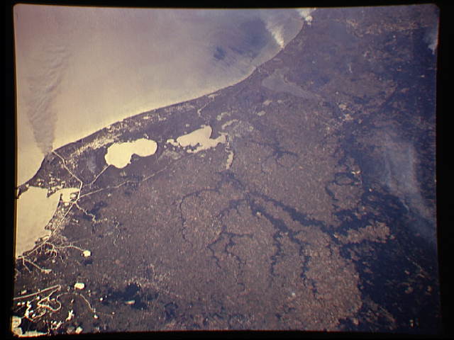
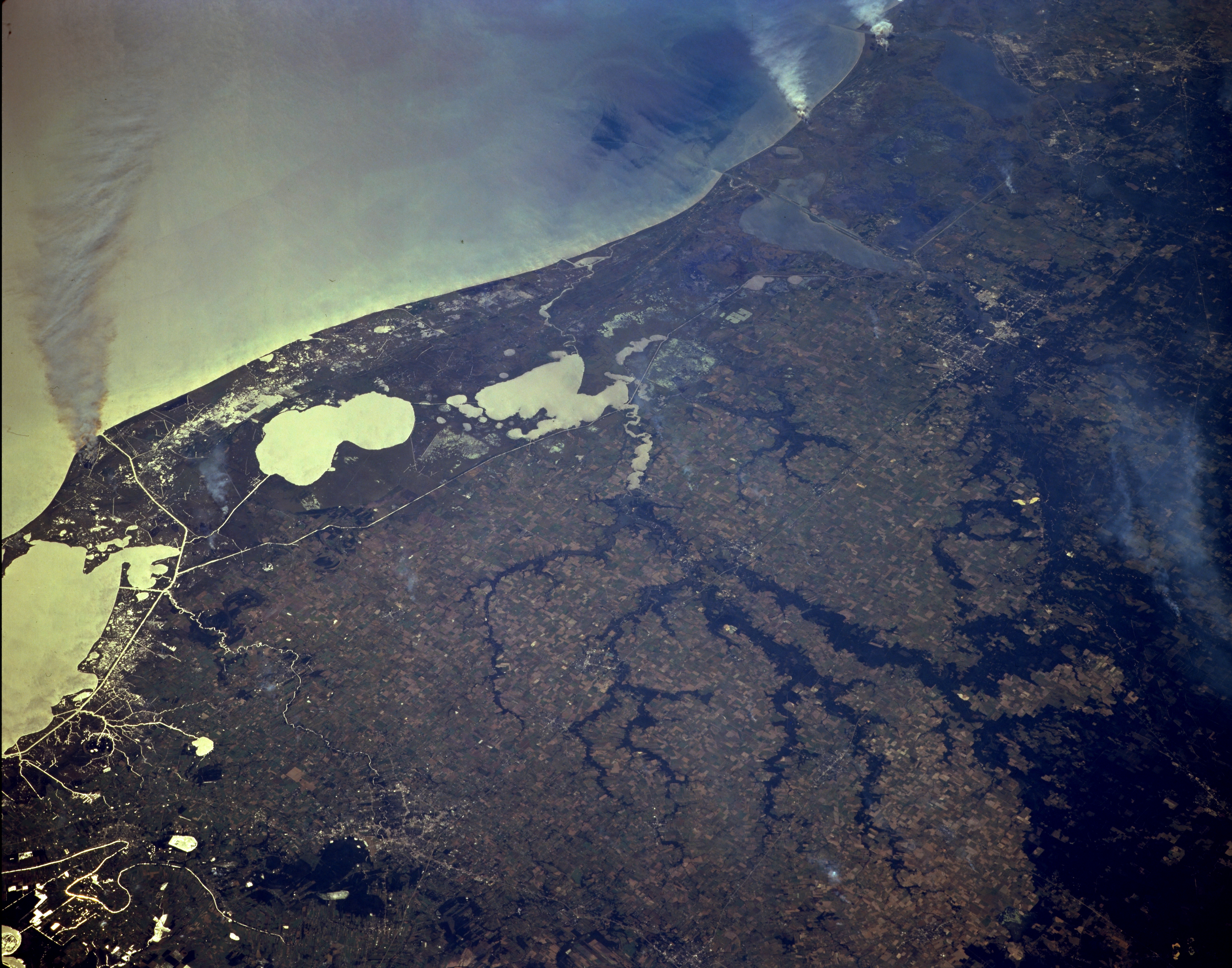
Image Caption: STS068-170-079 Southwest Louisiana, U.S.A. October 1994
Sunglint, the sun's reflection off the water, helps differentiate land-water boundaries in this photograph of the southwest coast of Louisiana. From east to west a large bay and several lakes are identifiable--Vermilion Bay (left edge), White Lake, and Grand Lake. Farther west are elongated Calcasieu Lake and Sabine Lake, which lies on the Texas-Louisiana border. The coastal plains are a mixture of fresh and salt marshes and grasslands; the darker area is the southern extent of a slightly undulating, upland, forested landscape. Several wooded tributaries of Bayou Nezpique present a dendritic drainage pattern as this bayou empties into Grand Lake from the north. Three large smoke plumes are visible along the shoreline, and the white, linear features near the coast are part of the Intracoastal Waterway and interconnecting canals. Lafayette to the east and Lake Charles to the west can be identified by their street patterns.
Sunglint, the sun's reflection off the water, helps differentiate land-water boundaries in this photograph of the southwest coast of Louisiana. From east to west a large bay and several lakes are identifiable--Vermilion Bay (left edge), White Lake, and Grand Lake. Farther west are elongated Calcasieu Lake and Sabine Lake, which lies on the Texas-Louisiana border. The coastal plains are a mixture of fresh and salt marshes and grasslands; the darker area is the southern extent of a slightly undulating, upland, forested landscape. Several wooded tributaries of Bayou Nezpique present a dendritic drainage pattern as this bayou empties into Grand Lake from the north. Three large smoke plumes are visible along the shoreline, and the white, linear features near the coast are part of the Intracoastal Waterway and interconnecting canals. Lafayette to the east and Lake Charles to the west can be identified by their street patterns.
