STS068-170-107A
| NASA Photo ID | STS068-170-107A |
| Focal Length | 250mm |
| Date taken | 1994.10.04 |
| Time taken | 20:50:43 GMT |
Cloud masks available for this image:
Spacecraft nadir point: 42.0° N, 124.6° W
Photo center point: 43.0° N, 124.5° W
Photo center point by machine learning:
Photo center point: 43.0° N, 124.5° W
Photo center point by machine learning:
Nadir to Photo Center: North
Spacecraft Altitude: 116 nautical miles (215km)
Country or Geographic Name: | USA-OREGON |
Features: | COOS BAY, CAPE BLANCO, MTS |
| Features Found Using Machine Learning: | |
Cloud Cover Percentage: | 0 (no clouds present) |
Sun Elevation Angle: | 43° |
Sun Azimuth: | 195° |
Camera: | Linhof |
Focal Length: | 250mm |
Camera Tilt: | 27 degrees |
Format: | 5048: Kodak, natural color positive, Lumiere 100x/5048, ASA 100x, standard base |
Film Exposure: | Normal |
| Additional Information | |
| Width | Height | Annotated | Cropped | Purpose | Links |
|---|---|---|---|---|---|
| 4096 pixels | 5184 pixels | No | No | Earth From Space collection | Download Image |
| 505 pixels | 640 pixels | No | No | Earth From Space collection | Download Image |
| 640 pixels | 480 pixels | No | No | ISD 1 | Download Image |
Download Packaged File
Download a Google Earth KML for this Image
View photo footprint information
Download a GeoTIFF for this photo
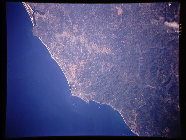
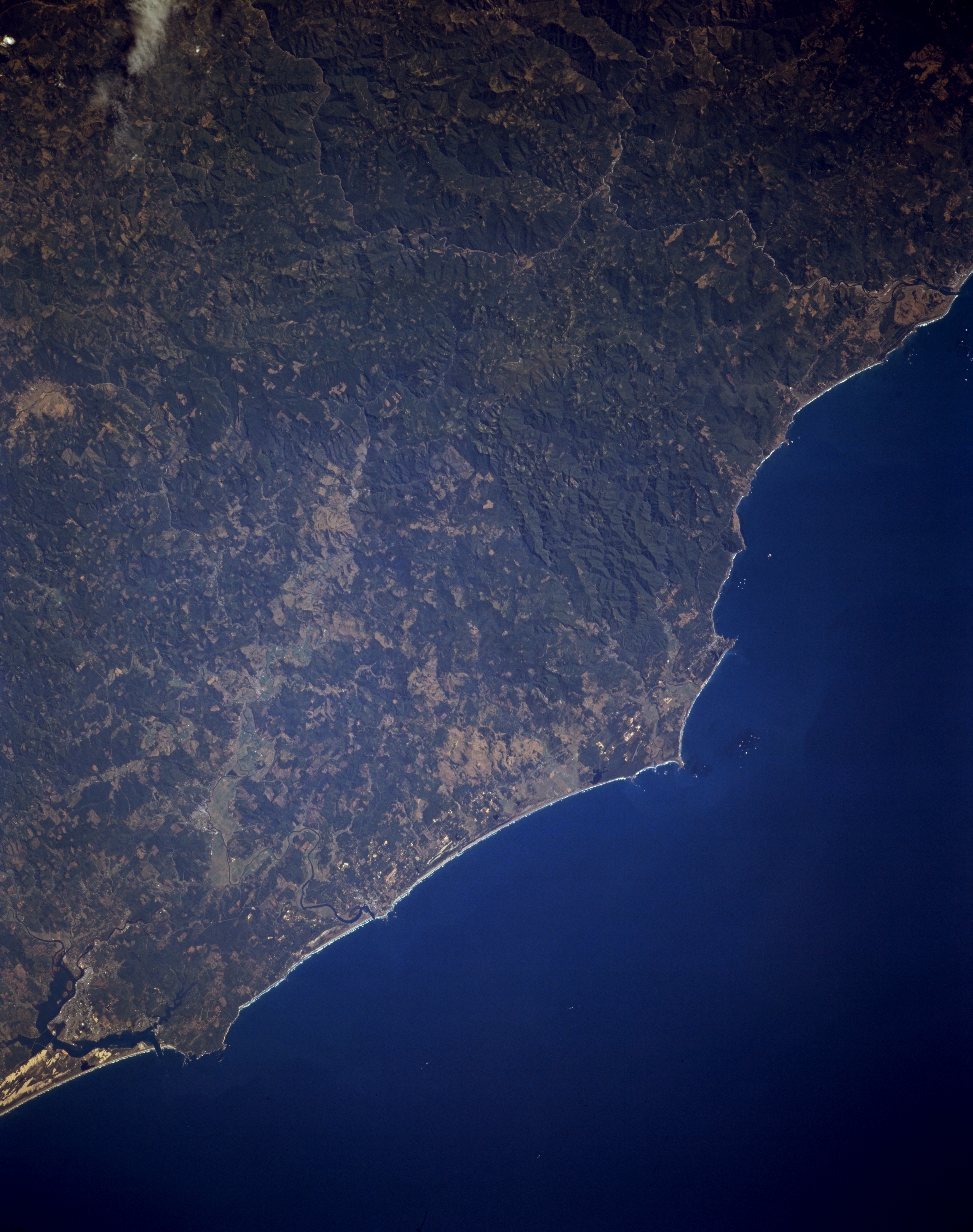
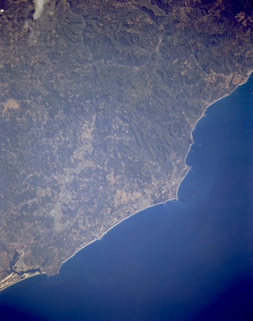
Image Caption: STS068-170-107A Cape Blanco and Coos Bay, Oregon, U.S.A. October 1994
The forest-covered Coast Range and the central Oregon coast are visible in this south-southeast-looking, low-oblique photograph. Small rectangles designate timber-cutting operations scattered throughout the Coast Range. The Rogue River is apparent entering the Pacific Ocean at the upper right of the photograph, and Cape Blanco is visible to the right of the center. Coos Bay, a small port city on the central Oregon coast with a population of more than 16 500, is visible at the bottom left of the photograph. Coos Bay, a popular tourist resort, also has lumber, shipping, fishing, and canning industries. North of Coos Bay is the Oregon Dunes National Recreation Area.
The forest-covered Coast Range and the central Oregon coast are visible in this south-southeast-looking, low-oblique photograph. Small rectangles designate timber-cutting operations scattered throughout the Coast Range. The Rogue River is apparent entering the Pacific Ocean at the upper right of the photograph, and Cape Blanco is visible to the right of the center. Coos Bay, a small port city on the central Oregon coast with a population of more than 16 500, is visible at the bottom left of the photograph. Coos Bay, a popular tourist resort, also has lumber, shipping, fishing, and canning industries. North of Coos Bay is the Oregon Dunes National Recreation Area.
