STS068-167-N
| NASA Photo ID | STS068-167-N |
| Focal Length | 250mm |
| Date taken | 1994.10.09 |
| Time taken | 17:37:11 GMT |

Cloud masks available for this image:
Spacecraft nadir point: 37.7° N, 98.9° W
Photo center point: 39.5° N, 97.0° W
Photo center point by machine learning:
Photo center point: 39.5° N, 97.0° W
Photo center point by machine learning:
Nadir to Photo Center: Northeast
Spacecraft Altitude: 111 nautical miles (206km)
Country or Geographic Name: | USA-KANSAS |
Features: | REPUBLICAN RIVER, RES., AGR |
| Features Found Using Machine Learning: | |
Cloud Cover Percentage: | 0 (no clouds present) |
Sun Elevation Angle: | 45° |
Sun Azimuth: | 164° |
Camera: | Linhof |
Focal Length: | 250mm |
Camera Tilt: | 55 degrees |
Format: | 5048: Kodak, natural color positive, Lumiere 100x/5048, ASA 100x, standard base |
Film Exposure: | Normal |
| Additional Information | |
| Width | Height | Annotated | Cropped | Purpose | Links |
|---|---|---|---|---|---|
| 5152 pixels | 4096 pixels | No | No | Earth From Space collection | Download Image |
| 640 pixels | 508 pixels | No | No | Earth From Space collection | Download Image |
| 640 pixels | 480 pixels | No | No | ISD 1 | Download Image |
Download Packaged File
Download a Google Earth KML for this Image
View photo footprint information
Download a GeoTIFF for this photo
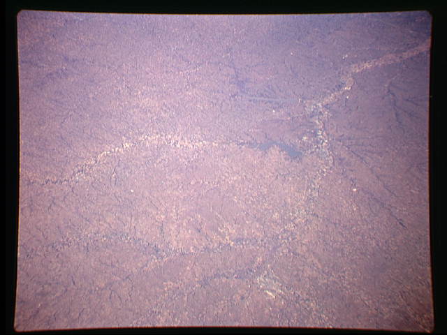
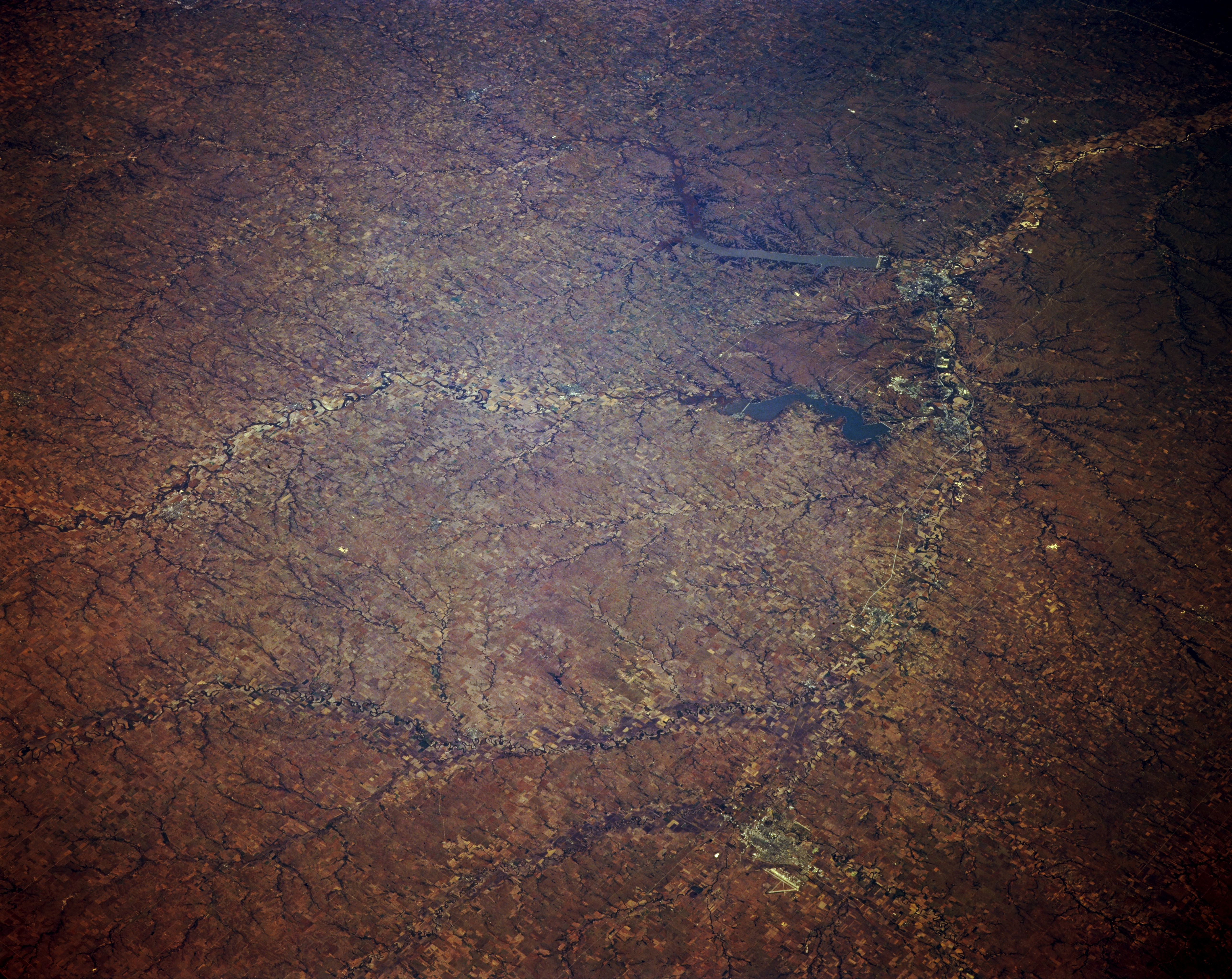
Image Caption: STS068-167-00N North-Central Kansas, U.S.A. October 1994
The agricultural lands of north-central Kansas are discernible in this northeast-looking, low-oblique photograph. The Smoky Hill River extends eastward through Salina, with its long north-south airport runway, to near Junction City and the Milford Reservoir where it joins the southeast-flowing Republican River to become the Kansas River, which continues a generally eastward path. Discernible are Tuttle Creek Reservoir east-northeast of Milford Reservoir and Manhattan (barely discernible) to its south.
The agricultural lands of north-central Kansas are discernible in this northeast-looking, low-oblique photograph. The Smoky Hill River extends eastward through Salina, with its long north-south airport runway, to near Junction City and the Milford Reservoir where it joins the southeast-flowing Republican River to become the Kansas River, which continues a generally eastward path. Discernible are Tuttle Creek Reservoir east-northeast of Milford Reservoir and Manhattan (barely discernible) to its south.
