STS068-164-125

| NASA Photo ID | STS068-164-125 |
| Focal Length | 250mm |
| Date taken | 1994.10.02 |
| Time taken | 18:30:07 GMT |

Cloud masks available for this image:
Spacecraft nadir point: 45.4° N, 82.5° W
Photo center point: 44.5° N, 84.5° W
Photo center point by machine learning:
Photo center point: 44.5° N, 84.5° W
Photo center point by machine learning:
Nadir to Photo Center: West
Spacecraft Altitude: 118 nautical miles (219km)
Country or Geographic Name: | USA-MICHIGAN |
Features: | HOUGHTON & HIGGINS L, AGR |
| Features Found Using Machine Learning: | |
Cloud Cover Percentage: | 5 (1-10)% |
Sun Elevation Angle: | 39° |
Sun Azimuth: | 203° |
Camera: | Linhof |
Focal Length: | 250mm |
Camera Tilt: | 48 degrees |
Format: | 5046: Kodak, natural color positive, Lumiere 100/5046, ASA 100, standard base |
Film Exposure: | Normal |
| Additional Information | |
| Width | Height | Annotated | Cropped | Purpose | Links |
|---|---|---|---|---|---|
| 5152 pixels | 4096 pixels | No | No | Earth From Space collection | Download Image |
| 640 pixels | 508 pixels | No | No | Earth From Space collection | Download Image |
| 640 pixels | 480 pixels | No | No | ISD 1 | Download Image |
Download Packaged File
Download a Google Earth KML for this Image
View photo footprint information
Download a GeoTIFF for this photo
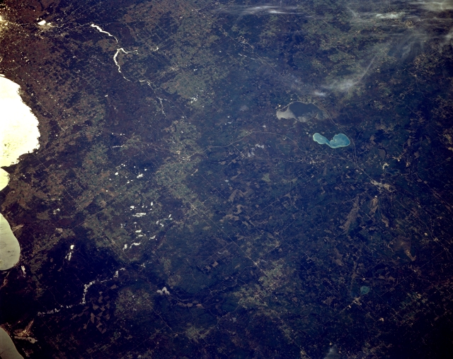
Image Caption: STS068-164-125 West of Saginaw Bay, Michigan, U.S.A. October 1994
Featured in this southwest-looking, low-oblique photograph are the shoreline (in sunglint) of Saginaw Bay (left edge) and the forest and agricultural lands of eastern Michigan west of Saginaw Bay as far west as Houghton Lake and Higgins Lake (right and top of center, respectively). This popular tourist area has a glacial landscape with high concentrations of sand and moraines and a higher elevation than that of southern Michigan. Visible are the runways of Paul B. Wurtsmith Air Force Base and the Au Sable River (bottom left); Midland and two small reservoirs on the Tittabawassee River northwest of Midland (upper left); and West Twin Lake and the small city of Lewiston (barely discernible at bottom right).
Featured in this southwest-looking, low-oblique photograph are the shoreline (in sunglint) of Saginaw Bay (left edge) and the forest and agricultural lands of eastern Michigan west of Saginaw Bay as far west as Houghton Lake and Higgins Lake (right and top of center, respectively). This popular tourist area has a glacial landscape with high concentrations of sand and moraines and a higher elevation than that of southern Michigan. Visible are the runways of Paul B. Wurtsmith Air Force Base and the Au Sable River (bottom left); Midland and two small reservoirs on the Tittabawassee River northwest of Midland (upper left); and West Twin Lake and the small city of Lewiston (barely discernible at bottom right).
