STS067-731A-80
| NASA Photo ID | STS067-731A-80 |
| Focal Length | 250mm |
| Date taken | 1995.03.__ |
| Time taken | GMT |
Cloud masks available for this image:
Spacecraft nadir point:
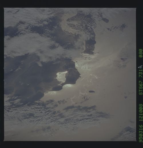
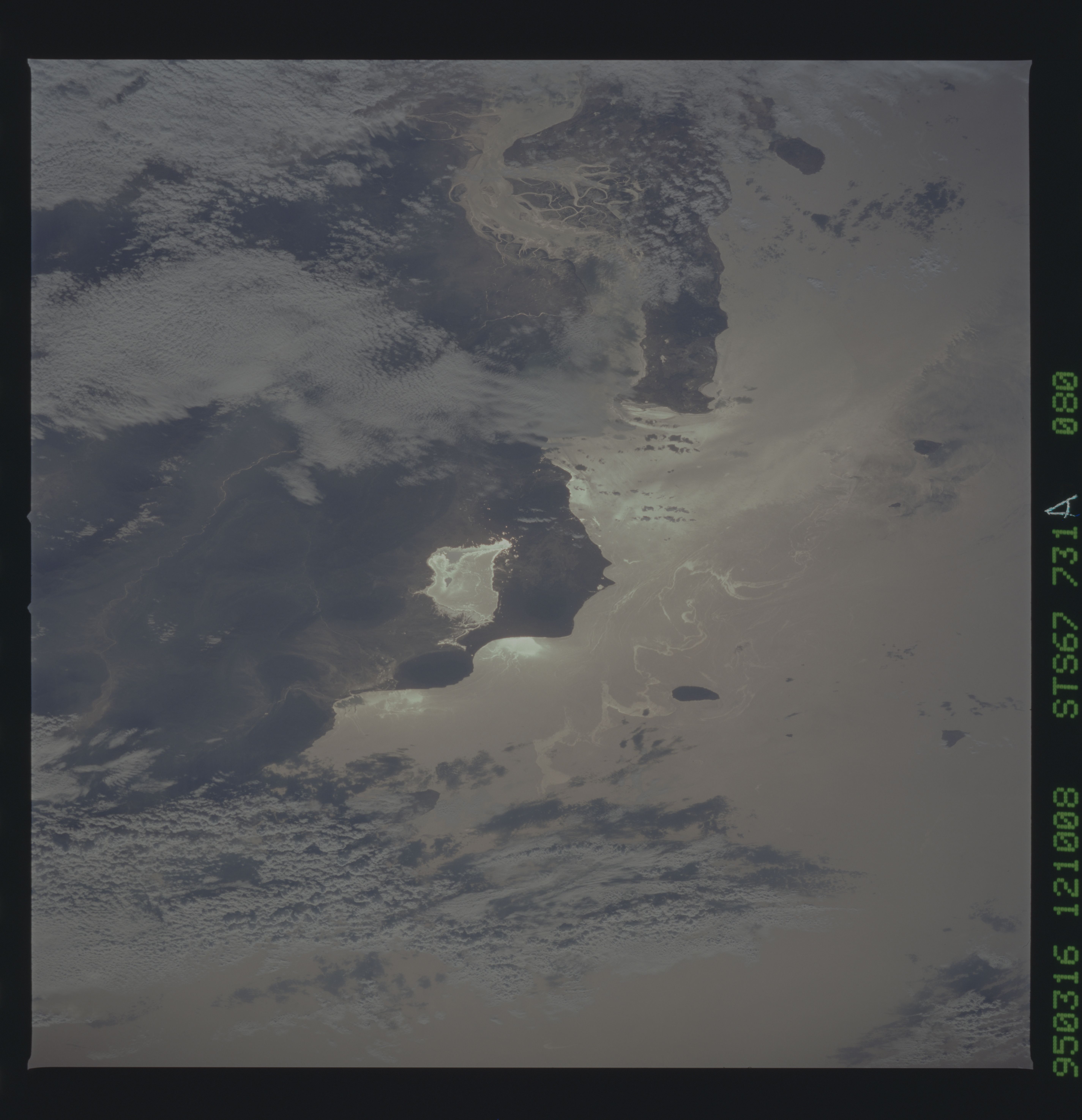
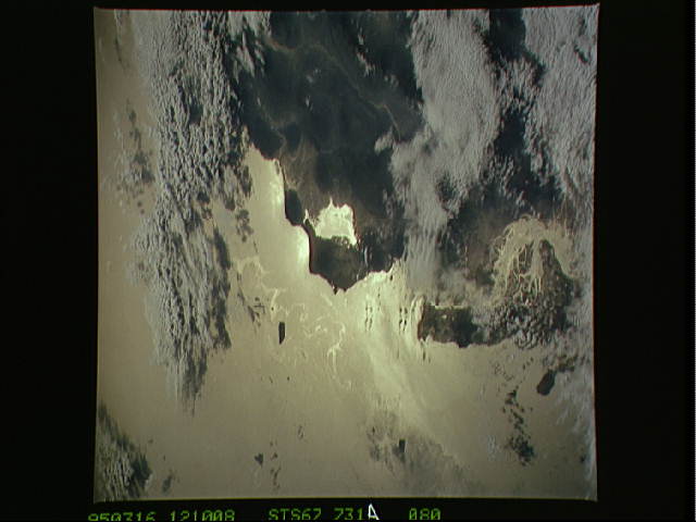
Photo center point: 26.5° N, 55.0° E
Photo center point by machine learning:
Photo center point: 26.5° N, 55.0° E
Photo center point by machine learning:
Nadir to Photo Center: West
Spacecraft Altitude: nautical miles (0km)
Country or Geographic Name: | PERSIAN GULF |
Features: | SUNGLINT, WATER DYNAMICS |
| Features Found Using Machine Learning: | |
Cloud Cover Percentage: | 40 (26-50)% |
Sun Elevation Angle: | ° |
Sun Azimuth: | ° |
Camera: | Hasselblad |
Focal Length: | 250mm |
Camera Tilt: | Low Oblique |
Format: | 5046: Kodak, natural color positive, Lumiere 100/5046, ASA 100, standard base |
Film Exposure: | Normal |
| Additional Information | |
| Width | Height | Annotated | Cropped | Purpose | Links |
|---|---|---|---|---|---|
| 5700 pixels | 5900 pixels | No | No | Download Image | |
| 500 pixels | 518 pixels | No | No | Download Image | |
| 640 pixels | 480 pixels | No | No | Download Image |
Download Packaged File
Download a Google Earth KML for this Image
View photo footprint information
Download a GeoTIFF for this photo
Image Caption: Strait of Hormuz in sunglint. 19 sec later. Due to
sunglint, eddy and the ship wakes are visible. Biological surfactants
and man-contributed oils produce a thin layer at the surface. These
"oils" take the form of the waters motion and also change the surface
reflectance allowing ocean features to be outlined in the sunglint.
STS067-731A-080 Hormuz oil slicks
