STS067-716A-66

| NASA Photo ID | STS067-716A-66 |
| Focal Length | 250mm |
| Date taken | 1995.03.__ |
| Time taken | GMT |
Resolutions offered for this image:
3955 x 3932 pixels 640 x 636 pixels 5700 x 5900 pixels 500 x 518 pixels 640 x 480 pixels 3940 x 3917 pixels 2671 x 2544 pixels
3955 x 3932 pixels 640 x 636 pixels 5700 x 5900 pixels 500 x 518 pixels 640 x 480 pixels 3940 x 3917 pixels 2671 x 2544 pixels


Cloud masks available for this image:
Spacecraft nadir point:
Photo center point: 17.5° N, 88.0° W
Photo center point by machine learning:
Photo center point: 17.5° N, 88.0° W
Photo center point by machine learning:
Nadir to Photo Center: West
Spacecraft Altitude: nautical miles (0km)
Country or Geographic Name: | BELIZE |
Features: | REEFS, TURNEFFE ISLAND |
| Features Found Using Machine Learning: | |
Cloud Cover Percentage: | 20 (11-25)% |
Sun Elevation Angle: | ° |
Sun Azimuth: | ° |
Camera: | Hasselblad |
Focal Length: | 250mm |
Camera Tilt: | Low Oblique |
Format: | 5046: Kodak, natural color positive, Lumiere 100/5046, ASA 100, standard base |
Film Exposure: | Normal |
| Additional Information | |
| Width | Height | Annotated | Cropped | Purpose | Links |
|---|---|---|---|---|---|
| 3955 pixels | 3932 pixels | No | No | Earth From Space collection | Download Image |
| 640 pixels | 636 pixels | No | No | Earth From Space collection | Download Image |
| 5700 pixels | 5900 pixels | No | No | Download Image | |
| 500 pixels | 518 pixels | No | No | Download Image | |
| 640 pixels | 480 pixels | No | No | Download Image | |
| 3940 pixels | 3917 pixels | ReefBase pilot | Download Image | ||
| 2671 pixels | 2544 pixels | No | No | ReefBase 2 | Download Image |
Download Packaged File
Download a Google Earth KML for this Image
View photo footprint information
Download a GeoTIFF for this photo
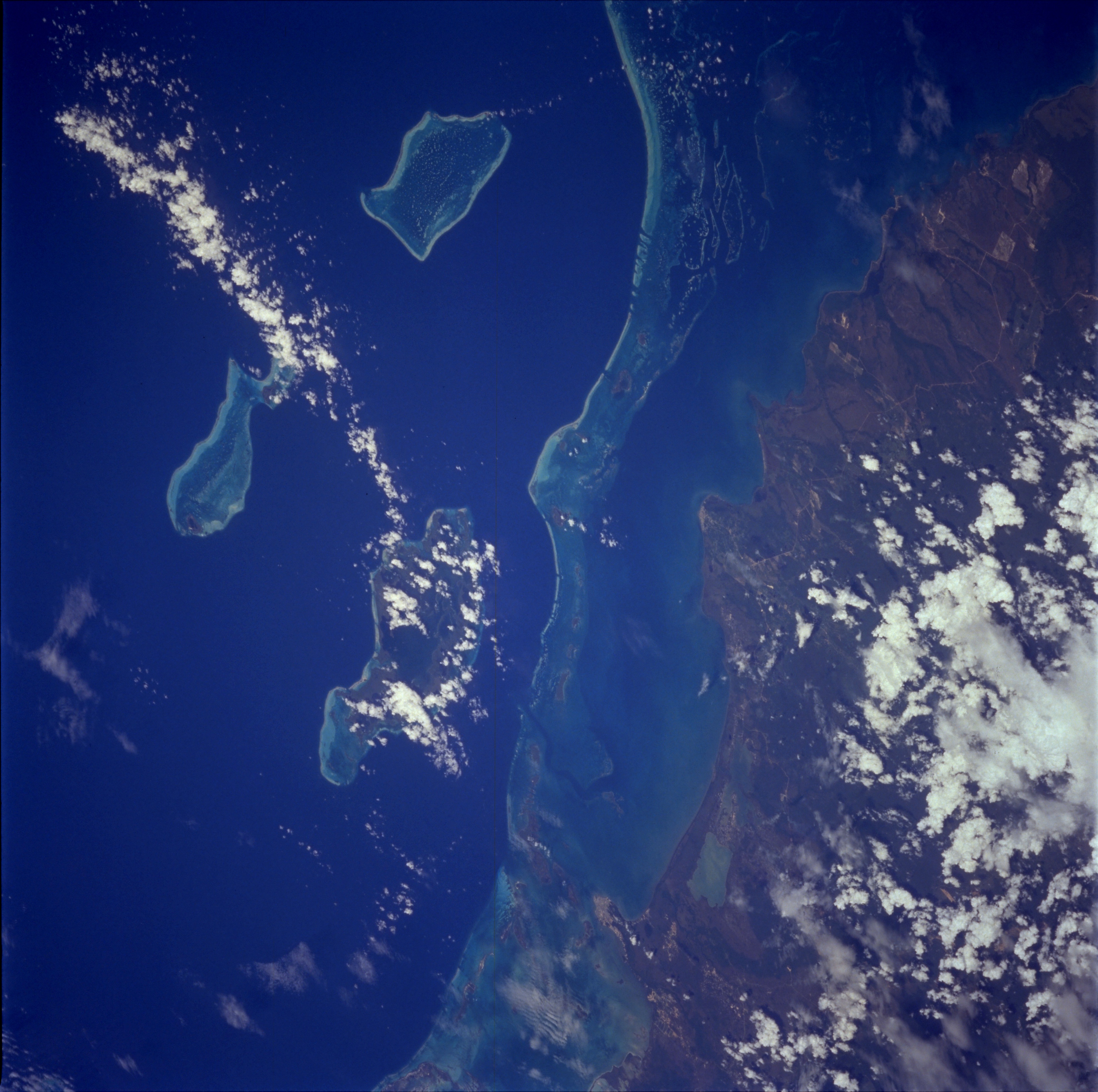
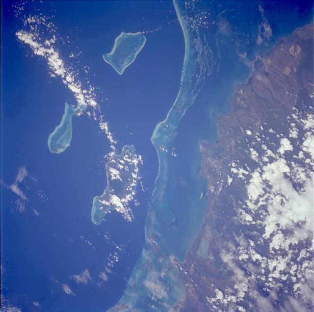
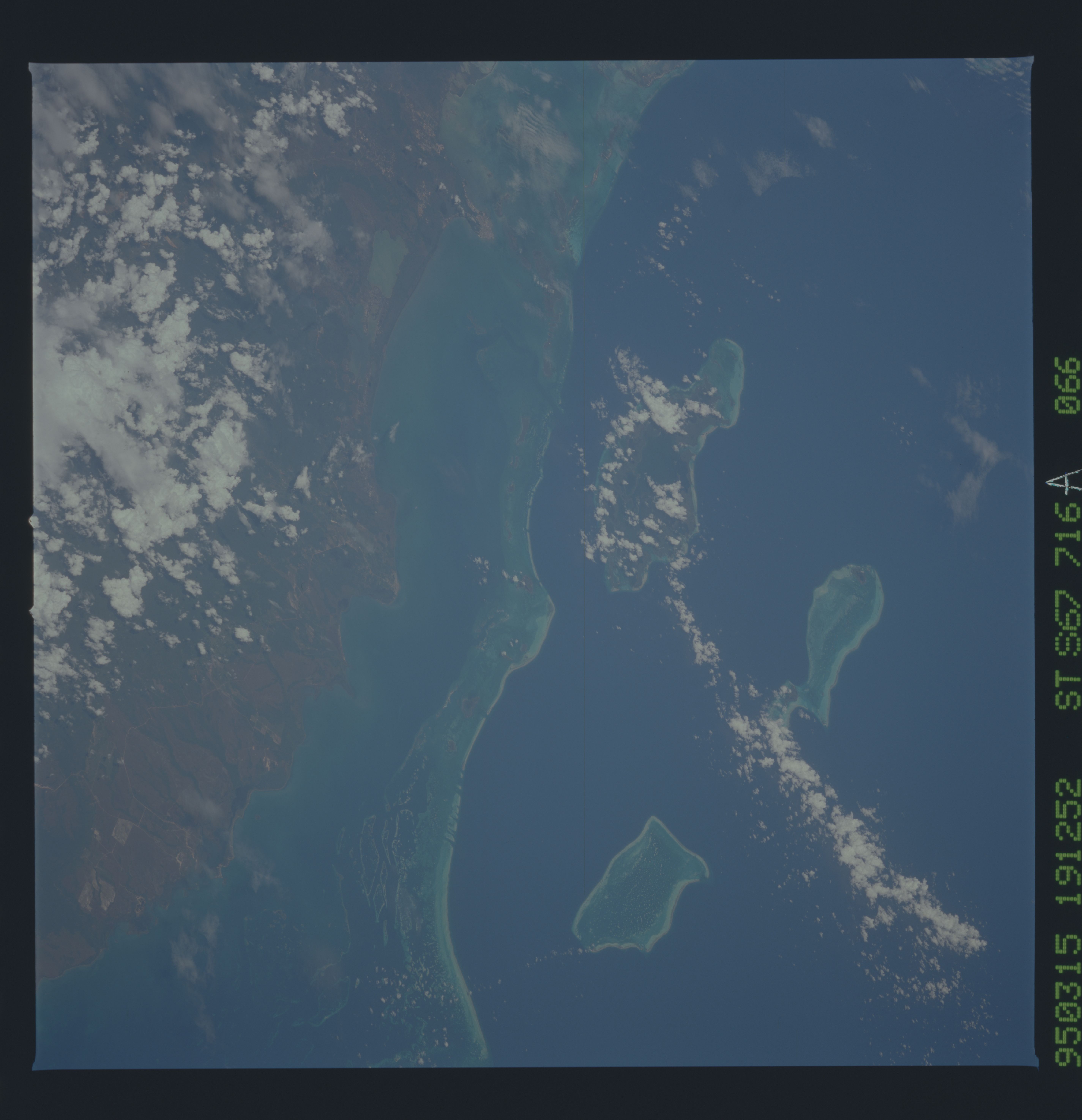
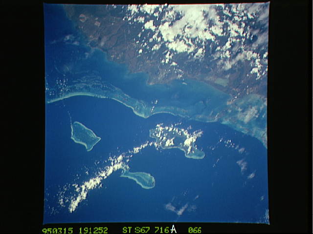
Image Caption: STS067-716A-066 Reefs, Belize March 1995
Formerly known as British Honduras, the low and marshy coastal plain of the small country of Belize is visible in this low-oblique, southeast-looking photograph. A popular site for skin diving and snorkeling, an almost unbroken chain of coral reefs and shoals stretches in the clear waters of the western Caribbean Sea approximately 12 miles (20 kilometers) from the east coast of Belize. Three large concentrations of reefs and islands farther east are the Turneffe Islands (partially obscured by clouds), Lighthouse Reef (easternmost and fish-shaped), and Glover Reef. The relatively remote location and the pristine environment of Belize provide natural attractions to the area. The entire country of Belize has a population of slightly more than 200 000; population density is very low. The largest city, Belize City (population of approximately 50 000), is barely evident on the small peninsula near the north edge of the photograph. Sugar and citrus fruits are the country's two leading agricultural products; tourism is becoming a viable industry. Ethnically Belize is more closely tied to its Caribbean island neighbors than to the Spanish-speaking countries of Central America.
Formerly known as British Honduras, the low and marshy coastal plain of the small country of Belize is visible in this low-oblique, southeast-looking photograph. A popular site for skin diving and snorkeling, an almost unbroken chain of coral reefs and shoals stretches in the clear waters of the western Caribbean Sea approximately 12 miles (20 kilometers) from the east coast of Belize. Three large concentrations of reefs and islands farther east are the Turneffe Islands (partially obscured by clouds), Lighthouse Reef (easternmost and fish-shaped), and Glover Reef. The relatively remote location and the pristine environment of Belize provide natural attractions to the area. The entire country of Belize has a population of slightly more than 200 000; population density is very low. The largest city, Belize City (population of approximately 50 000), is barely evident on the small peninsula near the north edge of the photograph. Sugar and citrus fruits are the country's two leading agricultural products; tourism is becoming a viable industry. Ethnically Belize is more closely tied to its Caribbean island neighbors than to the Spanish-speaking countries of Central America.
