STS067-709-84
| NASA Photo ID | STS067-709-84 |
| Focal Length | 250mm |
| Date taken | 1995.03.03 |
| Time taken | 08:01:31 GMT |
Resolutions offered for this image:
768 x 768 pixels 540 x 540 pixels 5700 x 5900 pixels 500 x 518 pixels 640 x 480 pixels 960 x 979 pixels
768 x 768 pixels 540 x 540 pixels 5700 x 5900 pixels 500 x 518 pixels 640 x 480 pixels 960 x 979 pixels


Cloud masks available for this image:
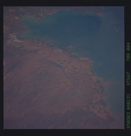
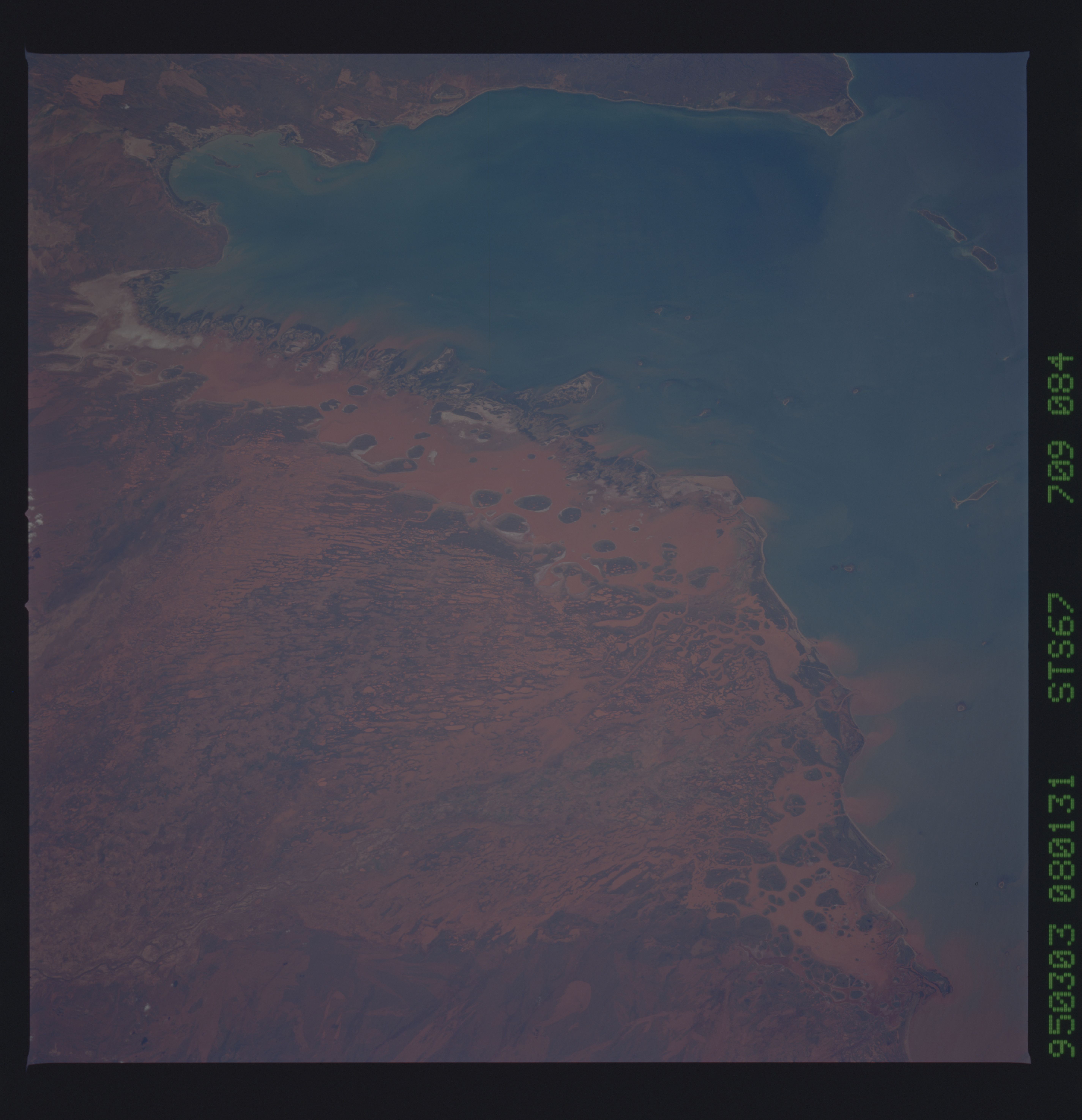
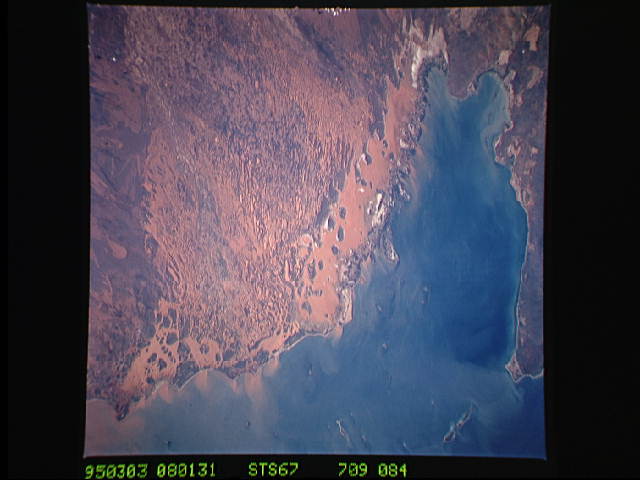
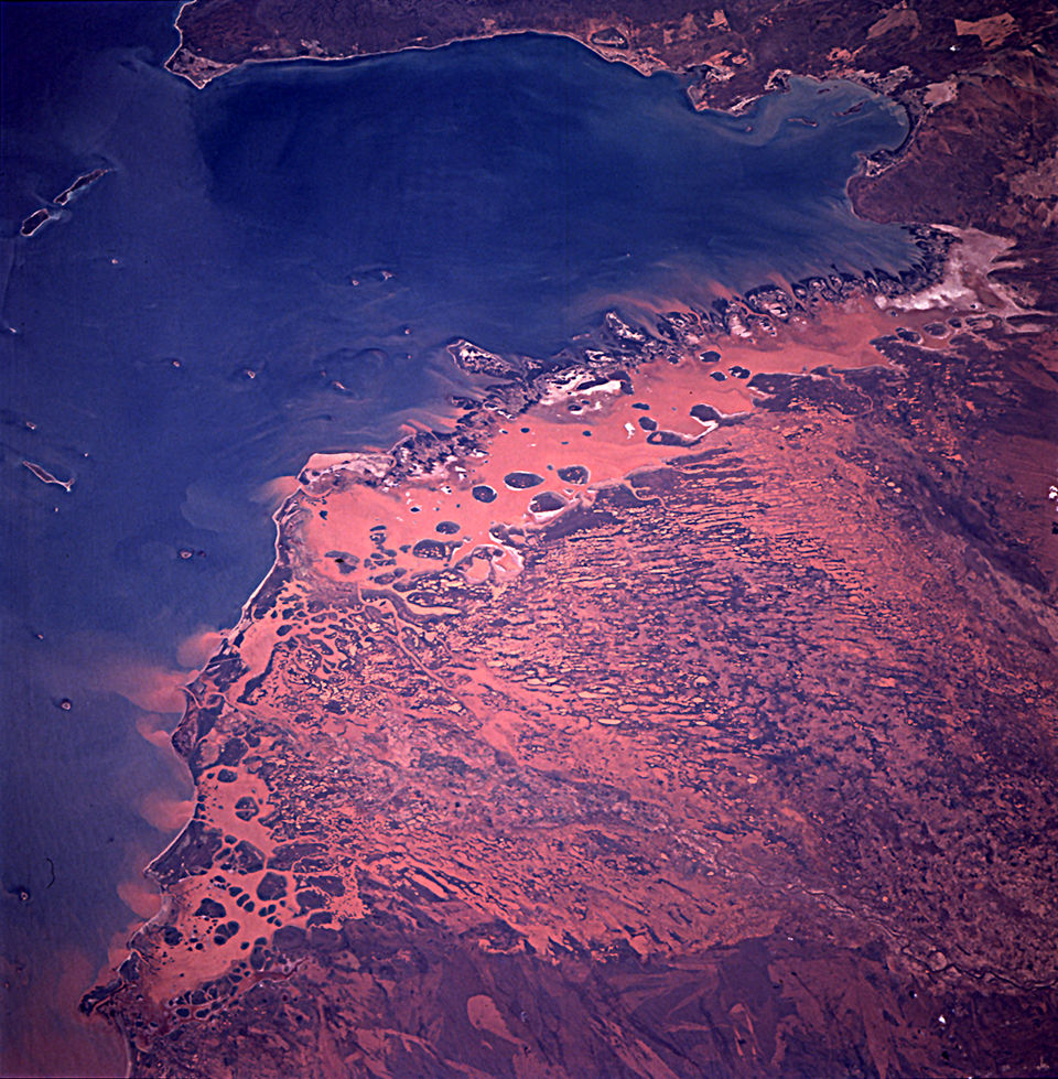
Spacecraft nadir point: 20.6° S, 117.3° E
Photo center point: 22.0° S, 114.5° E
Photo center point by machine learning:
Photo center point: 22.0° S, 114.5° E
Photo center point by machine learning:
Nadir to Photo Center: Southwest
Spacecraft Altitude: 188 nautical miles (348km)
Country or Geographic Name: | AUSTRALIA-WA |
Features: | EXMOUTH GULF, PEN., SED. |
| Features Found Using Machine Learning: | |
Cloud Cover Percentage: | 0 (no clouds present) |
Sun Elevation Angle: | 35° |
Sun Azimuth: | 276° |
Camera: | Hasselblad |
Focal Length: | 250mm |
Camera Tilt: | 45 degrees |
Format: | 5046: Kodak, natural color positive, Lumiere 100/5046, ASA 100, standard base |
Film Exposure: | Normal |
| Additional Information | |
| Width | Height | Annotated | Cropped | Purpose | Links |
|---|---|---|---|---|---|
| 768 pixels | 768 pixels | Photographic Highlights | Download Image | ||
| 540 pixels | 540 pixels | Photographic Highlights | Download Image | ||
| 5700 pixels | 5900 pixels | No | No | Download Image | |
| 500 pixels | 518 pixels | No | No | Download Image | |
| 640 pixels | 480 pixels | No | No | Download Image | |
| 960 pixels | 979 pixels | No | No | Download Image |
Download Packaged File
Download a Google Earth KML for this Image
View photo footprint information
Download a GeoTIFF for this photo
Image Caption: Red floodwater from Hurricane Bobby (300 mm [12 inches] of
rain) illustrates the fact the whole region along the east side of the
Exmouth gulf is one big delta. March 3, 1995. The floodwater fingers
out into the blue waters of the Gulf through dark mangrove islands.
rain) illustrates the fact the whole region along the east side of the
Exmouth gulf is one big delta. March 3, 1995. The floodwater fingers
out into the blue waters of the Gulf through dark mangrove islands.
