STS067-703D-90
| NASA Photo ID | STS067-703D-90 |
| Focal Length | 250mm |
| Date taken | 1995.03.__ |
| Time taken | GMT |
Resolutions offered for this image:
5294 x 5294 pixels 640 x 640 pixels 5700 x 5900 pixels 500 x 518 pixels 640 x 480 pixels
5294 x 5294 pixels 640 x 640 pixels 5700 x 5900 pixels 500 x 518 pixels 640 x 480 pixels


Cloud masks available for this image:
Spacecraft nadir point:
Photo center point: 4.5° S, 15.5° E
Photo center point by machine learning:
Photo center point: 4.5° S, 15.5° E
Photo center point by machine learning:
Nadir to Photo Center: West
Spacecraft Altitude: nautical miles (0km)
Country or Geographic Name: | DEM. REP. OF CONGO |
Features: | KINSHASA, BRAZZAVILLE |
| Features Found Using Machine Learning: | |
Cloud Cover Percentage: | 0 (no clouds present) |
Sun Elevation Angle: | ° |
Sun Azimuth: | ° |
Camera: | Hasselblad |
Focal Length: | 250mm |
Camera Tilt: | Near Vertical |
Format: | 2443: Kodak Aerochrome 2443, color IR, thin base, EA-5 process thru June 1999, E-6 process afterward |
Film Exposure: | Under Exposed |
| Additional Information | |
| Width | Height | Annotated | Cropped | Purpose | Links |
|---|---|---|---|---|---|
| 5294 pixels | 5294 pixels | No | No | Earth From Space collection | Download Image |
| 640 pixels | 640 pixels | No | No | Earth From Space collection | Download Image |
| 5700 pixels | 5900 pixels | No | No | Download Image | |
| 500 pixels | 518 pixels | No | No | Download Image | |
| 640 pixels | 480 pixels | No | No | Download Image |
Download Packaged File
Download a Google Earth KML for this Image
View photo footprint information
Download a GeoTIFF for this photo
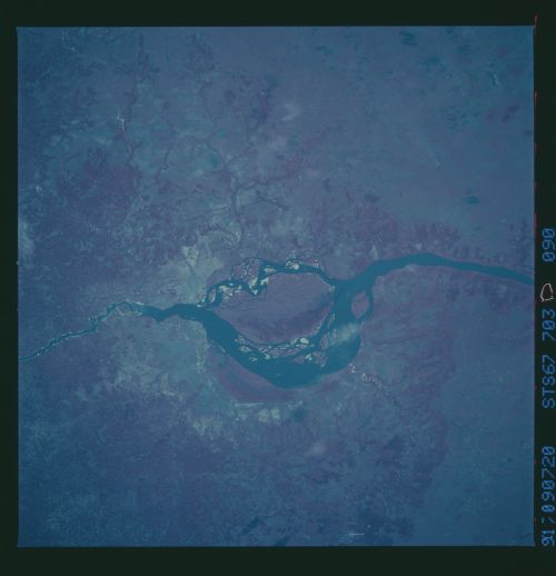
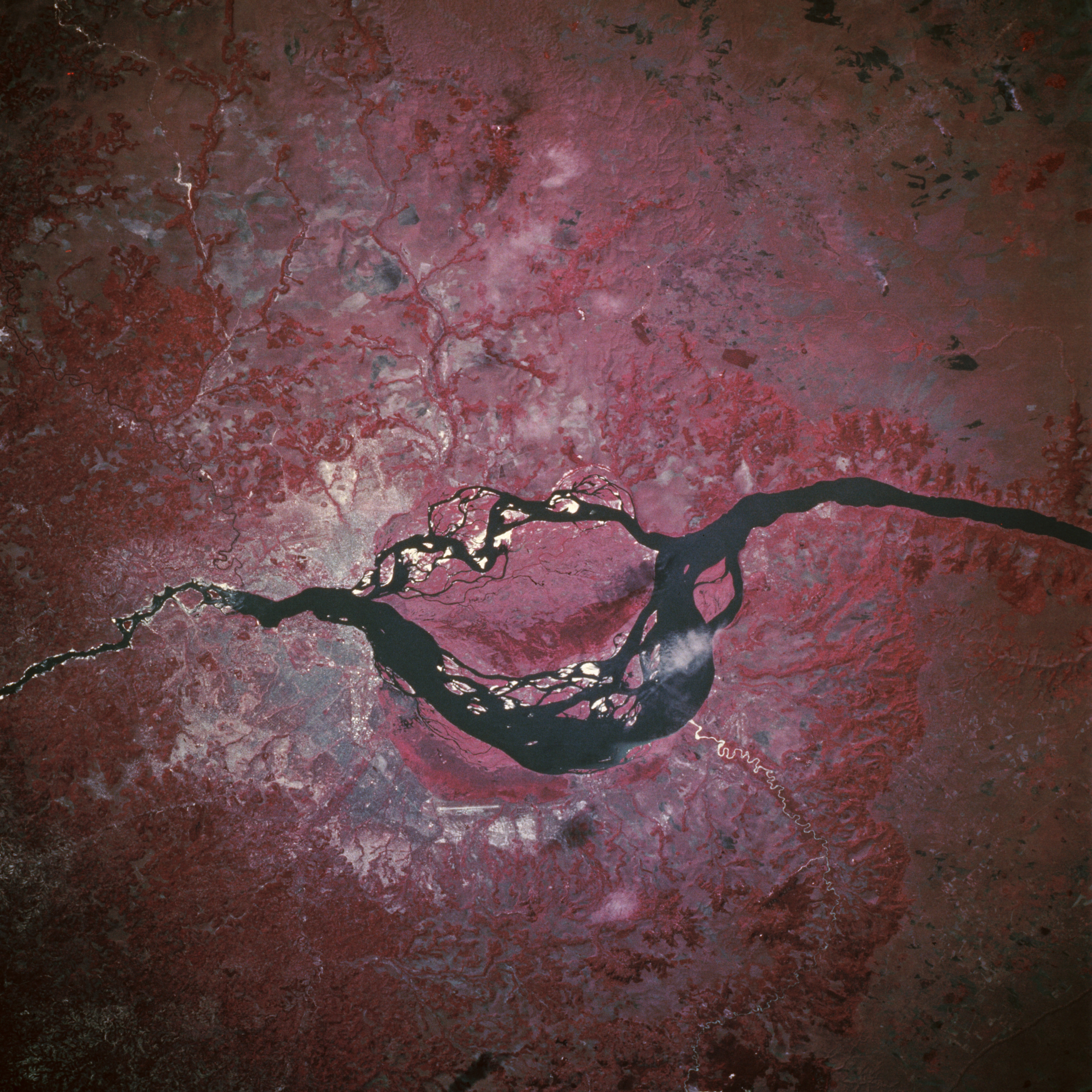
Image Caption: STS067-703D-090 Kinshasa, Zaire; Brazzaville, Congo March 1995
This near-vertical, color infrared photograph shows the Zaire River (also called the Congo River) as it travels to its mouth 230 miles (370 kilometers) to the southwest where it empties into the Atlantic Ocean. The capital cities of Kinshasa (Zaire) and Brazzaville (Congo) are situated on opposite banks of the Zaire River--Brazzaville with an estimated population of 825 000 on the northwest bank and Kinshasa with more than 4 million people on the southeast shore. The runway of Kinshasa/North Djili International Airport is discernible southeast of the city, the only major identifiable infrastructure for either city. The large island in the river is M'Bamou Island, Congo. Unlike many of the major rivers of the world, the Zaire is not an efficient transportation link because of many rapids and falls to negotiate between Kinshasa and the port city of Matadi. The color infrared film shows that little economic development has occurred on either side of the Zaire River. The general landscape is characterized by dense vegetation on the hills and low mountains (deeper reds) and marshlands primarily east of the urban areas (blues and reds). No bridge appears to connect these two large urban areas.
This near-vertical, color infrared photograph shows the Zaire River (also called the Congo River) as it travels to its mouth 230 miles (370 kilometers) to the southwest where it empties into the Atlantic Ocean. The capital cities of Kinshasa (Zaire) and Brazzaville (Congo) are situated on opposite banks of the Zaire River--Brazzaville with an estimated population of 825 000 on the northwest bank and Kinshasa with more than 4 million people on the southeast shore. The runway of Kinshasa/North Djili International Airport is discernible southeast of the city, the only major identifiable infrastructure for either city. The large island in the river is M'Bamou Island, Congo. Unlike many of the major rivers of the world, the Zaire is not an efficient transportation link because of many rapids and falls to negotiate between Kinshasa and the port city of Matadi. The color infrared film shows that little economic development has occurred on either side of the Zaire River. The general landscape is characterized by dense vegetation on the hills and low mountains (deeper reds) and marshlands primarily east of the urban areas (blues and reds). No bridge appears to connect these two large urban areas.
