STS066-95-95
| NASA Photo ID | STS066-95-95 |
| Focal Length | 100mm |
| Date taken | 1994.11.05 |
| Time taken | 05:23:49 GMT |
Resolutions offered for this image:
4096 x 4096 pixels 640 x 640 pixels 5700 x 5900 pixels 500 x 518 pixels 640 x 480 pixels 520 x 521 pixels
4096 x 4096 pixels 640 x 640 pixels 5700 x 5900 pixels 500 x 518 pixels 640 x 480 pixels 520 x 521 pixels


Cloud masks available for this image:
Spacecraft nadir point: 45.9° N, 107.5° E
Photo center point: 39.5° N, 101.0° E
Photo center point by machine learning:
Photo center point: 39.5° N, 101.0° E
Photo center point by machine learning:
Nadir to Photo Center: Southwest
Spacecraft Altitude: 164 nautical miles (304km)
Country or Geographic Name: | CHINA |
Features: | GOBI DESERT, DUST STORM |
| Features Found Using Machine Learning: | |
Cloud Cover Percentage: | 10 (1-10)% |
Sun Elevation Angle: | 28° |
Sun Azimuth: | 194° |
Camera: | Hasselblad |
Focal Length: | 100mm |
Camera Tilt: | High Oblique |
Format: | 5046: Kodak, natural color positive, Lumiere 100/5046, ASA 100, standard base |
Film Exposure: | Normal |
| Additional Information | |
| Width | Height | Annotated | Cropped | Purpose | Links |
|---|---|---|---|---|---|
| 4096 pixels | 4096 pixels | No | No | Earth From Space collection | Download Image |
| 640 pixels | 640 pixels | No | No | Earth From Space collection | Download Image |
| 5700 pixels | 5900 pixels | No | No | Download Image | |
| 500 pixels | 518 pixels | No | No | Download Image | |
| 640 pixels | 480 pixels | No | No | Download Image | |
| 520 pixels | 521 pixels | Download Image |
Download Packaged File
Download a Google Earth KML for this Image
View photo footprint information
Download a GeoTIFF for this photo
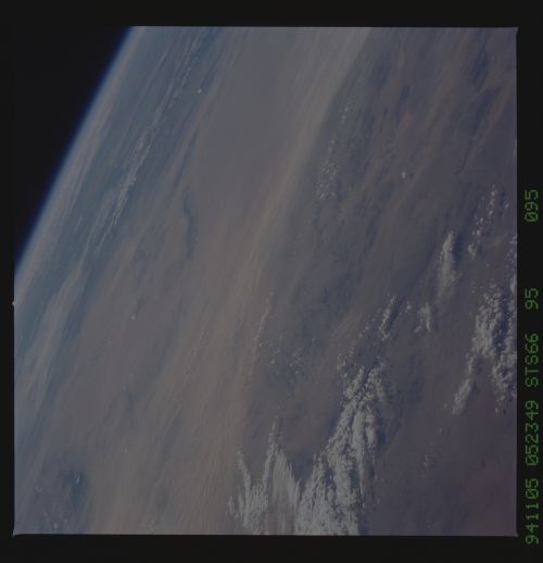
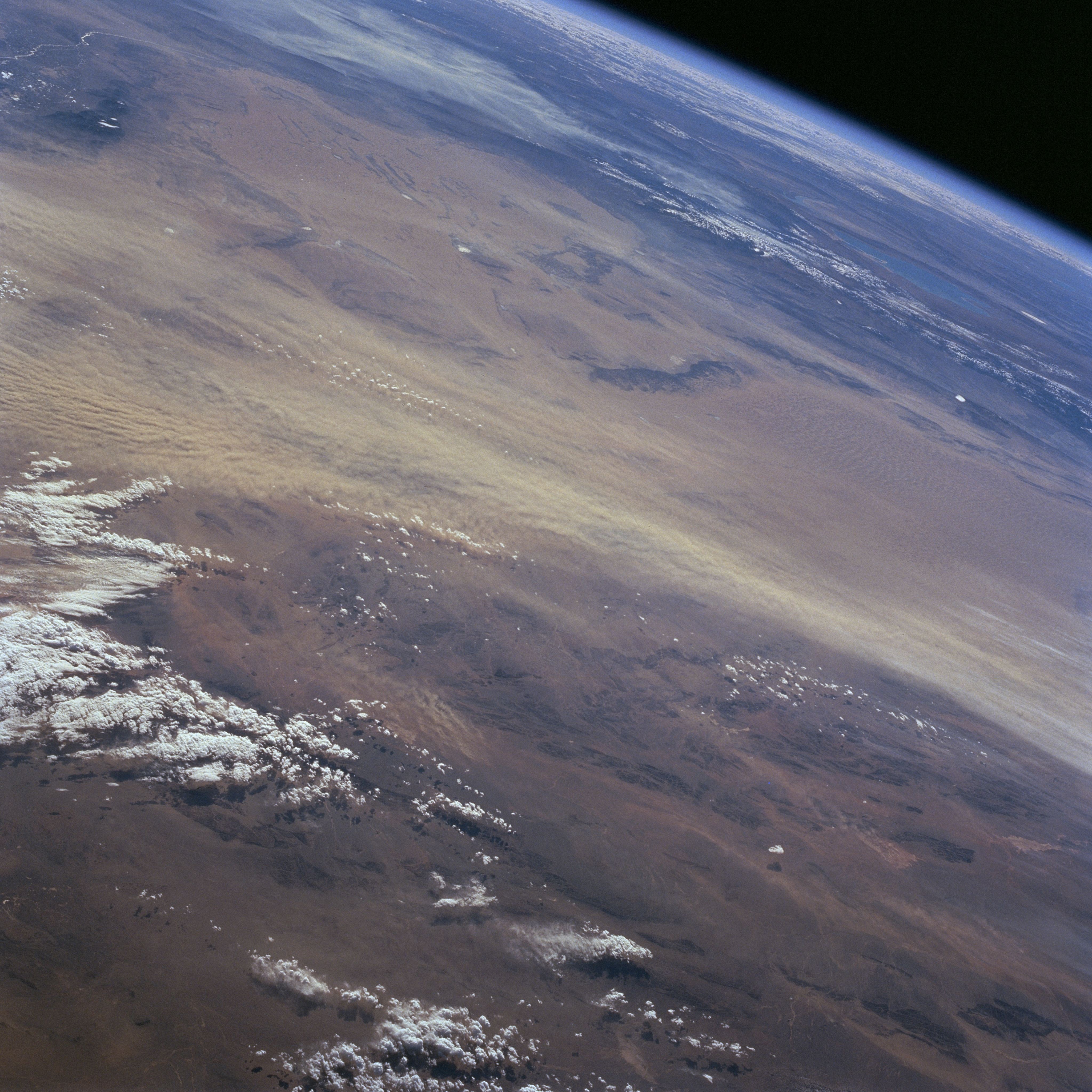
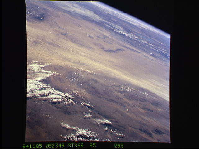
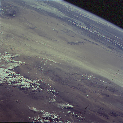
Image Caption: STS066-095-095 Dust Storm, Gobi Desert, China November 1994
This high oblique, southeasterly view shows a large dust storm in progress (light-color, east-west swath) along the southern margin of the Gobi Desert. Tremendous quantities of soil are transported from the deserts of west central China eastward. The westerly winds carry fine-grained silt from western China towards east China where large deposits of loess have created vertical cliffs that are several hundred feet high in the vicinity of the Huang Ho (formerly called the Yellow River). Recognizable physical landforms in this image include the Helan Mountains (small dark area - upper left); a very small section of the Huang Ho (light colored linear feature east of Helan Mountains); and the northeast - southwest aligned Yabral Mountains (elongated, dark feature slightly above and right of center).
This high oblique, southeasterly view shows a large dust storm in progress (light-color, east-west swath) along the southern margin of the Gobi Desert. Tremendous quantities of soil are transported from the deserts of west central China eastward. The westerly winds carry fine-grained silt from western China towards east China where large deposits of loess have created vertical cliffs that are several hundred feet high in the vicinity of the Huang Ho (formerly called the Yellow River). Recognizable physical landforms in this image include the Helan Mountains (small dark area - upper left); a very small section of the Huang Ho (light colored linear feature east of Helan Mountains); and the northeast - southwest aligned Yabral Mountains (elongated, dark feature slightly above and right of center).
