STS066-89-14
| NASA Photo ID | STS066-89-14 |
| Focal Length | 100mm |
| Date taken | 1994.11.06 |
| Time taken | 00:27:57 GMT |
Cloud masks available for this image:
Spacecraft nadir point: 52.6° S, 77.4° E
Photo center point: 53.0° S, 74.0° E
Photo center point by machine learning:
Photo center point: 53.0° S, 74.0° E
Photo center point by machine learning:
Nadir to Photo Center: West
Spacecraft Altitude: 160 nautical miles (296km)
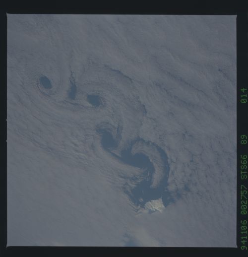
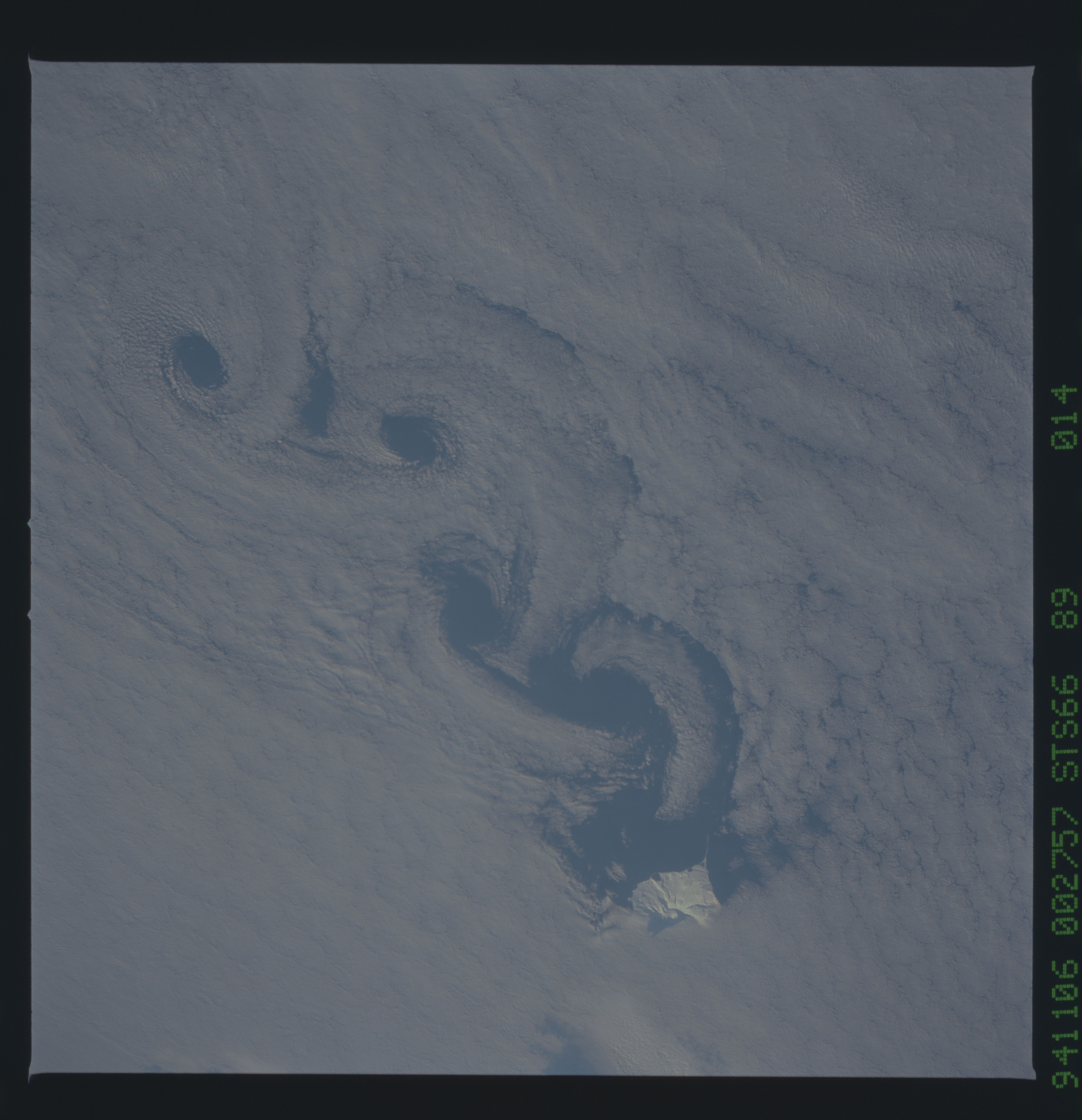
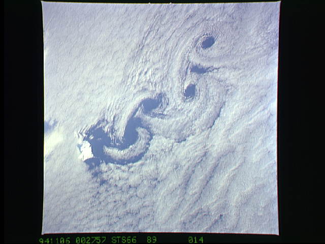
Country or Geographic Name: | INDIAN OCEAN I(S). |
Features: | HEARD I., CLOUD WAKE |
| Features Found Using Machine Learning: | |
Cloud Cover Percentage: | 95 (76-100)% |
Sun Elevation Angle: | 12° |
Sun Azimuth: | 101° |
Camera: | Hasselblad |
Focal Length: | 100mm |
Camera Tilt: | 52 degrees |
Format: | 5046: Kodak, natural color positive, Lumiere 100/5046, ASA 100, standard base |
Film Exposure: | Normal |
| Additional Information | |
| Width | Height | Annotated | Cropped | Purpose | Links |
|---|---|---|---|---|---|
| 5700 pixels | 5900 pixels | No | No | Download Image | |
| 500 pixels | 518 pixels | No | No | Download Image | |
| 640 pixels | 480 pixels | No | No | Download Image |
Download Packaged File
Download a Google Earth KML for this Image
View photo footprint information
Download a GeoTIFF for this photo
Image Caption: The Adriatic coast of Bosnia-Herzegovina and Croatia is centered at approximately 44.5 degrees north and 15.0 degrees east. The town of Bihac is located under the cloud layer near the center of the frame. The terrain is composed of limestone and geomorphic term "karst" is named after a city in the area. The Velebit Mountains form the rugged coast in the center of the frame.
As wind moved over the southern tip of South America, it is forced around the mountain peaks and causes the formation of small circular eddies. This photograph shows the effects these eddies, called Von Karmen Vortices, have on a low altitude cloud deck.
As wind moved over the southern tip of South America, it is forced around the mountain peaks and causes the formation of small circular eddies. This photograph shows the effects these eddies, called Von Karmen Vortices, have on a low altitude cloud deck.
