STS066-84-38
| NASA Photo ID | STS066-84-38 |
| Focal Length | 250mm |
| Date taken | 1994.11.08 |
| Time taken | 07:07:21 GMT |

Cloud masks available for this image:
Spacecraft nadir point: 14.6° N, 32.3° E
Photo center point: 14.0° N, 33.0° E
Photo center point by machine learning:
Photo center point: 14.0° N, 33.0° E
Photo center point by machine learning:
Nadir to Photo Center: Southeast
Spacecraft Altitude: 160 nautical miles (296km)
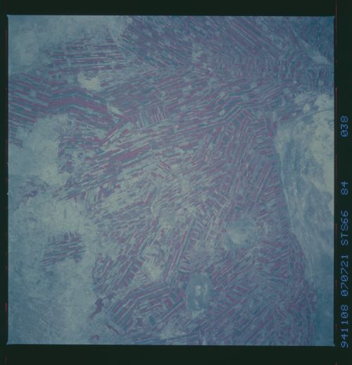
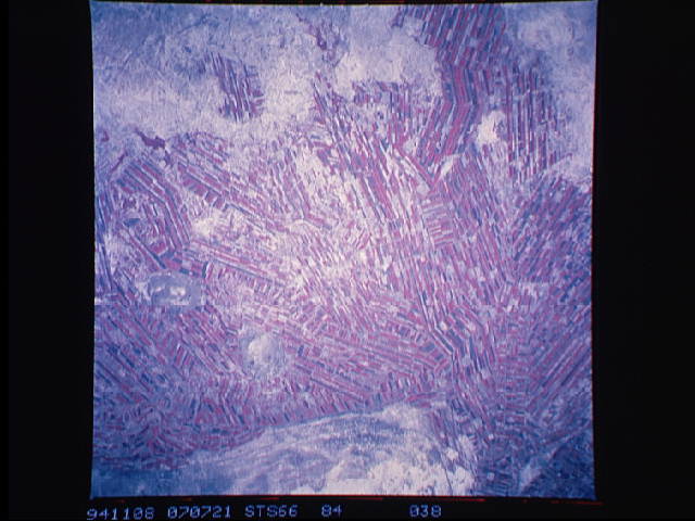
Country or Geographic Name: | SUDAN |
Features: | IRRIGATED COTTON FIELDS |
| Features Found Using Machine Learning: | |
Cloud Cover Percentage: | 0 (no clouds present) |
Sun Elevation Angle: | 42° |
Sun Azimuth: | 129° |
Camera: | Hasselblad |
Focal Length: | 250mm |
Camera Tilt: | 19 degrees |
Format: | 2443: Kodak Aerochrome 2443, color IR, thin base, EA-5 process thru June 1999, E-6 process afterward |
Film Exposure: | Normal |
| Additional Information | |
| Width | Height | Annotated | Cropped | Purpose | Links |
|---|---|---|---|---|---|
| 5700 pixels | 5900 pixels | No | No | Download Image | |
| 500 pixels | 518 pixels | No | No | Download Image | |
| 640 pixels | 480 pixels | No | No | Download Image |
Download Packaged File
Download a Google Earth KML for this Image
View photo footprint information
Download a GeoTIFF for this photo
Image Caption: Agricultural patterns are distinctly visible in this near-vertical false color infrared photograph (fig. 7). The area depicted on the photograph is south of Khartoum between the White and Blue Nile Rivers. By far the most important irrigation project in sub-Saharan Africa, both large and small scale agricultural enterprises have been developed using water transported from the perennial Nile Rivers. Hundreds of small rectangular fields and water-filled canals can be seen in this photograph. Throughout the year one half of the fields will be in crops and the other half will be fallow. This rotation system is for resting the soil and for pest control. The major crops grown in this region include cotton, durra, and millet.
