STS066-82-17
| NASA Photo ID | STS066-82-17 |
| Focal Length | 250mm |
| Date taken | 1994.11.08 |
| Time taken | 08:48:56 GMT |
Resolutions offered for this image:
4096 x 4096 pixels 640 x 640 pixels 5700 x 5900 pixels 500 x 518 pixels 640 x 480 pixels 507 x 520 pixels
4096 x 4096 pixels 640 x 640 pixels 5700 x 5900 pixels 500 x 518 pixels 640 x 480 pixels 507 x 520 pixels


Cloud masks available for this image:
Spacecraft nadir point: 47.7° N, 41.9° E
Photo center point: 47.0° N, 41.5° E
Photo center point by machine learning:
Photo center point: 47.0° N, 41.5° E
Photo center point by machine learning:
Nadir to Photo Center: Southwest
Spacecraft Altitude: 161 nautical miles (298km)
Country or Geographic Name: | RUSSIAN FEDERATION |
Features: | RES, PROLETARSK AREA |
| Features Found Using Machine Learning: | |
Cloud Cover Percentage: | 0 (no clouds present) |
Sun Elevation Angle: | 26° |
Sun Azimuth: | 178° |
Camera: | Hasselblad |
Focal Length: | 250mm |
Camera Tilt: | 17 degrees |
Format: | 2443: Kodak Aerochrome 2443, color IR, thin base, EA-5 process thru June 1999, E-6 process afterward |
Film Exposure: | Normal |
| Additional Information | |
| Width | Height | Annotated | Cropped | Purpose | Links |
|---|---|---|---|---|---|
| 4096 pixels | 4096 pixels | No | No | Earth From Space collection | Download Image |
| 640 pixels | 640 pixels | No | No | Earth From Space collection | Download Image |
| 5700 pixels | 5900 pixels | No | No | Download Image | |
| 500 pixels | 518 pixels | No | No | Download Image | |
| 640 pixels | 480 pixels | No | No | Download Image | |
| 507 pixels | 520 pixels | No | No | Download Image |
Download Packaged File
Download a Google Earth KML for this Image
View photo footprint information
Download a GeoTIFF for this photo
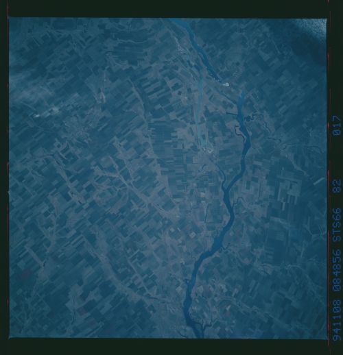
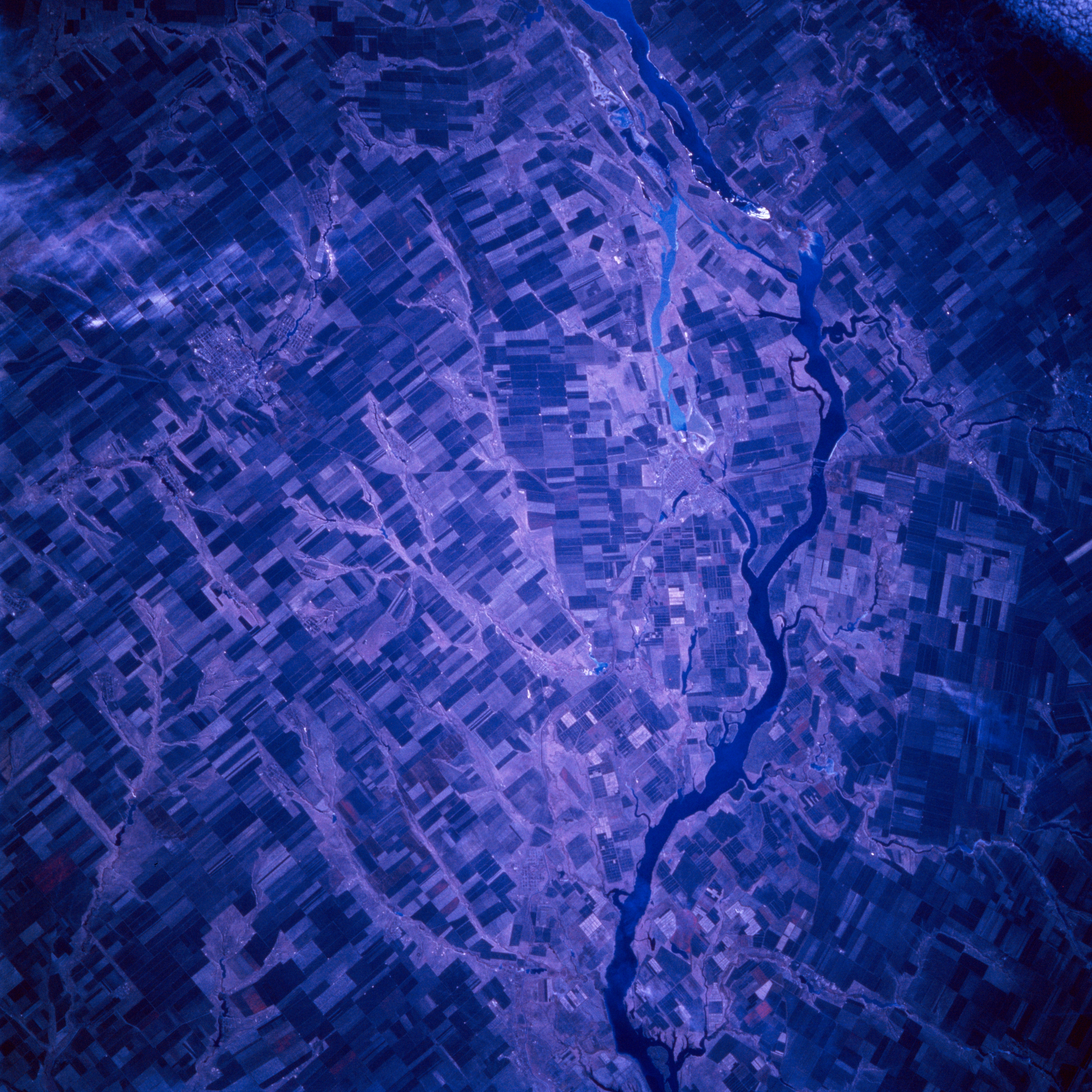
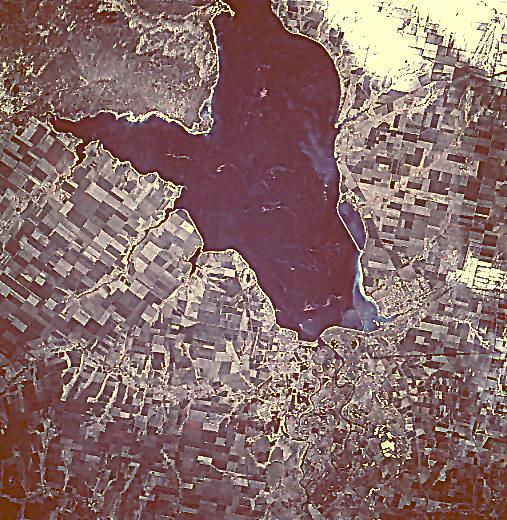
Image Caption: STS066-082-017 Tsimlyansk Reservoir, Russia November 1994
The Don River, located in southwest Russia, has been dammed creating the Tsimlyansk Reservoir (dark feature center of image). The Don River through a series of canals connects the Caspian Sea (through the Volga River) to the Black Sea. Two distinct outlets from the reservoir are visible as winding, dark features (lower right) at the western end of the reservoir. The southerly water feature is a canal and the paralleling meandering stream channel is the original Don River channel. Practically all of the land in this image is used for farming (large angular field patterns) except the large peninsula (upper left) where sandy soils are not conducive for agriculture. Due to the late autumn data acquisition timeframe of this image, healthy green field crops (vegetation) that are usually depicted in various shades of red on color infrared film are not discernible on this image. Recent snowfall obscures some cultivated fields (white areas, upper right corner).
The Don River, located in southwest Russia, has been dammed creating the Tsimlyansk Reservoir (dark feature center of image). The Don River through a series of canals connects the Caspian Sea (through the Volga River) to the Black Sea. Two distinct outlets from the reservoir are visible as winding, dark features (lower right) at the western end of the reservoir. The southerly water feature is a canal and the paralleling meandering stream channel is the original Don River channel. Practically all of the land in this image is used for farming (large angular field patterns) except the large peninsula (upper left) where sandy soils are not conducive for agriculture. Due to the late autumn data acquisition timeframe of this image, healthy green field crops (vegetation) that are usually depicted in various shades of red on color infrared film are not discernible on this image. Recent snowfall obscures some cultivated fields (white areas, upper right corner).
