STS066-158-97
| NASA Photo ID | STS066-158-97 |
| Focal Length | 250mm |
| Date taken | 1994.11.__ |
| Time taken | GMT |
Cloud masks available for this image:
Spacecraft nadir point:
Photo center point: 35.0° N, 90.0° W
Photo center point by machine learning:
Photo center point: 35.0° N, 90.0° W
Photo center point by machine learning:
Nadir to Photo Center:
Spacecraft Altitude: nautical miles (0km)
Country or Geographic Name: | USA-TENNESSEE |
Features: | MEMPHIS AREA |
| Features Found Using Machine Learning: | |
Cloud Cover Percentage: | 0 (no clouds present) |
Sun Elevation Angle: | ° |
Sun Azimuth: | ° |
Camera: | Linhof |
Focal Length: | 250mm |
Camera Tilt: | Low Oblique |
Format: | 5046: Kodak, natural color positive, Lumiere 100/5046, ASA 100, standard base |
Film Exposure: | Normal |
| Additional Information | |
| Width | Height | Annotated | Cropped | Purpose | Links |
|---|---|---|---|---|---|
| 5152 pixels | 4096 pixels | No | No | Earth From Space collection | Download Image |
| 640 pixels | 508 pixels | No | No | Earth From Space collection | Download Image |
| 640 pixels | 480 pixels | No | No | ISD 1 | Download Image |
Download Packaged File
Download a Google Earth KML for this Image
View photo footprint information
Download a GeoTIFF for this photo
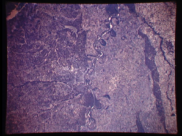
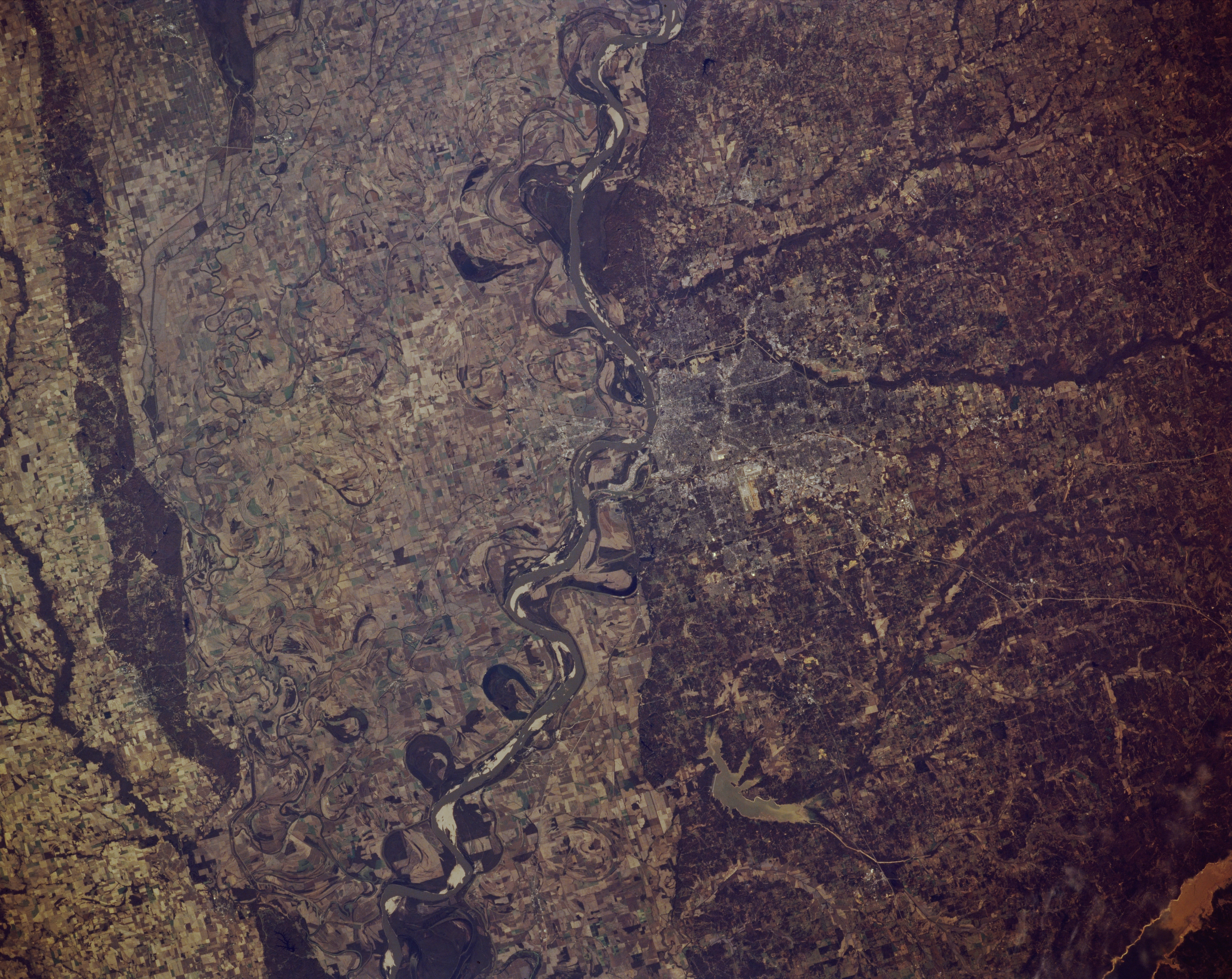
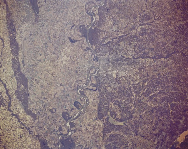
Image Caption: STS066-158-097 Mississippi River Valley, Tennessee, U.S.A. November 1994
Visible in this northeast-looking photograph are Memphis, the largest city in southwest Tennessee (east of center); West Memphis on the west side of the Mississippi River in Arkansas; two major drainage features--dark, vegetated Wolf Creek and the Loosahatchie River Canal that pass through northern Memphis and drain into the Mississippi River north of the city; and in Mississippi the Arkabutla Reservoir south of Memphis and Sardis Lake (lower right corner). The runways of Memphis International Airport are barely visible south of the urban area. The darker, eastern half of the photograph depicts an elevated, rolling terrain separated from the flat, broad floodplain by a steep escarpment that results in the linear, east-west color change between the two landforms. Apparent are extensive agriculture patterns on the floodplain; meander scars; dark, wooded bottom land that follows entrenched streambeds; thin, dark levees that have been constructed to prevent flooding on some of the floodplain; and white sandbars within the main channel of the Mississippi River.
Visible in this northeast-looking photograph are Memphis, the largest city in southwest Tennessee (east of center); West Memphis on the west side of the Mississippi River in Arkansas; two major drainage features--dark, vegetated Wolf Creek and the Loosahatchie River Canal that pass through northern Memphis and drain into the Mississippi River north of the city; and in Mississippi the Arkabutla Reservoir south of Memphis and Sardis Lake (lower right corner). The runways of Memphis International Airport are barely visible south of the urban area. The darker, eastern half of the photograph depicts an elevated, rolling terrain separated from the flat, broad floodplain by a steep escarpment that results in the linear, east-west color change between the two landforms. Apparent are extensive agriculture patterns on the floodplain; meander scars; dark, wooded bottom land that follows entrenched streambeds; thin, dark levees that have been constructed to prevent flooding on some of the floodplain; and white sandbars within the main channel of the Mississippi River.
