STS066-157-72
| NASA Photo ID | STS066-157-72 |
| Focal Length | 250mm |
| Date taken | 1994.11.08 |
| Time taken | 04:22:04 GMT |
Cloud masks available for this image:
Spacecraft nadir point: 55.7° N, 135.7° E
Photo center point: 55.0° N, 135.5° E
Photo center point by machine learning:
Photo center point: 55.0° N, 135.5° E
Photo center point by machine learning:
Nadir to Photo Center: South
Spacecraft Altitude: 162 nautical miles (300km)
Country or Geographic Name: | RUSSIAN FEDERATION |
Features: | UDA RIVER, UDSKAYA BAY |
| Features Found Using Machine Learning: | |
Cloud Cover Percentage: | 0 (no clouds present) |
Sun Elevation Angle: | 15° |
Sun Azimuth: | 205° |
Camera: | Linhof |
Focal Length: | 250mm |
Camera Tilt: | 15 degrees |
Format: | 5046: Kodak, natural color positive, Lumiere 100/5046, ASA 100, standard base |
Film Exposure: | Normal |
| Additional Information | |
| Width | Height | Annotated | Cropped | Purpose | Links |
|---|---|---|---|---|---|
| 5233 pixels | 4089 pixels | No | No | Earth From Space collection | Download Image |
| 639 pixels | 500 pixels | No | No | Earth From Space collection | Download Image |
| 640 pixels | 480 pixels | No | No | ISD 1 | Download Image |
Download Packaged File
Download a Google Earth KML for this Image
View photo footprint information
Download a GeoTIFF for this photo
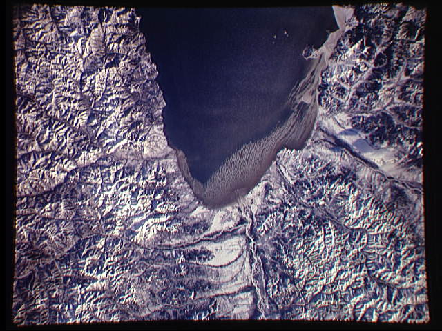
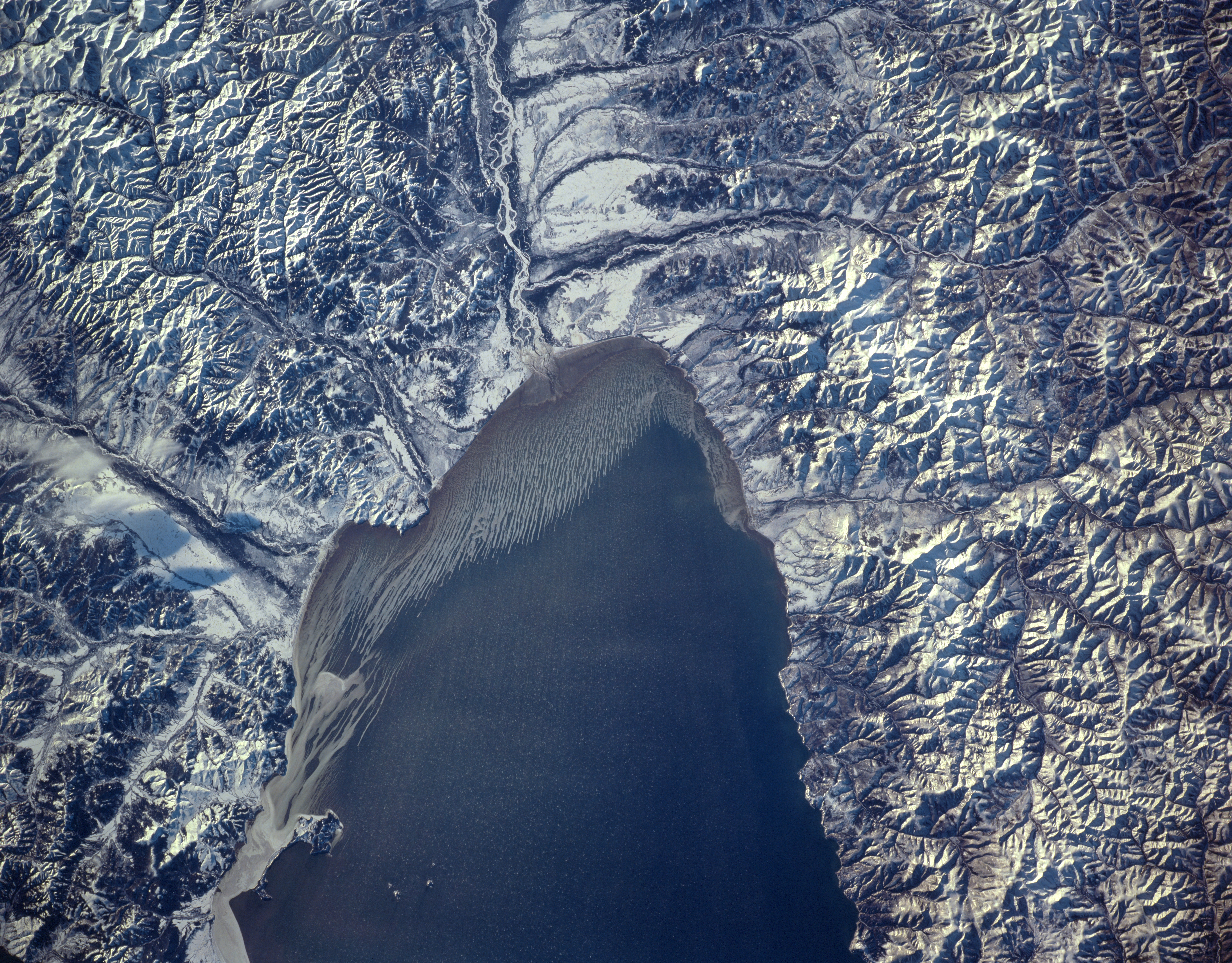
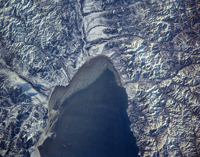
Image Caption: STS066-157-072 Udskaya Bay, Russia November 1994
Several rivers enter the western end of Udskaya Bay along the cold, sparsely populated east coast of Russia. While most of this landscape is snow-covered mountains (with peak elevations ranging from 3000 feet - 915 meters to 5000 feet - 1524 meters), the Uda River Valley with its meandering, multi-braided channels has built a small delta along the western fringe of the bay. The drainage pattern around the periphery of the bay is very pronounced with several well-entrenched winding streams cutting through numerous valleys. The smaller Torom River Valley is visible as it drains northward and empties into the south side of the bay. A multitude of paralleling pieces of sea ice (linear, white, east-west aligned features along the extreme western margin of the bay - center of image) have already formed in this late autumn image. Smaller ice fragments (white flecks) are seen forming towards the center of Udskaya Bay.
Several rivers enter the western end of Udskaya Bay along the cold, sparsely populated east coast of Russia. While most of this landscape is snow-covered mountains (with peak elevations ranging from 3000 feet - 915 meters to 5000 feet - 1524 meters), the Uda River Valley with its meandering, multi-braided channels has built a small delta along the western fringe of the bay. The drainage pattern around the periphery of the bay is very pronounced with several well-entrenched winding streams cutting through numerous valleys. The smaller Torom River Valley is visible as it drains northward and empties into the south side of the bay. A multitude of paralleling pieces of sea ice (linear, white, east-west aligned features along the extreme western margin of the bay - center of image) have already formed in this late autumn image. Smaller ice fragments (white flecks) are seen forming towards the center of Udskaya Bay.
