STS066-157-134
| NASA Photo ID | STS066-157-134 |
| Focal Length | 250mm |
| Date taken | 1994.11.08 |
| Time taken | 05:52:25 GMT |

Cloud masks available for this image:
Spacecraft nadir point: 55.6° N, 112.1° E
Photo center point: 56.0° N, 111.5° E
Photo center point by machine learning:
Photo center point: 56.0° N, 111.5° E
Photo center point by machine learning:
Nadir to Photo Center: Northwest
Spacecraft Altitude: 162 nautical miles (300km)
Country or Geographic Name: | RUSSIAN FEDERATION |
Features: | ANGARA RIVER VALLEY |
| Features Found Using Machine Learning: | |
Cloud Cover Percentage: | 5 (1-10)% |
Sun Elevation Angle: | 15° |
Sun Azimuth: | 204° |
Camera: | Linhof |
Focal Length: | 250mm |
Camera Tilt: | 15 degrees |
Format: | 5046: Kodak, natural color positive, Lumiere 100/5046, ASA 100, standard base |
Film Exposure: | Normal |
| Additional Information | |
| Width | Height | Annotated | Cropped | Purpose | Links |
|---|---|---|---|---|---|
| 5225 pixels | 4089 pixels | No | No | Earth From Space collection | Download Image |
| 639 pixels | 500 pixels | No | No | Earth From Space collection | Download Image |
| 640 pixels | 480 pixels | No | No | ISD 1 | Download Image |
Download Packaged File
Download a Google Earth KML for this Image
View photo footprint information
Download a GeoTIFF for this photo
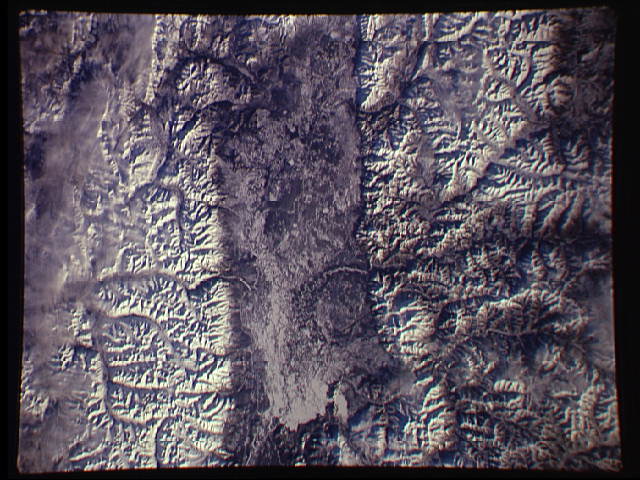
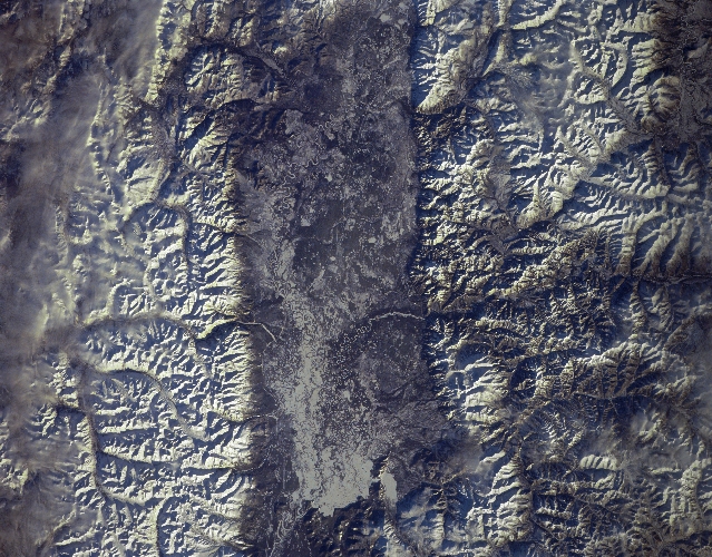
Image Caption: STS066-157-134 Angara River Valley, Russia November 1994
The valley of the Angara River, flanked by the Verkhne Angarsk Range to the north (bottom of image) and the Jkatsk Range to the south (top of image), is visible in this near-nadir view. This view is located to the east of the northern end of Lake Baykal. Snow covers the mountains and the river valley. Though portions of the Angara River Valley are swampy (right center), agricultural products are grown in the river valley during the summer months. Iron, coal, and gold deposits are found in the Angara Basin.
The valley of the Angara River, flanked by the Verkhne Angarsk Range to the north (bottom of image) and the Jkatsk Range to the south (top of image), is visible in this near-nadir view. This view is located to the east of the northern end of Lake Baykal. Snow covers the mountains and the river valley. Though portions of the Angara River Valley are swampy (right center), agricultural products are grown in the river valley during the summer months. Iron, coal, and gold deposits are found in the Angara Basin.
