STS066-153-175
| NASA Photo ID | STS066-153-175 |
| Focal Length | 250mm |
| Date taken | 1994.11.10 |
| Time taken | 16:34:04 GMT |
Cloud masks available for this image:
Spacecraft nadir point: 46.5° N, 89.6° W
Photo center point: 44.5° N, 88.5° W
Photo center point by machine learning:
Photo center point: 44.5° N, 88.5° W
Photo center point by machine learning:
Nadir to Photo Center: Southeast
Spacecraft Altitude: 158 nautical miles (293km)
Country or Geographic Name: | USA-WISCONSIN |
Features: | GREEN BAY, LAKE WINNEBAGO |
| Features Found Using Machine Learning: | |
Cloud Cover Percentage: | 5 (1-10)% |
Sun Elevation Angle: | 25° |
Sun Azimuth: | 162° |
Camera: | Linhof |
Focal Length: | 250mm |
Camera Tilt: | 41 degrees |
Format: | 5046: Kodak, natural color positive, Lumiere 100/5046, ASA 100, standard base |
Film Exposure: | Normal |
| Additional Information | |
| Width | Height | Annotated | Cropped | Purpose | Links |
|---|---|---|---|---|---|
| 5152 pixels | 4096 pixels | No | No | Earth From Space collection | Download Image |
| 640 pixels | 508 pixels | No | No | Earth From Space collection | Download Image |
| 640 pixels | 480 pixels | No | No | ISD 1 | Download Image |
Download Packaged File
Download a Google Earth KML for this Image
View photo footprint information
Download a GeoTIFF for this photo
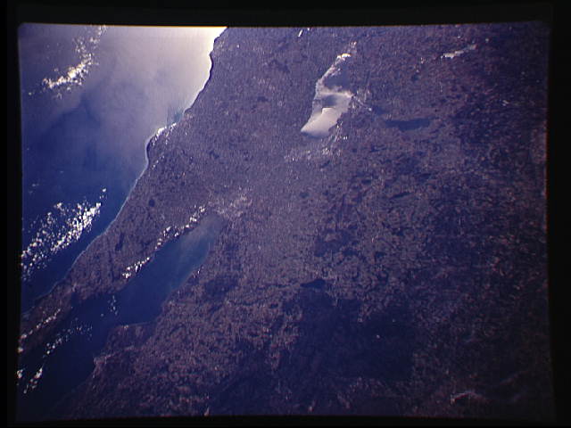
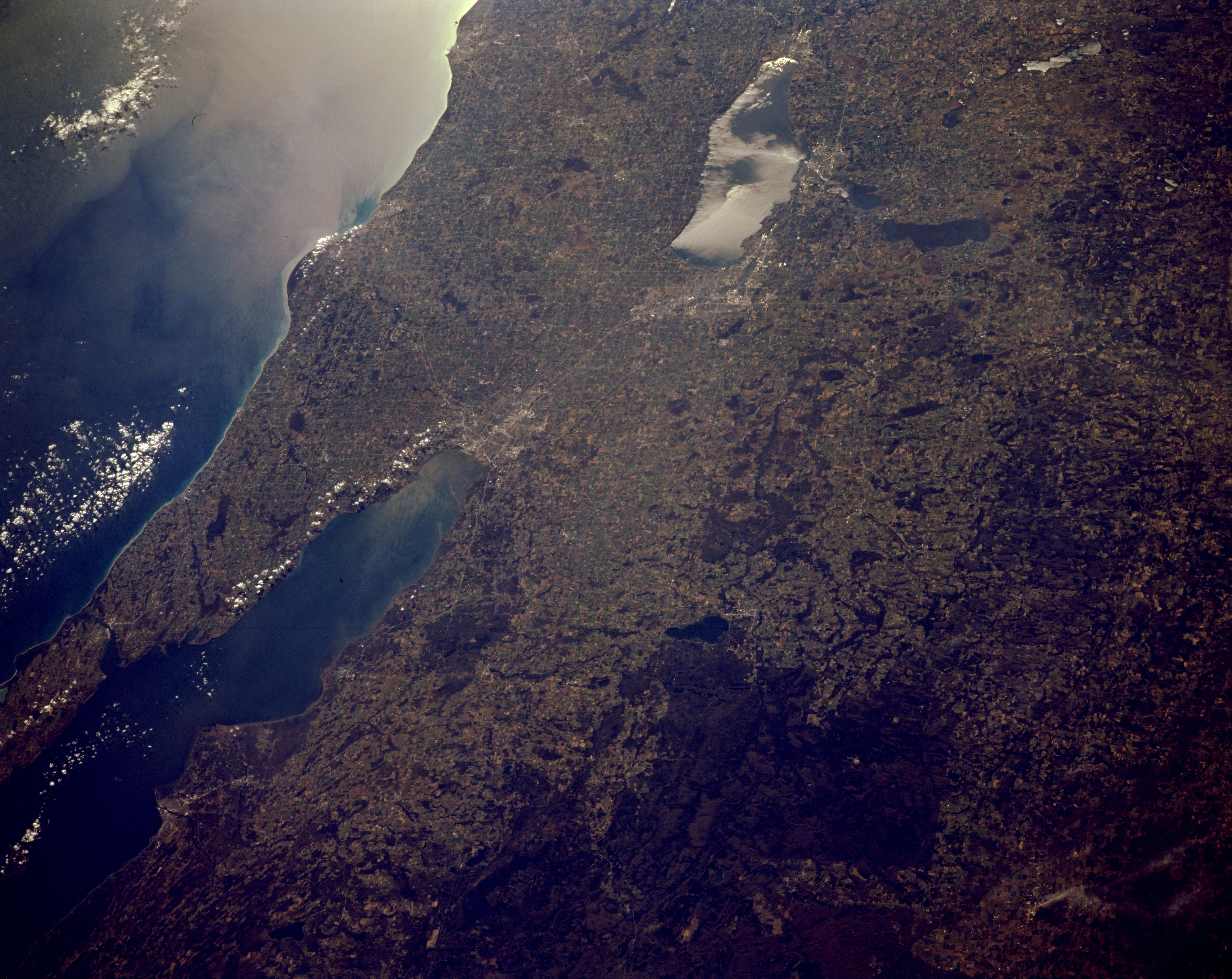
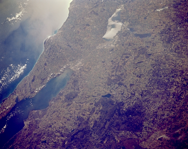
Image Caption: STS066-153-175 Green Bay, Door Peninsula; Lake Winnebago, Wisconsin, U.S.A. November 1994
Featured in this south-southeast-looking, low-oblique photograph are Lake Winnebago, Green Bay, and Door Peninsula in east-central Wisconsin. Green Bay, an arm of Lake Michigan (bottom left), is 100 miles (160 kilometers) long and 10 to 20 miles (16 to 32 kilometers) wide. At its southern end is the city of Green Bay at the mouth of the Fox River, whose sediment plume appears in the southern end of the bay. Southwest of Green Bay lies Lake Winnebago (seen in sunglint), a recreation area 30 miles (48 kilometers) long and 10 miles (16 kilometers) at its widest point. West of Lake Winnebago and Oshkosh is Lake Poygan. Viewing north from Lake Winnebago are Appleton (barely discernible), Shawano Lake, Menominee Indian Reservation, and the Nicolet National Forest. The central plains of Wisconsin are visible along the upper right and right center of the photograph.
Featured in this south-southeast-looking, low-oblique photograph are Lake Winnebago, Green Bay, and Door Peninsula in east-central Wisconsin. Green Bay, an arm of Lake Michigan (bottom left), is 100 miles (160 kilometers) long and 10 to 20 miles (16 to 32 kilometers) wide. At its southern end is the city of Green Bay at the mouth of the Fox River, whose sediment plume appears in the southern end of the bay. Southwest of Green Bay lies Lake Winnebago (seen in sunglint), a recreation area 30 miles (48 kilometers) long and 10 miles (16 kilometers) at its widest point. West of Lake Winnebago and Oshkosh is Lake Poygan. Viewing north from Lake Winnebago are Appleton (barely discernible), Shawano Lake, Menominee Indian Reservation, and the Nicolet National Forest. The central plains of Wisconsin are visible along the upper right and right center of the photograph.
