STS066-152-115
| NASA Photo ID | STS066-152-115 |
| Focal Length | 90mm |
| Date taken | 1994.11.__ |
| Time taken | GMT |
Cloud masks available for this image:
Spacecraft nadir point:
Photo center point: 33.0° N, 98.5° W
Photo center point by machine learning:
Photo center point: 33.0° N, 98.5° W
Photo center point by machine learning:
Nadir to Photo Center:
Spacecraft Altitude: nautical miles (0km)
Country or Geographic Name: | USA-TEXAS |
Features: | NEAR POSSUM KINGDOM L. |
| Features Found Using Machine Learning: | |
Cloud Cover Percentage: | 0 (no clouds present) |
Sun Elevation Angle: | ° |
Sun Azimuth: | ° |
Camera: | Linhof |
Focal Length: | 90mm |
Camera Tilt: | Near Vertical |
Format: | 5046: Kodak, natural color positive, Lumiere 100/5046, ASA 100, standard base |
Film Exposure: | Normal |
| Additional Information | |
| Width | Height | Annotated | Cropped | Purpose | Links |
|---|---|---|---|---|---|
| 5152 pixels | 4096 pixels | No | No | Earth From Space collection | Download Image |
| 640 pixels | 508 pixels | No | No | Earth From Space collection | Download Image |
| 640 pixels | 480 pixels | No | No | ISD 1 | Download Image |
Download Packaged File
Download a Google Earth KML for this Image
View photo footprint information
Download a GeoTIFF for this photo
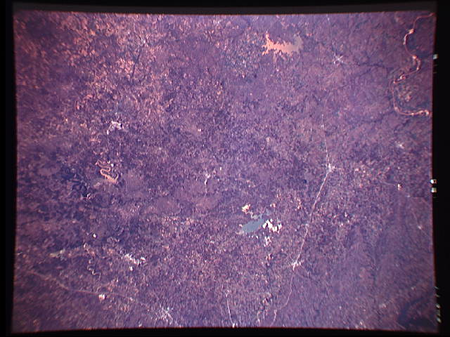
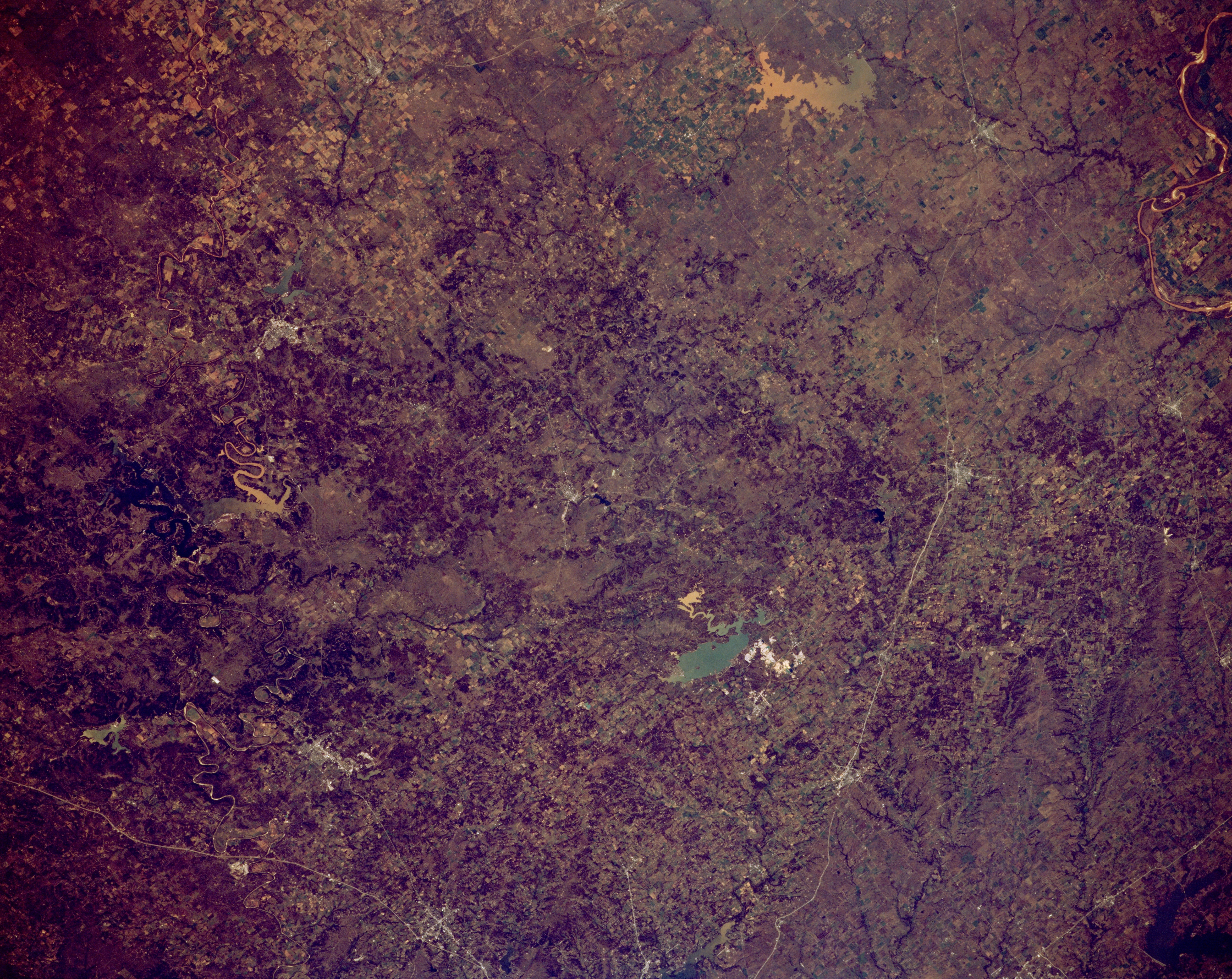
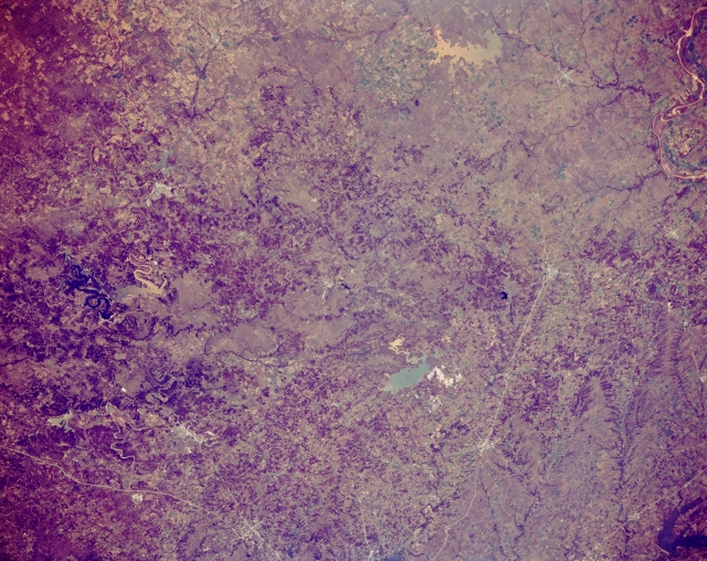
Image Caption: STS066-152-115 Lake Bridgeport, Texas, U.S.A. November 1994
This northwest-looking, panoramic photograph features low plateaus, rolling prairies, and cuestas west and northwest of Fort Worth. Discernible are Decatur, Bowie, and Henrietta along U.S. Highway 287 that connects Fort Worth with Wichita Falls. Two sizable reservoirs, aqua Lake Bridgeport and muddy Lake Arrowhead, lie west of U.S. Highway 287. More difficult to identify southwest of Lake Bridgeport is Possum Kingdom Lake, the northern branch of which appears muddy, while the western section is very dark. East-west-oriented Interstate Highway 20 (bottom left corner) appears south of Weatherford, just west of Fort Worth. A small section of the Red River is visible (upper right corner).
This northwest-looking, panoramic photograph features low plateaus, rolling prairies, and cuestas west and northwest of Fort Worth. Discernible are Decatur, Bowie, and Henrietta along U.S. Highway 287 that connects Fort Worth with Wichita Falls. Two sizable reservoirs, aqua Lake Bridgeport and muddy Lake Arrowhead, lie west of U.S. Highway 287. More difficult to identify southwest of Lake Bridgeport is Possum Kingdom Lake, the northern branch of which appears muddy, while the western section is very dark. East-west-oriented Interstate Highway 20 (bottom left corner) appears south of Weatherford, just west of Fort Worth. A small section of the Red River is visible (upper right corner).
