STS066-127-6
| NASA Photo ID | STS066-127-6 |
| Focal Length | 40mm |
| Date taken | 1994.11.07 |
| Time taken | 14:41:48 GMT |

Cloud masks available for this image:
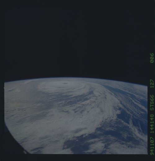
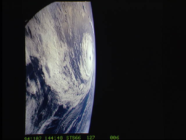
Spacecraft nadir point: 43.5° N, 49.4° W
Photo center point:
Photo center point by machine learning:
Photo center point:
Photo center point by machine learning:
Nadir to Photo Center:
Spacecraft Altitude: 162 nautical miles (300km)
Country or Geographic Name: | ATLANTIC OCEAN |
Features: | PAN-HURRICANE |
| Features Found Using Machine Learning: | |
Cloud Cover Percentage: | 65 (51-75)% |
Sun Elevation Angle: | 30° |
Sun Azimuth: | 175° |
Camera: | Hasselblad |
Focal Length: | 40mm |
Camera Tilt: | High Oblique |
Format: | 5046: Kodak, natural color positive, Lumiere 100/5046, ASA 100, standard base |
Film Exposure: | Normal |
| Additional Information | |
| Width | Height | Annotated | Cropped | Purpose | Links |
|---|---|---|---|---|---|
| 5700 pixels | 5900 pixels | No | No | Download Image | |
| 500 pixels | 518 pixels | No | No | Download Image | |
| 640 pixels | 480 pixels | No | No | Download Image |
Download Packaged File
Download a Google Earth KML for this Image
View photo footprint information
Download a GeoTIFF for this photo
Image Caption: From 165 nautical miles above the earth, the STS-66 astronauts were able to capture detail in a number of storm systems around the globe during their 11-day stay in space aboard the Space Shuttle Atlantis. A 70mm handheld Hasselblad was used to photograph Hurricane Florence in the Atlantic Ocean, about 400 miles from Bermuda.
