STS066-127-32
| NASA Photo ID | STS066-127-32 |
| Focal Length | 100mm |
| Date taken | 1994.11.07 |
| Time taken | 16:11:51 GMT |
Resolutions offered for this image:
3904 x 3904 pixels 639 x 639 pixels 5700 x 5900 pixels 500 x 518 pixels 640 x 480 pixels
3904 x 3904 pixels 639 x 639 pixels 5700 x 5900 pixels 500 x 518 pixels 640 x 480 pixels

Cloud masks available for this image:
Spacecraft nadir point: 42.4° N, 74.0° W
Photo center point: 41.0° N, 73.5° W
Photo center point by machine learning:
Photo center point: 41.0° N, 73.5° W
Photo center point by machine learning:
Nadir to Photo Center: South
Spacecraft Altitude: 162 nautical miles (300km)
Country or Geographic Name: | USA-NEW YORK |
Features: | LONG ISLAND, NEW YORK CY |
| Features Found Using Machine Learning: | |
Cloud Cover Percentage: | 0 (no clouds present) |
Sun Elevation Angle: | 31° |
Sun Azimuth: | 172° |
Camera: | Hasselblad |
Focal Length: | 100mm |
Camera Tilt: | 29 degrees |
Format: | 5046: Kodak, natural color positive, Lumiere 100/5046, ASA 100, standard base |
Film Exposure: | Normal |
| Additional Information | |
| Width | Height | Annotated | Cropped | Purpose | Links |
|---|---|---|---|---|---|
| 3904 pixels | 3904 pixels | No | No | Earth From Space collection | Download Image |
| 639 pixels | 639 pixels | No | No | Earth From Space collection | Download Image |
| 5700 pixels | 5900 pixels | No | No | Download Image | |
| 500 pixels | 518 pixels | No | No | Download Image | |
| 640 pixels | 480 pixels | No | No | Download Image |
Download Packaged File
Download a Google Earth KML for this Image
View photo footprint information
Download a GeoTIFF for this photo
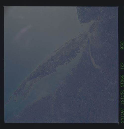
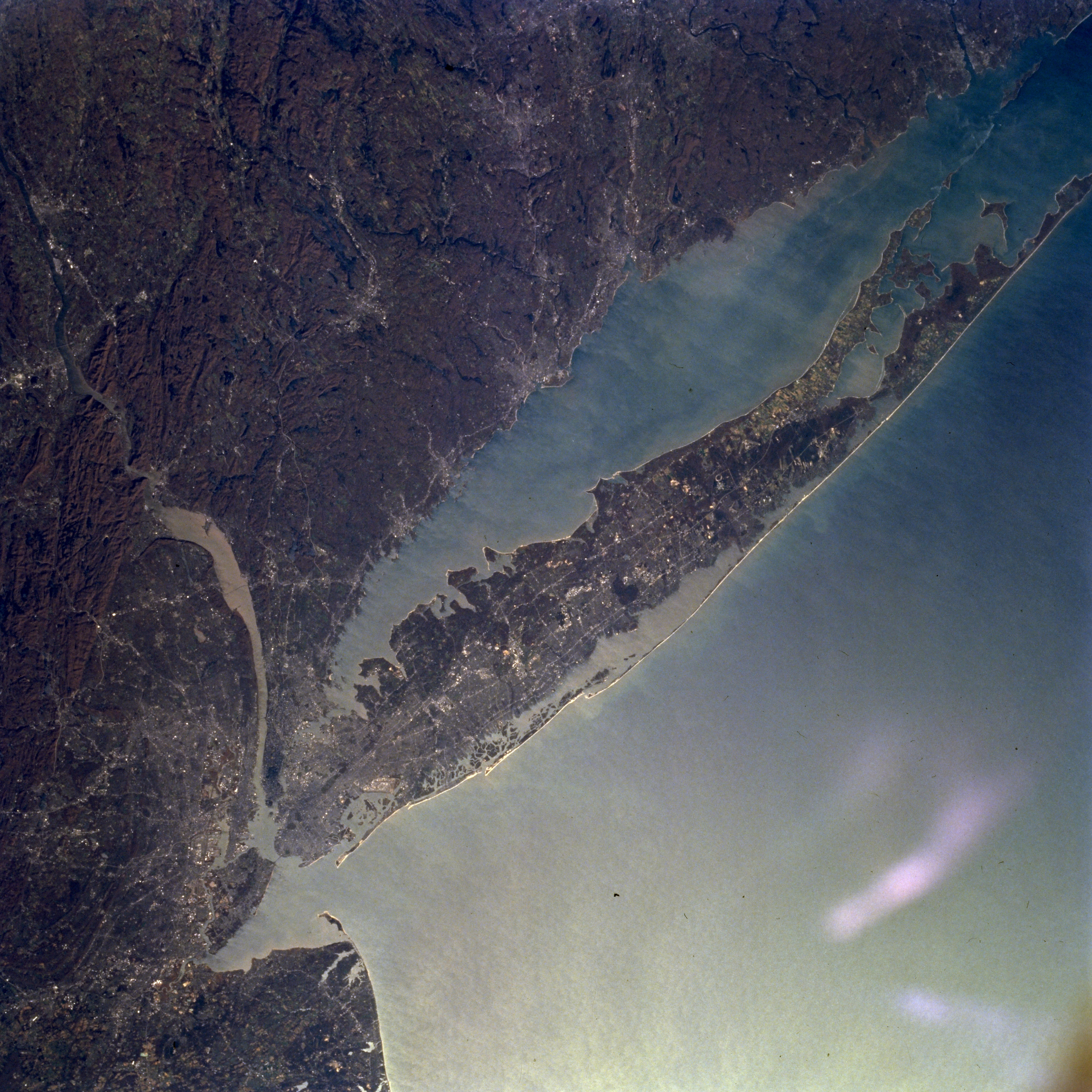
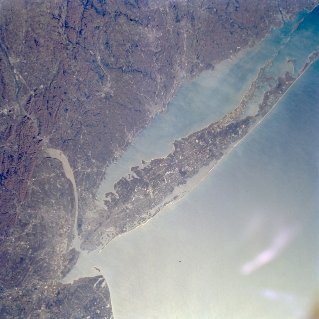
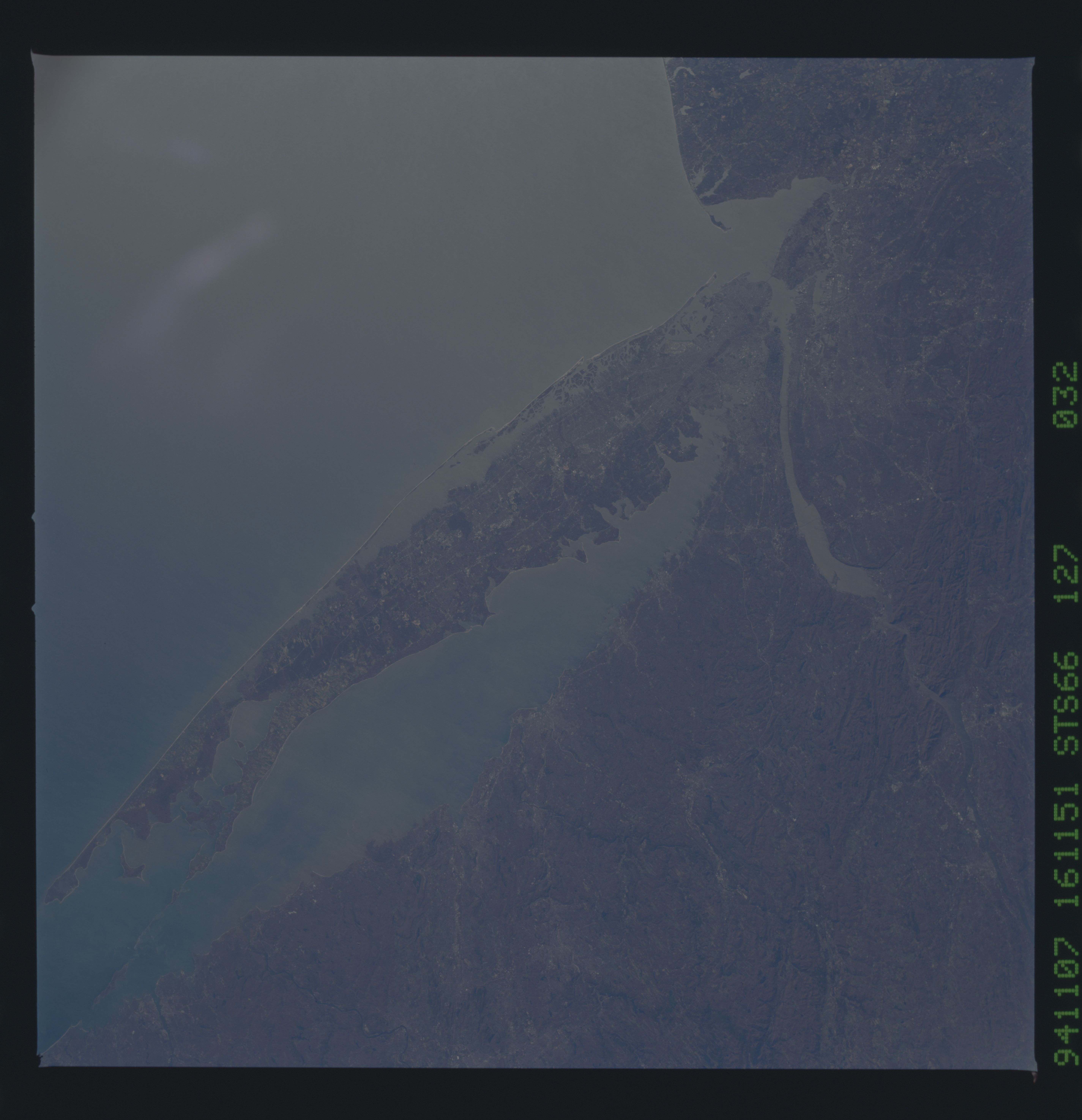
Image Caption: STS066-127-032 Long Island, New York November 1994
The fourth largest island of the United States and the largest outside of Alaska and Hawaii, Long Island can be seen in this northeast-looking view. Long Island is 118 miles (190 km) long, 12 to 20 miles (19 to 32 km) wide, and covers an area of 1723 sq. miles (4463 sq. km). Most of northern Long Island is made up of glacial deposits forming small hills and cliffs and indented bays. The southern portions of Long Island are low-lying out-wash plains of glacial deposits consisting of long sandy beaches, backed by dunes and shallow lagoons. Sand and gravel are quarried from the island's glacial deposits. Commercial fishing and recreation are also important commodities of the island. Long Island Sound, a former river valley, separates Long Island from the southern coast of the state of Connecticut. The New York/Newark Metropolitan areas are discernible extending north to south along the left (western) edge of the image.
The fourth largest island of the United States and the largest outside of Alaska and Hawaii, Long Island can be seen in this northeast-looking view. Long Island is 118 miles (190 km) long, 12 to 20 miles (19 to 32 km) wide, and covers an area of 1723 sq. miles (4463 sq. km). Most of northern Long Island is made up of glacial deposits forming small hills and cliffs and indented bays. The southern portions of Long Island are low-lying out-wash plains of glacial deposits consisting of long sandy beaches, backed by dunes and shallow lagoons. Sand and gravel are quarried from the island's glacial deposits. Commercial fishing and recreation are also important commodities of the island. Long Island Sound, a former river valley, separates Long Island from the southern coast of the state of Connecticut. The New York/Newark Metropolitan areas are discernible extending north to south along the left (western) edge of the image.
