STS066-125-5
| NASA Photo ID | STS066-125-5 |
| Focal Length | 40mm |
| Date taken | 1994.11.12 |
| Time taken | 06:07:40 GMT |

Cloud masks available for this image:
Spacecraft nadir point: 32.7° N, 39.6° E
Photo center point: 28.0° N, 35.0° E
Photo center point by machine learning:
Photo center point: 28.0° N, 35.0° E
Photo center point by machine learning:
Nadir to Photo Center: Southwest
Spacecraft Altitude: 158 nautical miles (293km)
Country or Geographic Name: | SAUDI ARABIA |
Features: | PAN-SINAI PEN., G. OF SUEZ |
| Features Found Using Machine Learning: | |
Cloud Cover Percentage: | 5 (1-10)% |
Sun Elevation Angle: | 24° |
Sun Azimuth: | 133° |
Camera: | Hasselblad |
Focal Length: | 40mm |
Camera Tilt: | High Oblique |
Format: | 5046: Kodak, natural color positive, Lumiere 100/5046, ASA 100, standard base |
Film Exposure: | Normal |
| Additional Information | |
| Width | Height | Annotated | Cropped | Purpose | Links |
|---|---|---|---|---|---|
| 5700 pixels | 5900 pixels | No | No | Download Image | |
| 500 pixels | 518 pixels | No | No | Download Image | |
| 640 pixels | 480 pixels | No | No | Download Image |
Download Packaged File
Download a Google Earth KML for this Image
View photo footprint information
Download a GeoTIFF for this photo
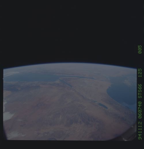
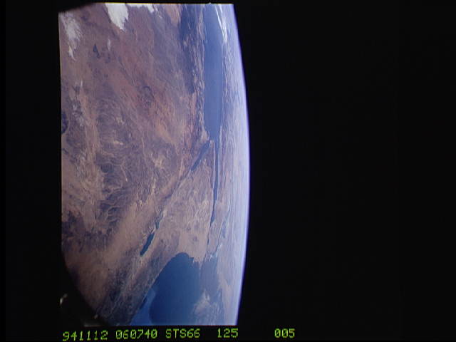
Image Caption: A high oblique view of the Middle East centered at approximately 28.0 degrees north and 34.0 degrees east. Portions of the countries of Egypt, Israel, Jordan and Saudi Arabia are visible. The Dead Sea Rift Valley continuing into the Gulf of Aqaba marks the boundary between Israel and Jordan. The vegetation change in the Sinai Peninsula is the border between the Gaza Strip and Egypt. In Egypt, the Suez Canal connects the Gulf of Suez with the Mediterranean Sea and forms the western boundary of the Sinai Peninsula. The green ribbon of the Nile River is in marked contrast to this arid region. Even the Jordan River does not support large scale agriculture.
