STS066-124-35
| NASA Photo ID | STS066-124-35 |
| Focal Length | 100mm |
| Date taken | 1994.11.10 |
| Time taken | 16:30:15 GMT |
Resolutions offered for this image:
3904 x 3904 pixels 639 x 639 pixels 5700 x 5900 pixels 500 x 518 pixels 640 x 480 pixels
3904 x 3904 pixels 639 x 639 pixels 5700 x 5900 pixels 500 x 518 pixels 640 x 480 pixels


Cloud masks available for this image:
Spacecraft nadir point: 36.2° N, 103.4° W
Photo center point: 37.0° N, 105.5° W
Photo center point by machine learning:
Photo center point: 37.0° N, 105.5° W
Photo center point by machine learning:
Nadir to Photo Center: West
Spacecraft Altitude: 158 nautical miles (293km)
Country or Geographic Name: | USA-COLORADO |
Features: | SANGRE DE CRISTO MTS, VOL |
| Features Found Using Machine Learning: | |
Cloud Cover Percentage: | 0 (no clouds present) |
Sun Elevation Angle: | 29° |
Sun Azimuth: | 145° |
Camera: | Hasselblad |
Focal Length: | 100mm |
Camera Tilt: | 41 degrees |
Format: | 5046: Kodak, natural color positive, Lumiere 100/5046, ASA 100, standard base |
Film Exposure: | Normal |
| Additional Information | |
| Width | Height | Annotated | Cropped | Purpose | Links |
|---|---|---|---|---|---|
| 3904 pixels | 3904 pixels | No | No | Earth From Space collection | Download Image |
| 639 pixels | 639 pixels | No | No | Earth From Space collection | Download Image |
| 5700 pixels | 5900 pixels | No | No | Download Image | |
| 500 pixels | 518 pixels | No | No | Download Image | |
| 640 pixels | 480 pixels | No | No | Download Image |
Download Packaged File
Download a Google Earth KML for this Image
View photo footprint information
Download a GeoTIFF for this photo
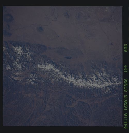
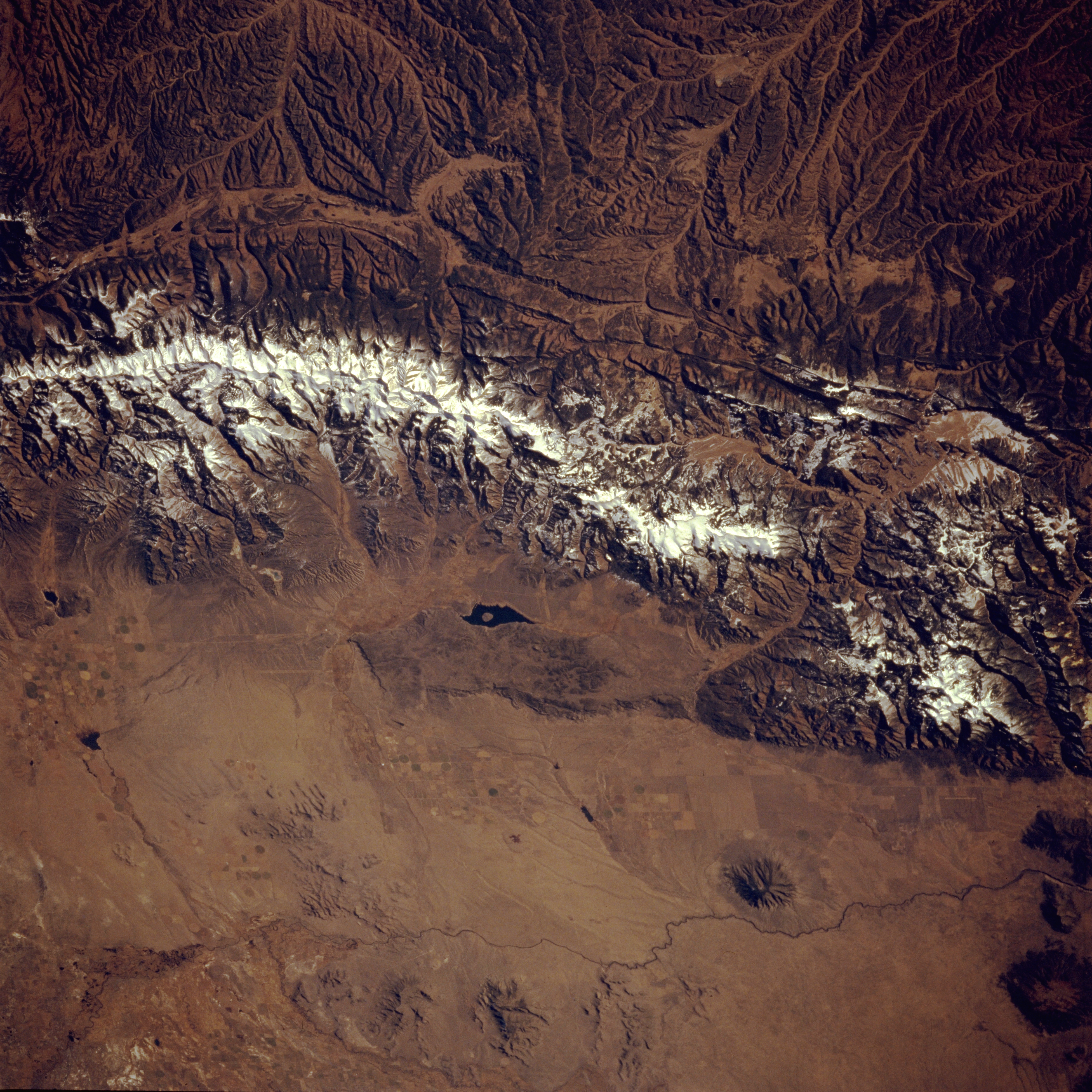
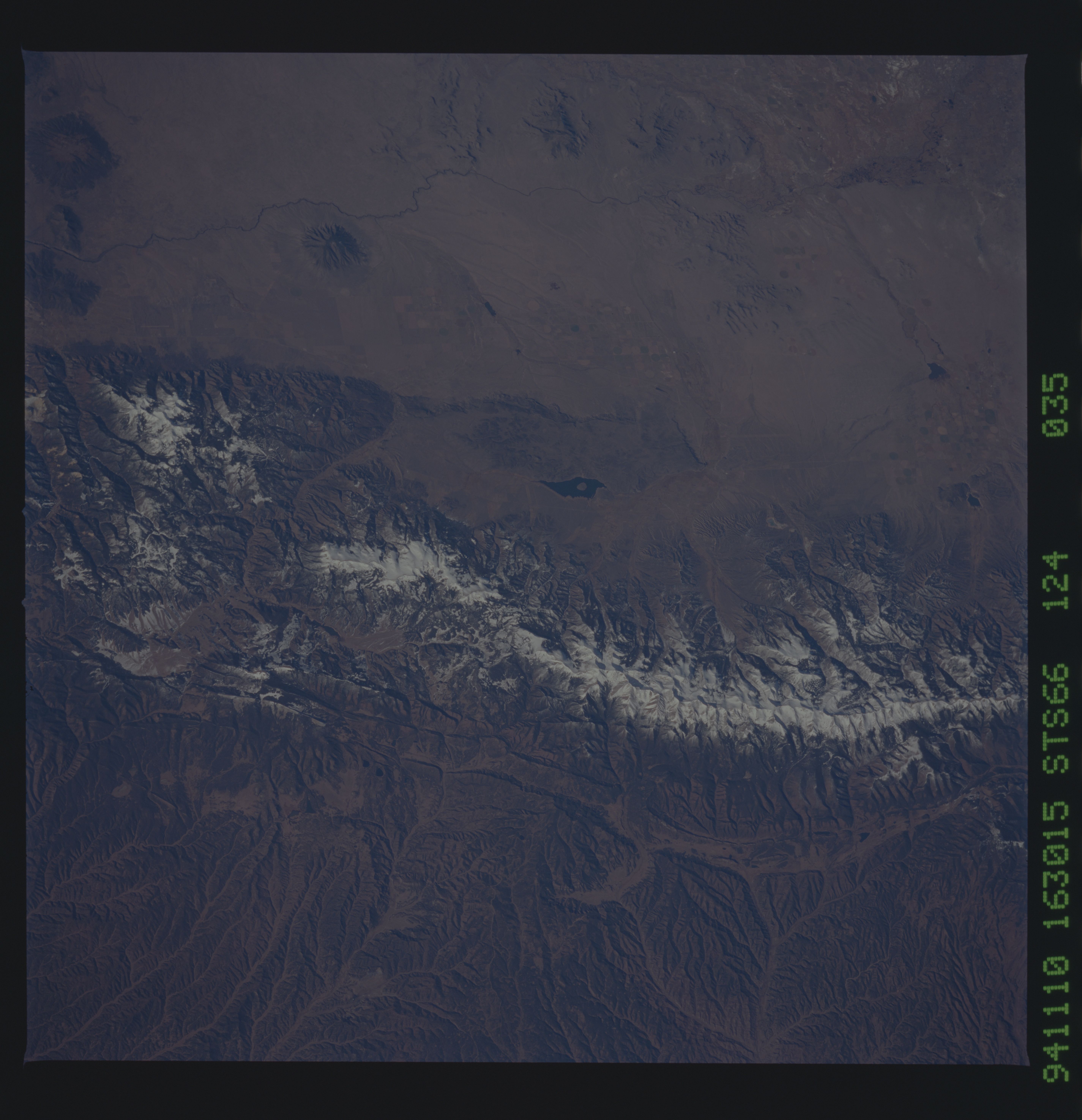
Image Caption: STS066-124-035 San Luis Valley and Sangre De Cristo Mountains, New Mexico and Colorado, U.S.A. November 1994
Mountainous terrain and the relatively flat surface of the Rio Grande Rift Valley are featured in this photograph of south-central Colorado and north-central New Mexico. On the eastern side of the snow-covered Sangre de Cristo Mountains, two distinct drainage patterns show the Canadian River tributaries that drain southeast from the mountains and the headwater area for the Purgatoire River, which flows northeast and eventually merges with the Arkansas River. Meandering across the plains of the San Luis Valley is the narrow, dark Rio Grande, on either side of which appear several volcanic domes in various stages of erosion as identified by their radial drainage patterns. Dark Sanchez Reservoir appears north of the Colorado-New Mexico border (middle of the photograph).
Mountainous terrain and the relatively flat surface of the Rio Grande Rift Valley are featured in this photograph of south-central Colorado and north-central New Mexico. On the eastern side of the snow-covered Sangre de Cristo Mountains, two distinct drainage patterns show the Canadian River tributaries that drain southeast from the mountains and the headwater area for the Purgatoire River, which flows northeast and eventually merges with the Arkansas River. Meandering across the plains of the San Luis Valley is the narrow, dark Rio Grande, on either side of which appear several volcanic domes in various stages of erosion as identified by their radial drainage patterns. Dark Sanchez Reservoir appears north of the Colorado-New Mexico border (middle of the photograph).
