STS066-121-5
| NASA Photo ID | STS066-121-5 |
| Focal Length | 100mm |
| Date taken | 1994.11.05 |
| Time taken | 18:55:26 GMT |
Resolutions offered for this image:
3904 x 3904 pixels 639 x 639 pixels 5700 x 5900 pixels 500 x 518 pixels 640 x 480 pixels
3904 x 3904 pixels 639 x 639 pixels 5700 x 5900 pixels 500 x 518 pixels 640 x 480 pixels

Cloud masks available for this image:
Spacecraft nadir point: 37.8° N, 110.4° W
Photo center point: 38.0° N, 110.5° W
Photo center point by machine learning:
Photo center point: 38.0° N, 110.5° W
Photo center point by machine learning:
Nadir to Photo Center: North
Spacecraft Altitude: 163 nautical miles (302km)
Country or Geographic Name: | USA-UTAH |
Features: | LAKE POWELL, COLORADO R. |
| Features Found Using Machine Learning: | |
Cloud Cover Percentage: | 0 (no clouds present) |
Sun Elevation Angle: | 37° |
Sun Azimuth: | 177° |
Camera: | Hasselblad |
Focal Length: | 100mm |
Camera Tilt: | 5 degrees |
Format: | 5046: Kodak, natural color positive, Lumiere 100/5046, ASA 100, standard base |
Film Exposure: | Normal |
| Additional Information | |
| Width | Height | Annotated | Cropped | Purpose | Links |
|---|---|---|---|---|---|
| 3904 pixels | 3904 pixels | No | No | Earth From Space collection | Download Image |
| 639 pixels | 639 pixels | No | No | Earth From Space collection | Download Image |
| 5700 pixels | 5900 pixels | No | No | Download Image | |
| 500 pixels | 518 pixels | No | No | Download Image | |
| 640 pixels | 480 pixels | No | No | Download Image |
Download Packaged File
Download a Google Earth KML for this Image
View photo footprint information
Download a GeoTIFF for this photo
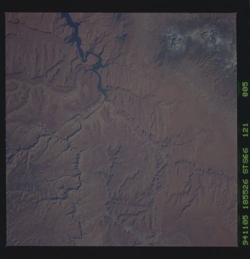
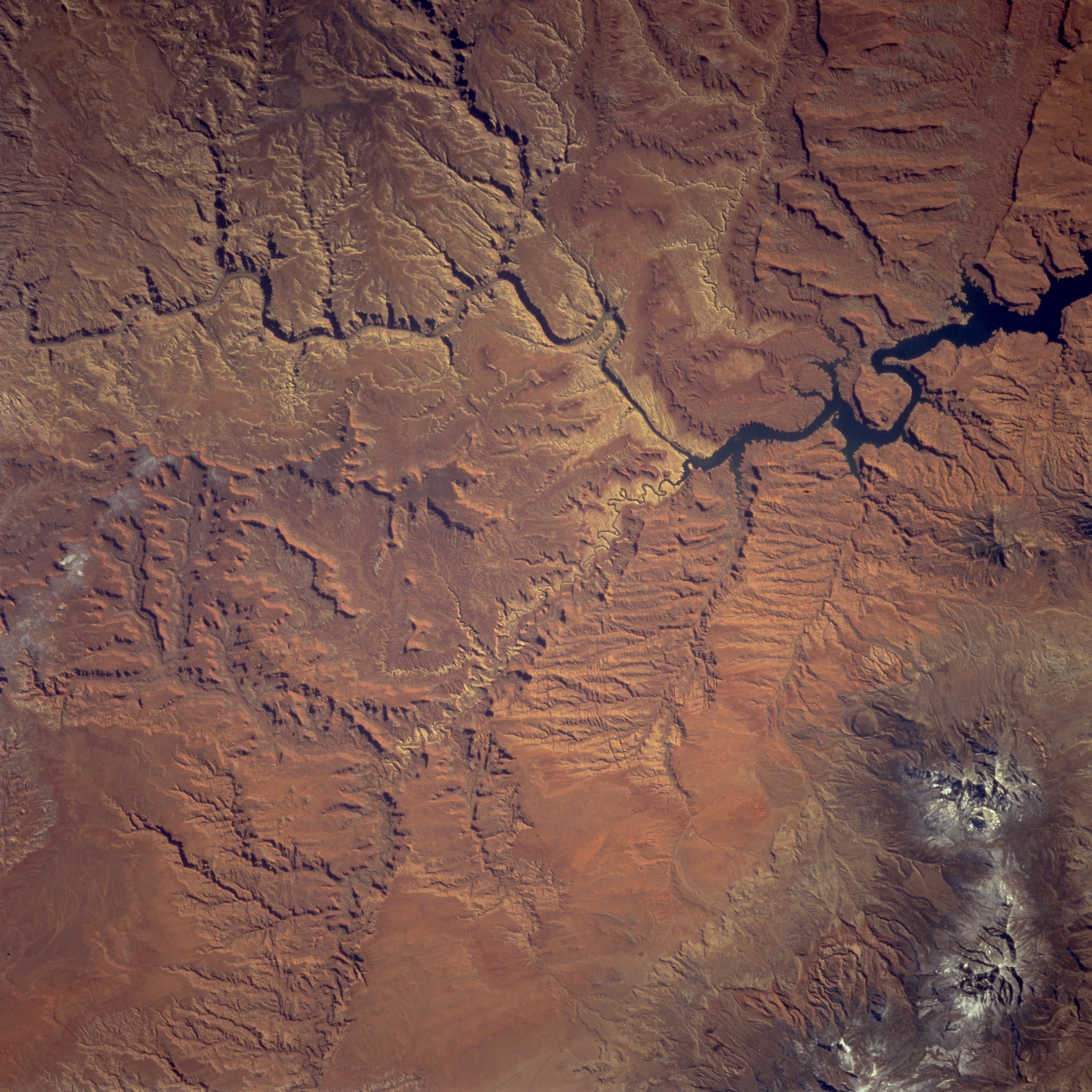
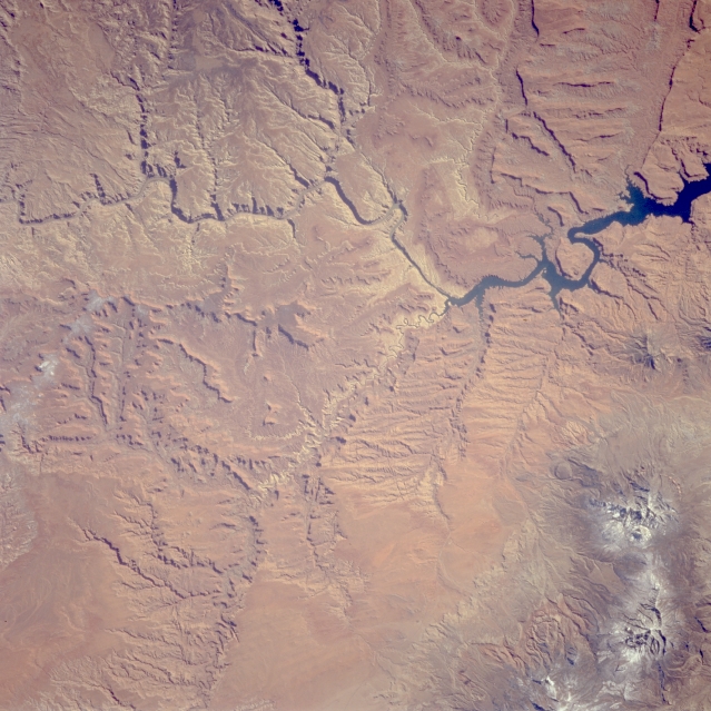
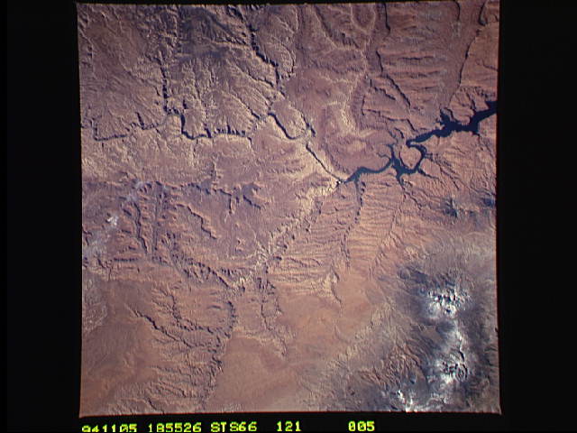
Image Caption: STS066-121-005 Colorado and Dirty Devil Rivers, Utah, U.S.A. November 1994
This southeast-looking, low-oblique photograph features part of the Colorado River winding its way northwestward through numerous canyons in Canyonlands National Park. The northern part of Lake Powell and the forested, snow-covered Henry Mountains to its north are visible. The Dirty Devil River joins Lake Powell (center of the photograph).
This southeast-looking, low-oblique photograph features part of the Colorado River winding its way northwestward through numerous canyons in Canyonlands National Park. The northern part of Lake Powell and the forested, snow-covered Henry Mountains to its north are visible. The Dirty Devil River joins Lake Powell (center of the photograph).
