STS066-121-27
| NASA Photo ID | STS066-121-27 |
| Focal Length | 100mm |
| Date taken | 1994.11.05 |
| Time taken | 19:01:58 GMT |
Resolutions offered for this image:
3904 x 3904 pixels 639 x 639 pixels 5700 x 5900 pixels 500 x 518 pixels 640 x 480 pixels
3904 x 3904 pixels 639 x 639 pixels 5700 x 5900 pixels 500 x 518 pixels 640 x 480 pixels

Cloud masks available for this image:
Spacecraft nadir point: 53.3° N, 81.9° W
Photo center point: 53.0° N, 82.0° W
Photo center point by machine learning:
Photo center point: 53.0° N, 82.0° W
Photo center point by machine learning:
Nadir to Photo Center: South
Spacecraft Altitude: 163 nautical miles (302km)
Country or Geographic Name: | CANADA-O |
Features: | AKIMISKI I., JAMES BAY |
| Features Found Using Machine Learning: | |
Cloud Cover Percentage: | 5 (1-10)% |
Sun Elevation Angle: | 17° |
Sun Azimuth: | 208° |
Camera: | Hasselblad |
Focal Length: | 100mm |
Camera Tilt: | 7 degrees |
Format: | 5046: Kodak, natural color positive, Lumiere 100/5046, ASA 100, standard base |
Film Exposure: | Normal |
| Additional Information | |
| Width | Height | Annotated | Cropped | Purpose | Links |
|---|---|---|---|---|---|
| 3904 pixels | 3904 pixels | No | No | Earth From Space collection | Download Image |
| 639 pixels | 639 pixels | No | No | Earth From Space collection | Download Image |
| 5700 pixels | 5900 pixels | No | No | Download Image | |
| 500 pixels | 518 pixels | No | No | Download Image | |
| 640 pixels | 480 pixels | No | No | Download Image |
Download Packaged File
Download a Google Earth KML for this Image
View photo footprint information
Download a GeoTIFF for this photo
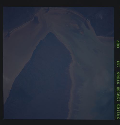
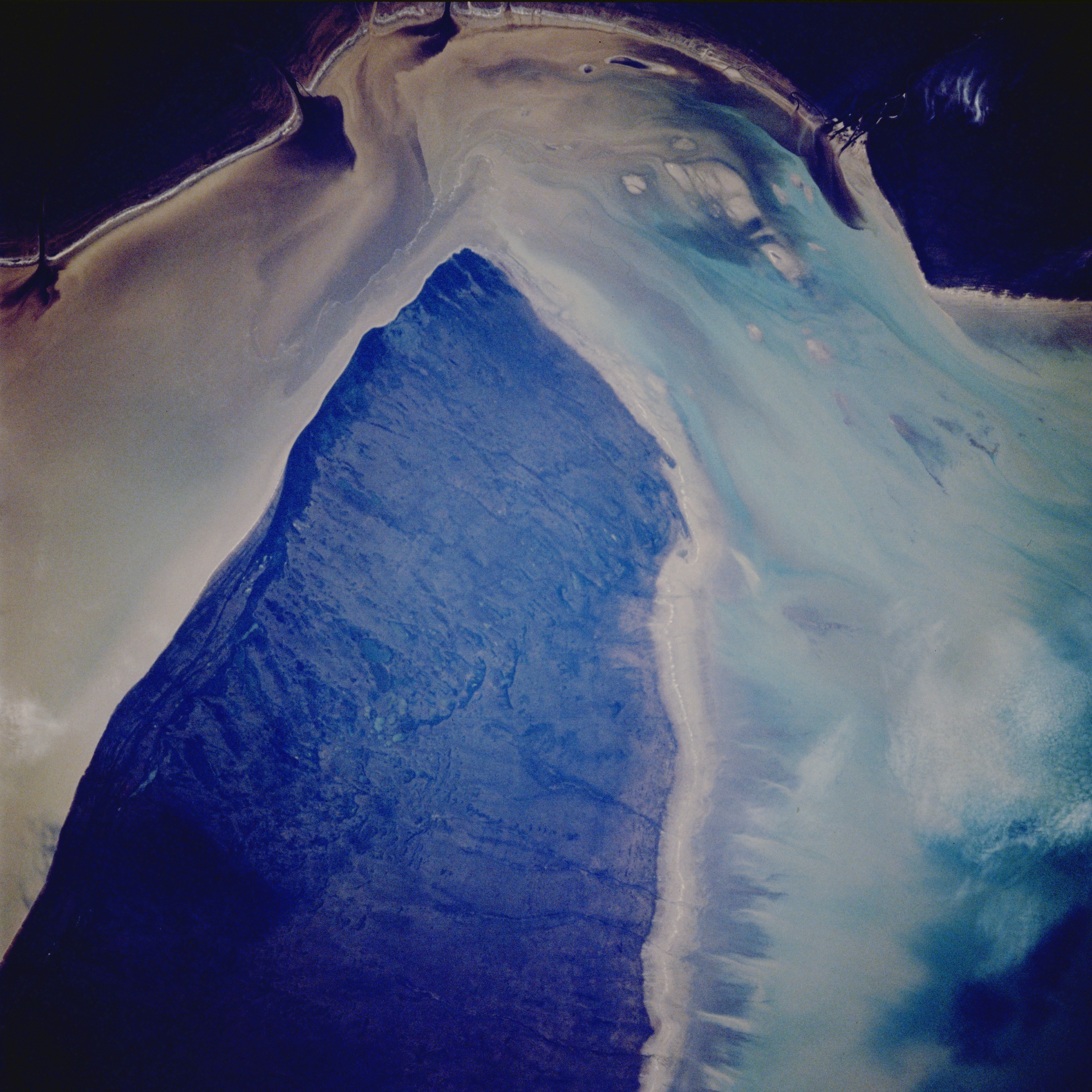
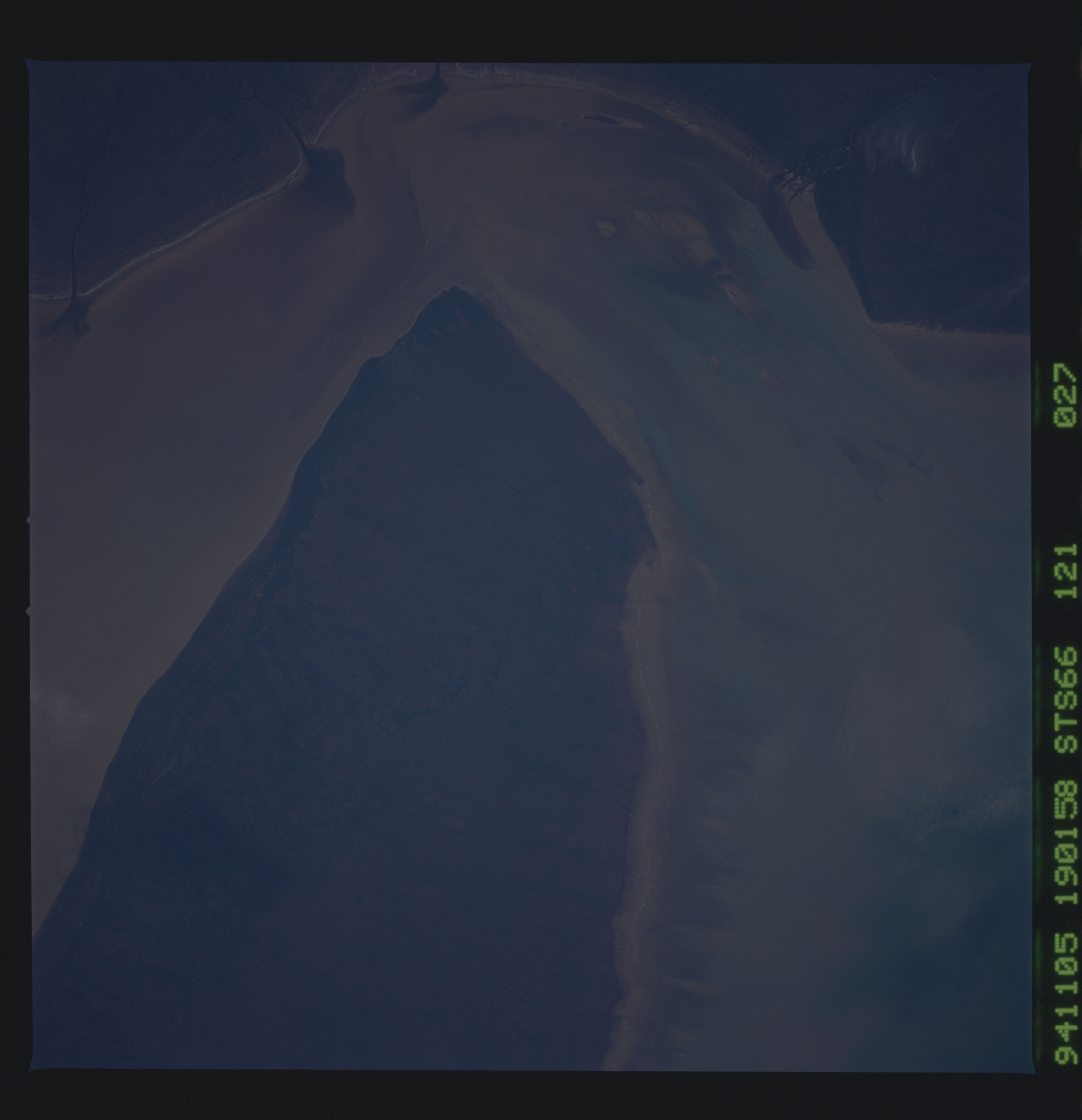
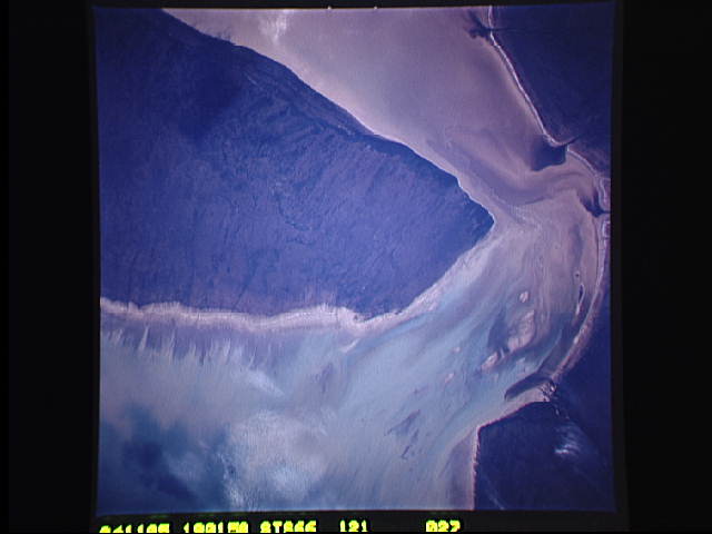
Image Caption: STS066-121-027 James Bay, Canada November 1994
The light parts of the picture show muddy sediment which is being fed into James Bay by local rivers. The sediment pattern and current flow around the western end of Akimiski Island (center of image) are very pronounced in this westward view along the west side of shallow James Bay. Akimiski Island is only separated from the mainland and the mouth of the Attawapiskat River by 10 miles (16 kilometers). The dark water plumes along the top of the picture show drainage into James Bay from several small rivers as well as the Attawapiskat River. The overall quality of the image is too dark to allow many landforms or topography to be discerned, except to note that the drainage off of Akimiski Island is towards the north (right side of image). Patterns in the water immediately right (north) of the island show that winds on the day this photo was taken were blowing from the south (left).
The light parts of the picture show muddy sediment which is being fed into James Bay by local rivers. The sediment pattern and current flow around the western end of Akimiski Island (center of image) are very pronounced in this westward view along the west side of shallow James Bay. Akimiski Island is only separated from the mainland and the mouth of the Attawapiskat River by 10 miles (16 kilometers). The dark water plumes along the top of the picture show drainage into James Bay from several small rivers as well as the Attawapiskat River. The overall quality of the image is too dark to allow many landforms or topography to be discerned, except to note that the drainage off of Akimiski Island is towards the north (right side of image). Patterns in the water immediately right (north) of the island show that winds on the day this photo was taken were blowing from the south (left).
