STS066-117-34
| NASA Photo ID | STS066-117-34 |
| Focal Length | 100mm |
| Date taken | 1994.11.09 |
| Time taken | 01:20:44 GMT |
Resolutions offered for this image:
4007 x 4007 pixels 640 x 640 pixels 5700 x 5900 pixels 500 x 518 pixels 640 x 480 pixels
4007 x 4007 pixels 640 x 640 pixels 5700 x 5900 pixels 500 x 518 pixels 640 x 480 pixels


Cloud masks available for this image:
Spacecraft nadir point: 39.5° N, 137.2° E
Photo center point: 38.0° N, 138.5° E
Photo center point by machine learning:
Photo center point: 38.0° N, 138.5° E
Photo center point by machine learning:
Nadir to Photo Center: Southeast
Spacecraft Altitude: 161 nautical miles (298km)
Country or Geographic Name: | JAPAN |
Features: | SADO ISLAND, ISLAND WAKE |
| Features Found Using Machine Learning: | |
Cloud Cover Percentage: | 0 (no clouds present) |
Sun Elevation Angle: | 31° |
Sun Azimuth: | 159° |
Camera: | Hasselblad |
Focal Length: | 100mm |
Camera Tilt: | 37 degrees |
Format: | 5046: Kodak, natural color positive, Lumiere 100/5046, ASA 100, standard base |
Film Exposure: | Normal |
| Additional Information | |
| Width | Height | Annotated | Cropped | Purpose | Links |
|---|---|---|---|---|---|
| 4007 pixels | 4007 pixels | No | No | Earth From Space collection | Download Image |
| 640 pixels | 640 pixels | No | No | Earth From Space collection | Download Image |
| 5700 pixels | 5900 pixels | No | No | Download Image | |
| 500 pixels | 518 pixels | No | No | Download Image | |
| 640 pixels | 480 pixels | No | No | Download Image |
Download Packaged File
Download a Google Earth KML for this Image
View photo footprint information
Download a GeoTIFF for this photo
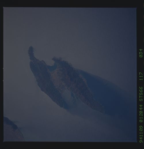
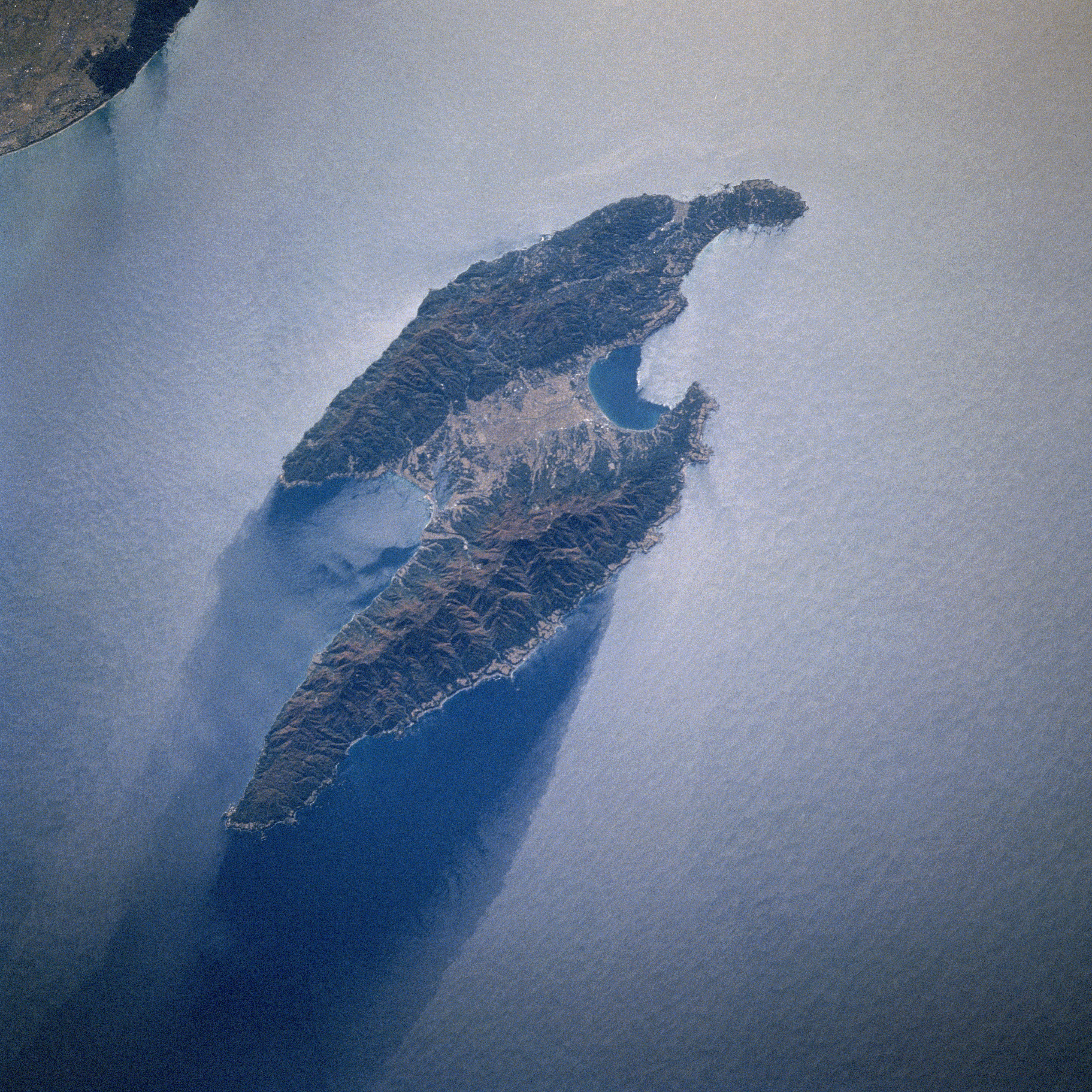
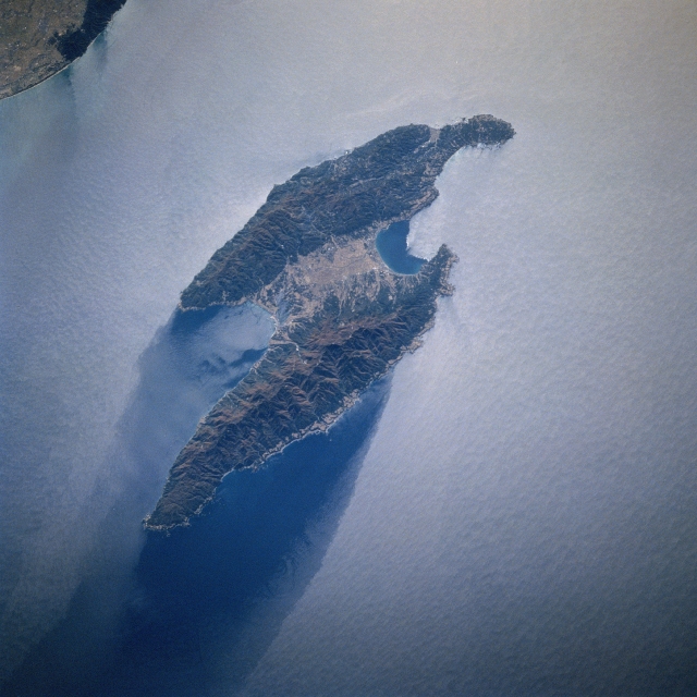
Image Caption: STS066-117-034 Sado Island, Japan November 1994
The paralleling, northeast-southwest aligned mountains of Sado Island are connected in the middle by a plain. The island is separated from the west coast of Honshu Island by 19 miles (30 km). A small section of the Echigo Plain and a small coastal mountain (darker feature) located south of the city of Niigata are visible in the upper left corner of the image. Administratively Sado Island is part of Niigata prefecture. Notice that the sun's reflection off the water's surface (a phenomenon known as sunglint or sun glitter) has created a light colored image. The sunglint does identify a dark area north of the island, thereby providing a clue as to the direction of the water flow or current around Sado Island (in this case flowing from south to north), creating an island wake along the north side of the island.
The paralleling, northeast-southwest aligned mountains of Sado Island are connected in the middle by a plain. The island is separated from the west coast of Honshu Island by 19 miles (30 km). A small section of the Echigo Plain and a small coastal mountain (darker feature) located south of the city of Niigata are visible in the upper left corner of the image. Administratively Sado Island is part of Niigata prefecture. Notice that the sun's reflection off the water's surface (a phenomenon known as sunglint or sun glitter) has created a light colored image. The sunglint does identify a dark area north of the island, thereby providing a clue as to the direction of the water flow or current around Sado Island (in this case flowing from south to north), creating an island wake along the north side of the island.
