STS065-96-11
| NASA Photo ID | STS065-96-11 |
| Focal Length | 250mm |
| Date taken | 1994.07.13 |
| Time taken | 21:57:25 GMT |
Resolutions offered for this image:
3904 x 3872 pixels 639 x 634 pixels 5700 x 5900 pixels 500 x 518 pixels 640 x 480 pixels
3904 x 3872 pixels 639 x 634 pixels 5700 x 5900 pixels 500 x 518 pixels 640 x 480 pixels
Cloud masks available for this image:
Spacecraft nadir point: 21.1° N, 157.2° W
Photo center point: 20.5° N, 156.5° W
Photo center point by machine learning:
Photo center point: 20.5° N, 156.5° W
Photo center point by machine learning:
Nadir to Photo Center: Southeast
Spacecraft Altitude: 160 nautical miles (296km)
Country or Geographic Name: | USA-HAWAII |
Features: | MAUI ISLAND, AGR. |
| Features Found Using Machine Learning: | |
Cloud Cover Percentage: | 10 (1-10)% |
Sun Elevation Angle: | 81° |
Sun Azimuth: | 83° |
Camera: | Hasselblad |
Focal Length: | 250mm |
Camera Tilt: | 19 degrees |
Format: | 5048: Kodak, natural color positive, Lumiere 100x/5048, ASA 100x, standard base |
Film Exposure: | Normal |
| Additional Information | |
| Width | Height | Annotated | Cropped | Purpose | Links |
|---|---|---|---|---|---|
| 3904 pixels | 3872 pixels | No | No | Earth From Space collection | Download Image |
| 639 pixels | 634 pixels | No | No | Earth From Space collection | Download Image |
| 5700 pixels | 5900 pixels | No | No | Download Image | |
| 500 pixels | 518 pixels | No | No | Download Image | |
| 640 pixels | 480 pixels | No | No | Download Image |
Download Packaged File
Download a Google Earth KML for this Image
View photo footprint information
Download a GeoTIFF for this photo
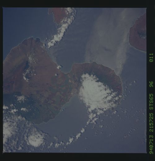
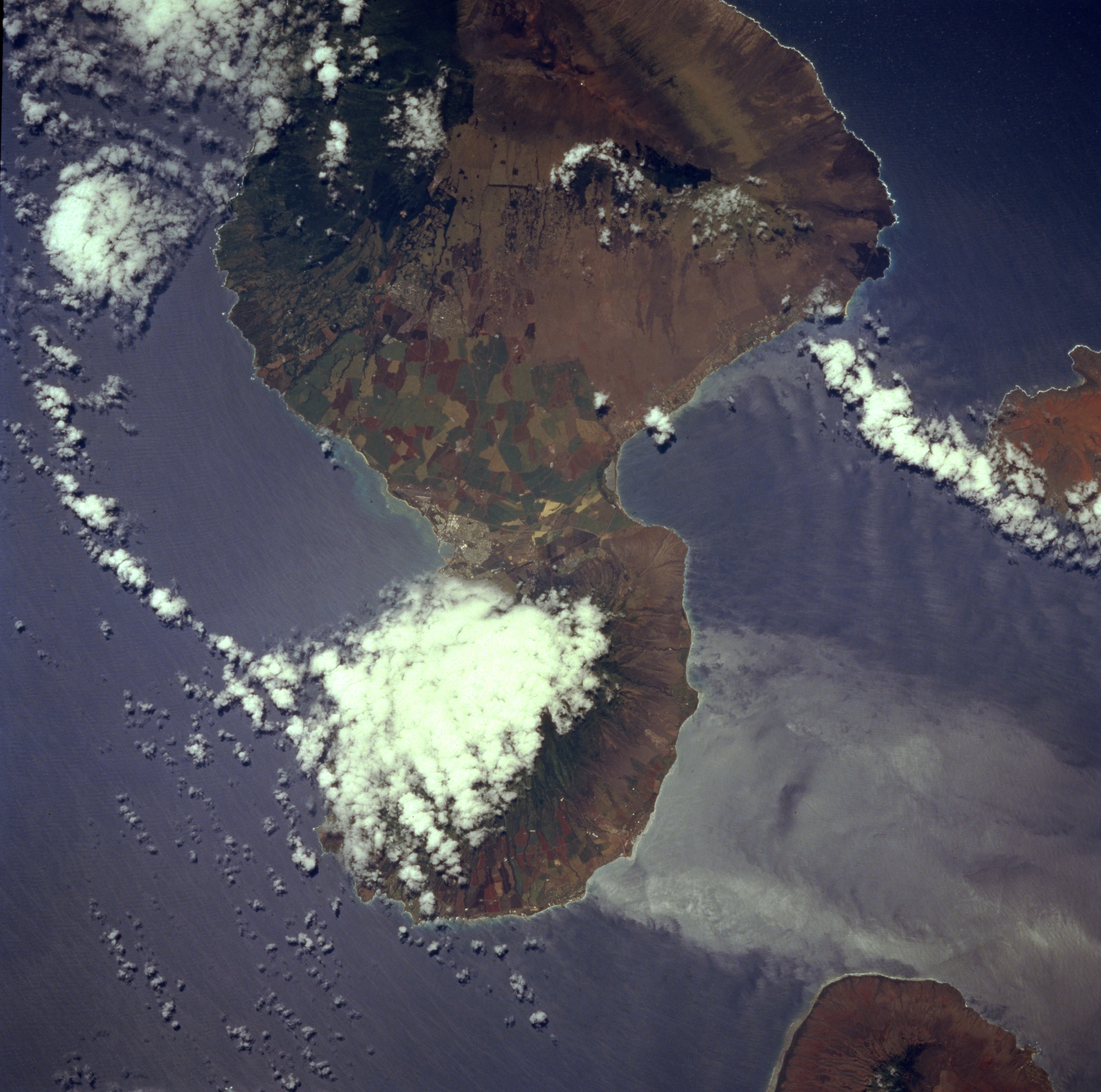
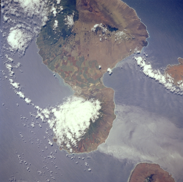
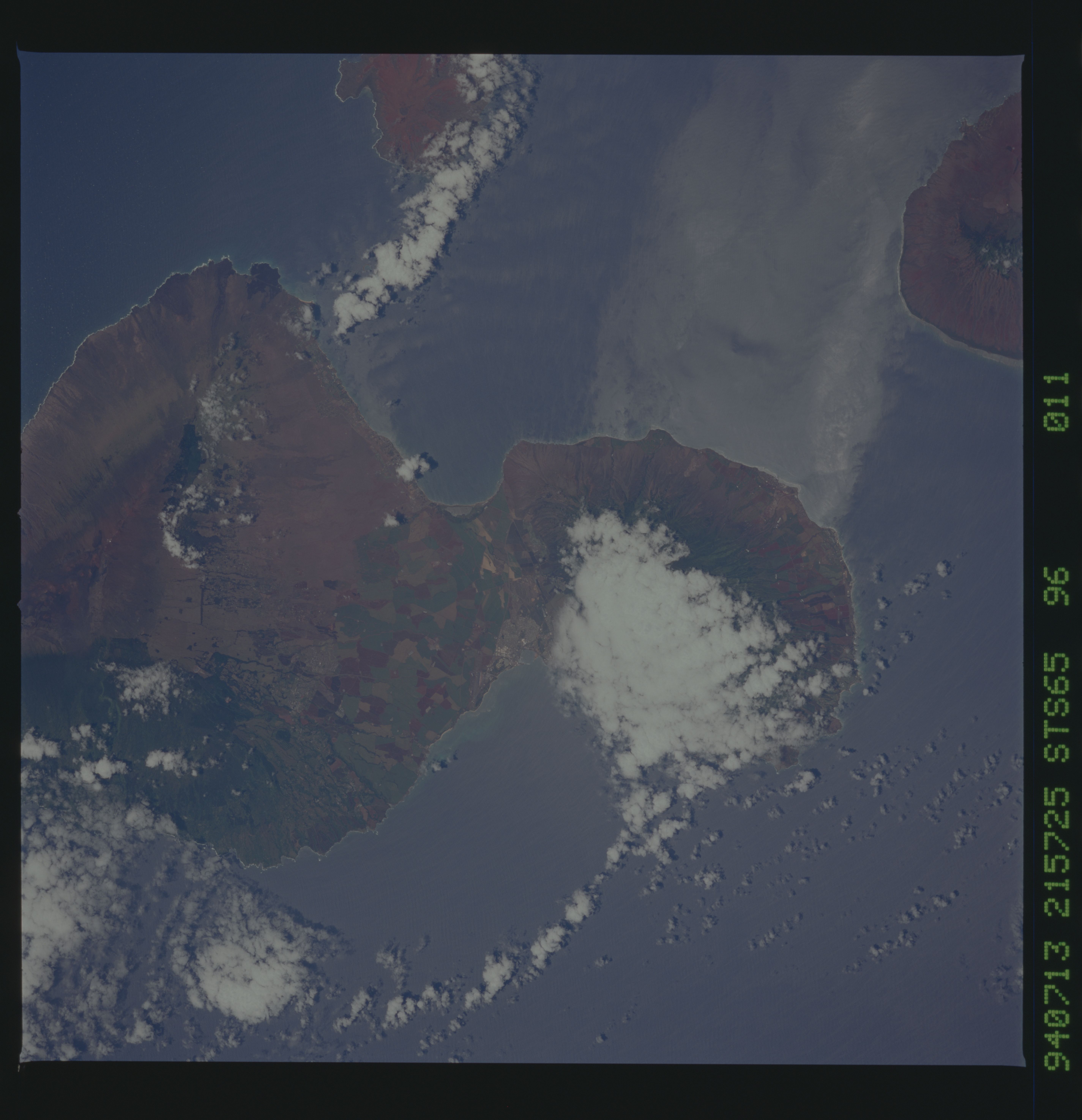
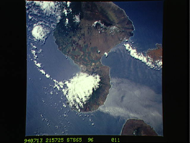
Image Caption: STS065-096-011 Maui, Hawaii, U.S.A. July 1994
Apparent in this low-oblique photograph of Maui are several features--a large buildup of probable rain clouds over the northeast slope of Puukukui Volcano, which makes up the small west-northwest peninsula of the island; the disturbed water pattern on the southwest side of the peninsula created by velocity variations of near-surface air movement, producing an island wake; and multicolored, intensively cultivated field patterns in the intermontane valley. Visible are Red Hill and Haleakala Crater near the top of the photograph and the eastern ends of Kahoolawe (right side) and Lanai (lower right edge).
Apparent in this low-oblique photograph of Maui are several features--a large buildup of probable rain clouds over the northeast slope of Puukukui Volcano, which makes up the small west-northwest peninsula of the island; the disturbed water pattern on the southwest side of the peninsula created by velocity variations of near-surface air movement, producing an island wake; and multicolored, intensively cultivated field patterns in the intermontane valley. Visible are Red Hill and Haleakala Crater near the top of the photograph and the eastern ends of Kahoolawe (right side) and Lanai (lower right edge).
