STS065-80-34

| NASA Photo ID | STS065-80-34 |
| Focal Length | 250mm |
| Date taken | 1994.07.12 |
| Time taken | 15:41:20 GMT |
Cloud masks available for this image:
Spacecraft nadir point: 28.5° N, 92.6° W
Photo center point: 29.5° N, 94.5° W
Photo center point by machine learning:
Photo center point: 29.5° N, 94.5° W
Photo center point by machine learning:
Nadir to Photo Center: Northwest
Spacecraft Altitude: 159 nautical miles (294km)
Country or Geographic Name: | USA-TEXAS |
Features: | GALVESTON, TEXAS CITY |
| Features Found Using Machine Learning: | |
Cloud Cover Percentage: | 15 (11-25)% |
Sun Elevation Angle: | 55° |
Sun Azimuth: | 91° |
Camera: | Hasselblad |
Focal Length: | 250mm |
Camera Tilt: | 39 degrees |
Format: | 5048: Kodak, natural color positive, Lumiere 100x/5048, ASA 100x, standard base |
Film Exposure: | Normal |
| Additional Information | |
| Width | Height | Annotated | Cropped | Purpose | Links |
|---|---|---|---|---|---|
| 5700 pixels | 5900 pixels | No | No | Download Image | |
| 500 pixels | 518 pixels | No | No | Download Image | |
| 640 pixels | 480 pixels | No | No | Download Image |
Download Packaged File
Download a Google Earth KML for this Image
View photo footprint information
Download a GeoTIFF for this photo
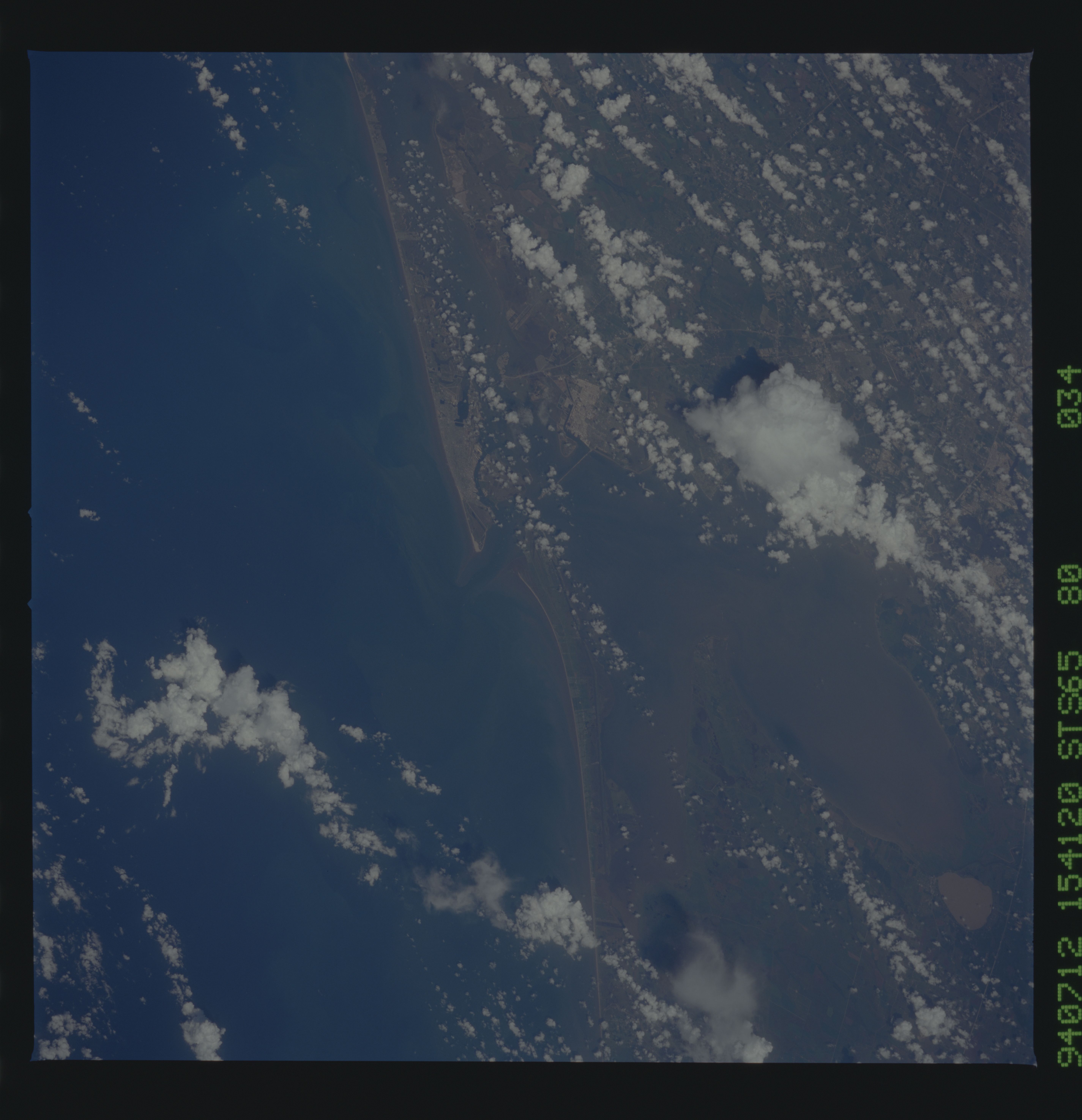
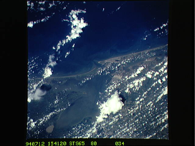
Image Caption: STS-65 Earth observation taken aboard Columbia, Orbiter Vehicle (OV) 102, shows the Bolivar Peninsula and Galveston Island in Texas. The peninsula and island form the seaward side of the Galveston Bay complex. The photograph is centered at approximately 29.3 degrees north and 94.8 degrees west. This view of the area shows typical summer clouds. Both coastal and bay current flows are prominent. Ship traffic is visible in Bolivar Roads. The Texas City Dike is near the center of the photograph and was designed to protect the upper bay from wave action. The heavily urbanized Galveston Island is in contrast to the lightly populated Bolivar Peninsula.
