STS065-79-38
| NASA Photo ID | STS065-79-38 |
| Focal Length | 40mm |
| Date taken | 1994.07.18 |
| Time taken | 20:42:46 GMT |


Cloud masks available for this image:
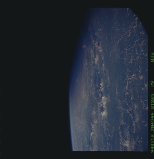
Spacecraft nadir point: 28.6° N, 135.3° E
Photo center point:
Photo center point by machine learning:
Photo center point:
Photo center point by machine learning:
Nadir to Photo Center:
Spacecraft Altitude: 157 nautical miles (291km)
Country or Geographic Name: | PHILIPPINE SEA |
Features: | PAN-TYPHOON TIM |
| Features Found Using Machine Learning: | |
Cloud Cover Percentage: | 60 (51-75)% |
Sun Elevation Angle: | 5° |
Sun Azimuth: | 69° |
Camera: | Hasselblad |
Focal Length: | 40mm |
Camera Tilt: | High Oblique |
Format: | 5048: Kodak, natural color positive, Lumiere 100x/5048, ASA 100x, standard base |
Film Exposure: | Normal |
| Additional Information | |
| Width | Height | Annotated | Cropped | Purpose | Links |
|---|---|---|---|---|---|
| 5700 pixels | 5900 pixels | No | No | Download Image | |
| 500 pixels | 518 pixels | No | No | Download Image | |
| 640 pixels | 480 pixels | No | No | Download Image |
Download Packaged File
Download a Google Earth KML for this Image
View photo footprint information
Download a GeoTIFF for this photo
Image Caption: This photograph was fairly characteristic of the western Pacific Ocean between the Philippine Islands and the area just south of the Japanese Islands during the duration of the STS-65 shuttle mission. The western half of a large typhoon can be seen near the horizon and terminator. Numerous small thunderstorms are visible toward the center of the photograph, and an extensive area of scattered clouds (with possibly dissipated or collapsed thunderstorms) can be seen towards the bottom of the picture. View was taken aboard Columbia, Orbiter Vehicle (OV) 102.
