STS064-98-75
| NASA Photo ID | STS064-98-75 |
| Focal Length | 250mm |
| Date taken | 1994.09.__ |
| Time taken | GMT |
Resolutions offered for this image:
5294 x 5294 pixels 640 x 640 pixels 5700 x 5900 pixels 500 x 518 pixels 640 x 480 pixels 960 x 929 pixels
5294 x 5294 pixels 640 x 640 pixels 5700 x 5900 pixels 500 x 518 pixels 640 x 480 pixels 960 x 929 pixels


Cloud masks available for this image:
Spacecraft nadir point:
Photo center point: 44.0° S, 173.0° E
Photo center point by machine learning:
Photo center point: 44.0° S, 173.0° E
Photo center point by machine learning:
Nadir to Photo Center:
Spacecraft Altitude: nautical miles (0km)
Country or Geographic Name: | NEW ZEALAND-SI |
Features: | BANKS PENINSULA |
| Features Found Using Machine Learning: | |
Cloud Cover Percentage: | 0 (no clouds present) |
Sun Elevation Angle: | ° |
Sun Azimuth: | ° |
Camera: | Hasselblad |
Focal Length: | 250mm |
Camera Tilt: | Low Oblique |
Format: | 5046: Kodak, natural color positive, Lumiere 100/5046, ASA 100, standard base |
Film Exposure: | Normal |
| Additional Information | |
| Width | Height | Annotated | Cropped | Purpose | Links |
|---|---|---|---|---|---|
| 5294 pixels | 5294 pixels | No | No | Earth From Space collection | Download Image |
| 640 pixels | 640 pixels | No | No | Earth From Space collection | Download Image |
| 5700 pixels | 5900 pixels | No | No | Download Image | |
| 500 pixels | 518 pixels | No | No | Download Image | |
| 640 pixels | 480 pixels | No | No | Download Image | |
| 960 pixels | 929 pixels | Yes | No | Download Image |
Download Packaged File
Download a Google Earth KML for this Image
View photo footprint information
Download a GeoTIFF for this photo
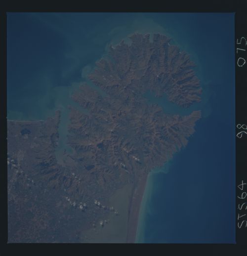
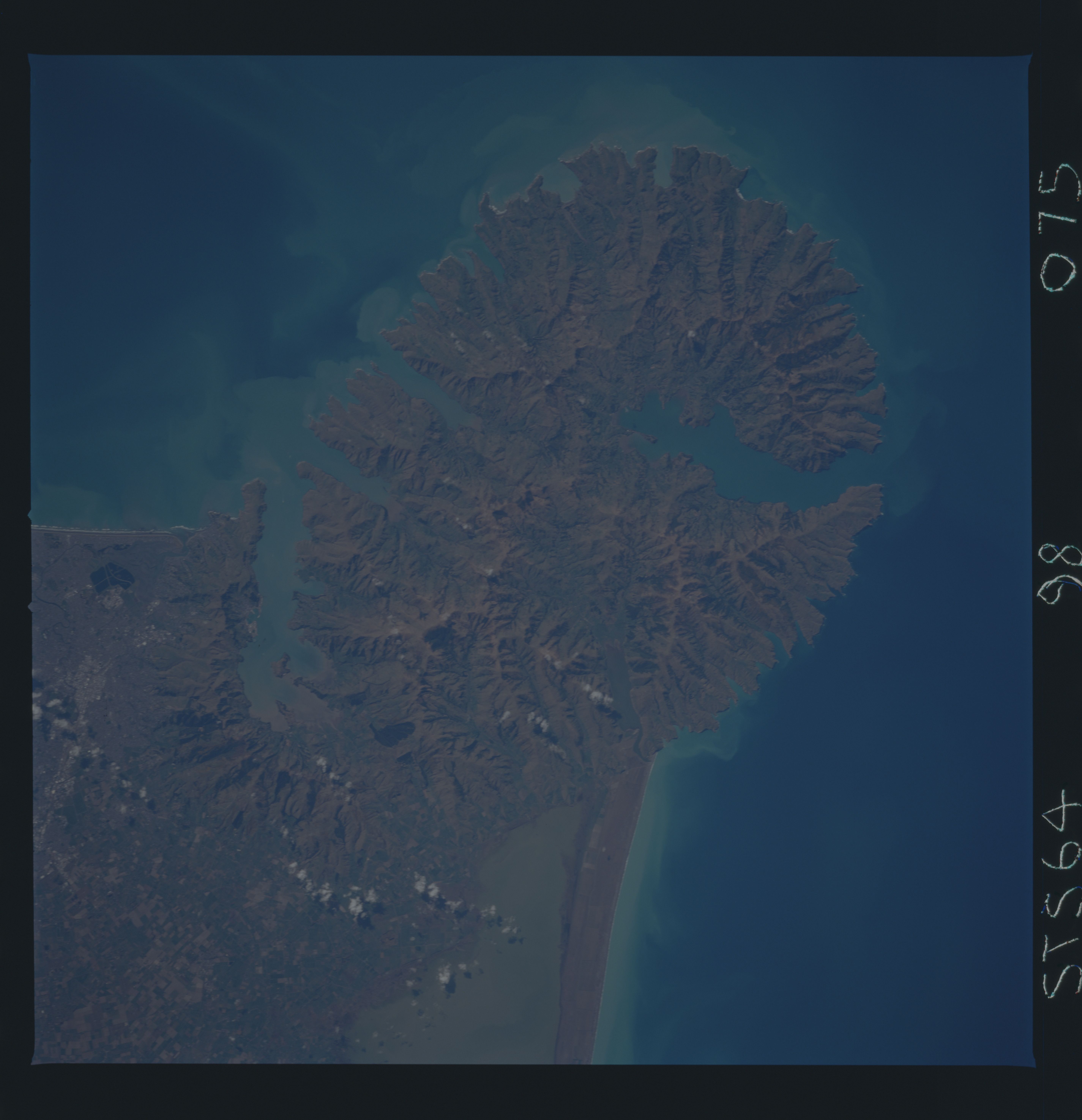
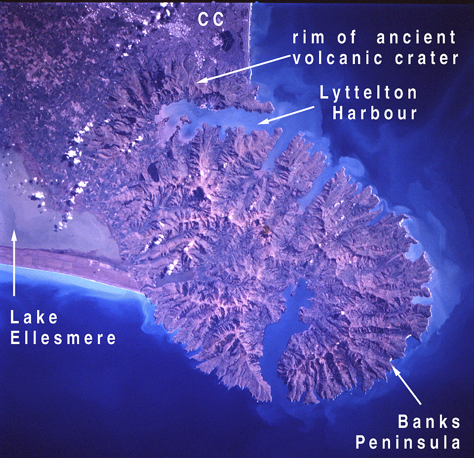
Image Caption: STS064-098-075 Bank's Peninsula, South Island, New Zealand September 1994
Bank's Peninsula, the only recognizable volcanic feature in South Island, is an ancient formation that has been deeply eroded but still possesses the classic circular shape and radial drainage pattern that typify many volcanoes. The peninsula is actually formed by two overlapping volcanic centers--the Lyttelton Volcano northwest and the Akaroa Volcano southeast of the formation. The two large harbors have the same names as the ancient volcanoes. Bank's Peninsula is joined to the Canterbury Plains to the west by the coalescing alluvial fans formed by the rivers draining the Southern Alps. North and west of the peninsula, sediment deposited by the rivers has been redeposited by the long shore drift to form the New Brighton (north) and Kaitorete (west) spits. Other features are visible in this photograph--Pegasus Bay to the north, Canterbury Bight to the south, the eastern end of Lake Ellesmere to the southwest, and part of the city of Christchurch to the northwest.
Bank's Peninsula, the only recognizable volcanic feature in South Island, is an ancient formation that has been deeply eroded but still possesses the classic circular shape and radial drainage pattern that typify many volcanoes. The peninsula is actually formed by two overlapping volcanic centers--the Lyttelton Volcano northwest and the Akaroa Volcano southeast of the formation. The two large harbors have the same names as the ancient volcanoes. Bank's Peninsula is joined to the Canterbury Plains to the west by the coalescing alluvial fans formed by the rivers draining the Southern Alps. North and west of the peninsula, sediment deposited by the rivers has been redeposited by the long shore drift to form the New Brighton (north) and Kaitorete (west) spits. Other features are visible in this photograph--Pegasus Bay to the north, Canterbury Bight to the south, the eastern end of Lake Ellesmere to the southwest, and part of the city of Christchurch to the northwest.
