STS064-94-46

| NASA Photo ID | STS064-94-46 |
| Focal Length | 40mm |
| Date taken | 1994.09.18 |
| Time taken | 21:27:39 GMT |
Cloud masks available for this image:
Spacecraft nadir point: 46.5° N, 94.4° W
Photo center point: 45.0° N, 91.5° W
Photo center point by machine learning:
Photo center point: 45.0° N, 91.5° W
Photo center point by machine learning:
Nadir to Photo Center: Southeast
Spacecraft Altitude: 129 nautical miles (239km)
Country or Geographic Name: | USA-WISCONSIN |
Features: | PAN-L. SUPERIOR & MICH. |
| Features Found Using Machine Learning: | |
Cloud Cover Percentage: | 10 (1-10)% |
Sun Elevation Angle: | 28° |
Sun Azimuth: | 239° |
Camera: | Hasselblad |
Focal Length: | 40mm |
Camera Tilt: | High Oblique |
Format: | 5046: Kodak, natural color positive, Lumiere 100/5046, ASA 100, standard base |
Film Exposure: | Normal |
| Additional Information | |
| Width | Height | Annotated | Cropped | Purpose | Links |
|---|---|---|---|---|---|
| 5700 pixels | 5900 pixels | No | No | Download Image | |
| 500 pixels | 518 pixels | No | No | Download Image | |
| 640 pixels | 480 pixels | No | No | Download Image |
Download Packaged File
Download a Google Earth KML for this Image
View photo footprint information
Download a GeoTIFF for this photo
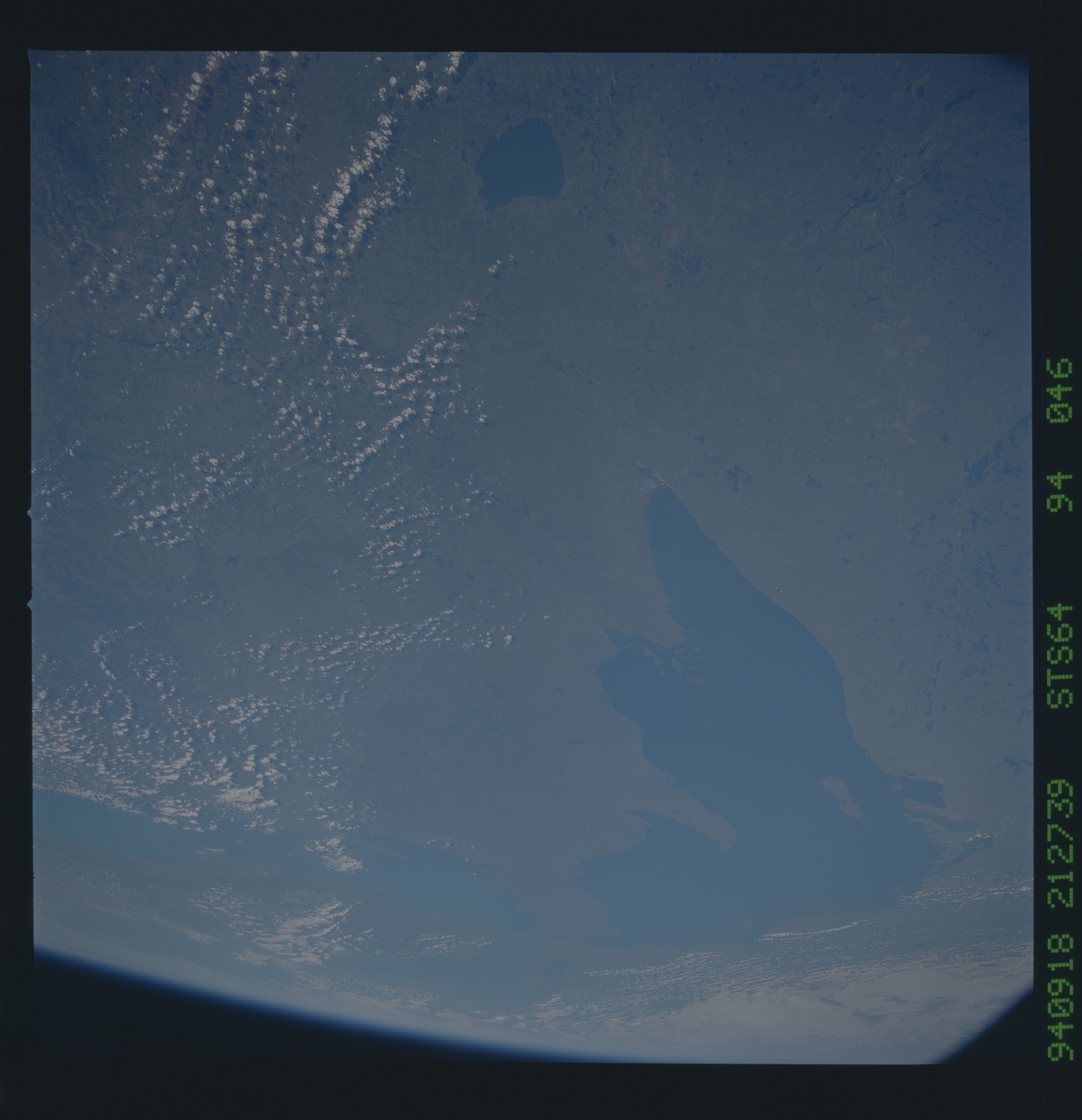
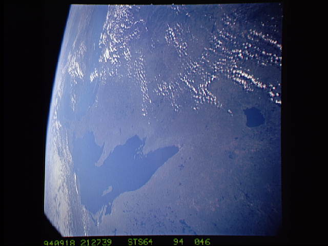
Image Caption: STS064-94-46 Lake Superior
Lake Superior is the dominent feature in this high oblique, southeast
looking view. At the western tip of Lake Superior is the city of
Diluth. The area west of Lake Superior, in this view, is the heavily
forested southern portion of the Mulcahy Shield/Ely region. Lake
Michigan can be seen near the horizon. The numerous small lakes are
the result of ancient glacier scouring. T581
