STS064-92-43
| NASA Photo ID | STS064-92-43 |
| Focal Length | 250mm |
| Date taken | 1994.09.15 |
| Time taken | 02:13:47 GMT |
Resolutions offered for this image:
3904 x 3872 pixels 639 x 634 pixels 5700 x 5900 pixels 500 x 518 pixels 640 x 480 pixels
3904 x 3872 pixels 639 x 634 pixels 5700 x 5900 pixels 500 x 518 pixels 640 x 480 pixels

Cloud masks available for this image:
Spacecraft nadir point: 27.0° S, 153.9° E
Photo center point: 28.0° S, 153.5° E
Photo center point by machine learning:
Photo center point: 28.0° S, 153.5° E
Photo center point by machine learning:
Nadir to Photo Center: South
Spacecraft Altitude: 140 nautical miles (259km)
Country or Geographic Name: | AUSTRALIA-Q |
Features: | SURFERS PARADISE, MTS, IS |
| Features Found Using Machine Learning: | |
Cloud Cover Percentage: | 0 (no clouds present) |
Sun Elevation Angle: | 59° |
Sun Azimuth: | 343° |
Camera: | Hasselblad |
Focal Length: | 250mm |
Camera Tilt: | 25 degrees |
Format: | 5046: Kodak, natural color positive, Lumiere 100/5046, ASA 100, standard base |
Film Exposure: | Normal |
| Additional Information | |
| Width | Height | Annotated | Cropped | Purpose | Links |
|---|---|---|---|---|---|
| 3904 pixels | 3872 pixels | No | No | Earth From Space collection | Download Image |
| 639 pixels | 634 pixels | No | No | Earth From Space collection | Download Image |
| 5700 pixels | 5900 pixels | No | No | Download Image | |
| 500 pixels | 518 pixels | No | No | Download Image | |
| 640 pixels | 480 pixels | No | No | Download Image |
Download Packaged File
Download a Google Earth KML for this Image
View photo footprint information
Download a GeoTIFF for this photo
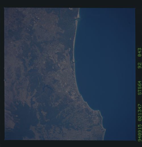
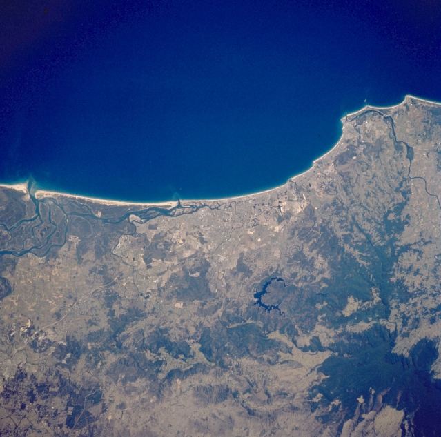
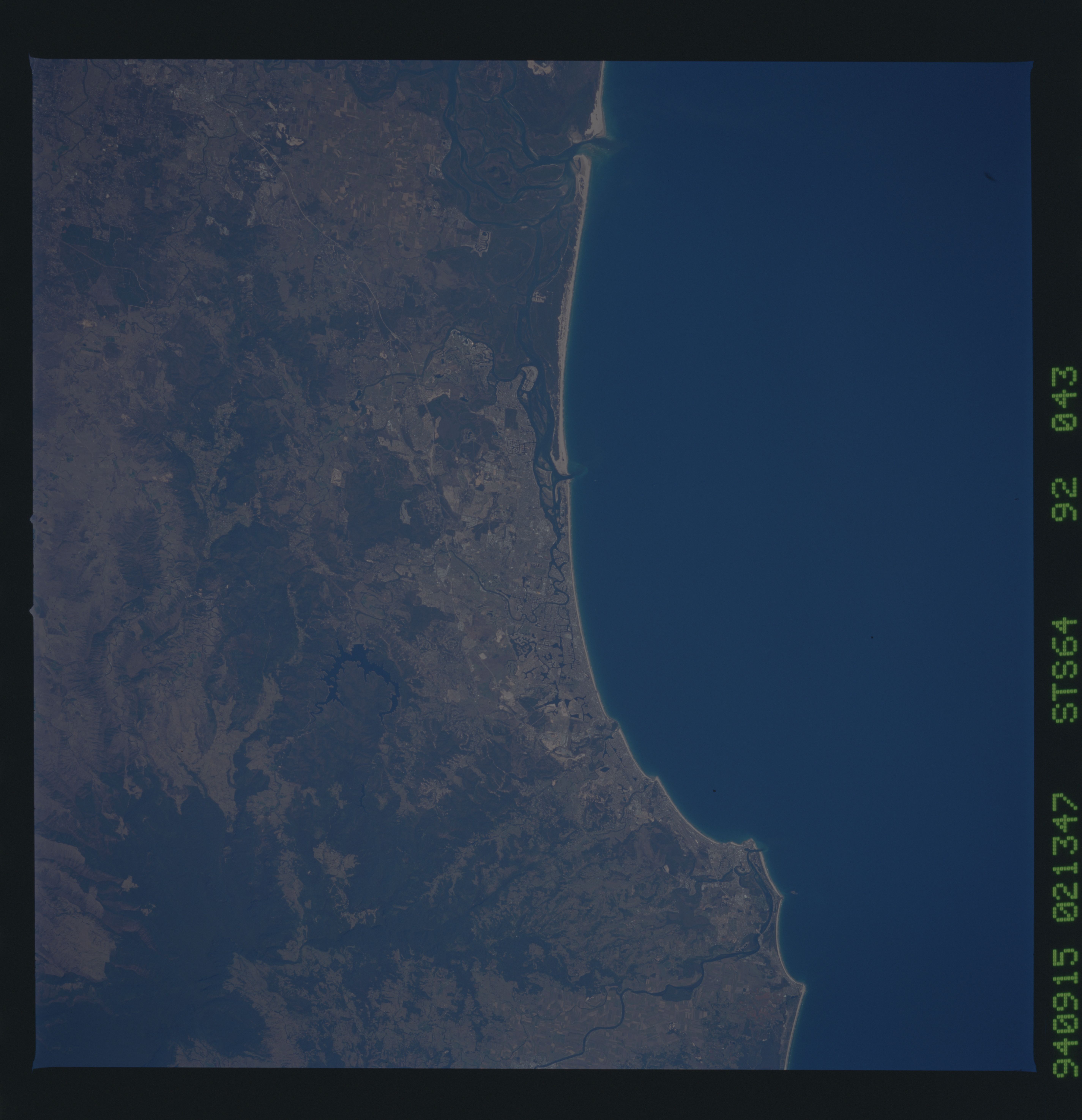
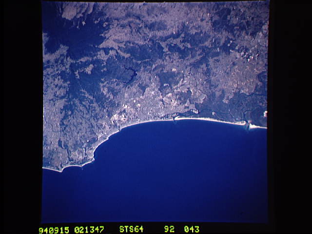
Image Caption: STS064-92-043 Surfers Paradise Area, Queensland, Australia September 1994
The coastal city of Surfers Paradise, located approximately 35 miles (56 kilometers) southeast of Brisbane, is located near the center of this image. Several cities aligned along this coast merge together with Surfers Paradise to form the Gold Coast of Queensland. The very dark area in the lower right quadrant of the image is part of the thickly vegetated subtropical rainforest that straddles the Queensland and New South Wales border. The U-shaped (dark feature) is a reservoir that has been constructed on the Coomeral River on the northern flank of Tweed (Wollumbin) Volcano. Careful examination of this image shows part of the radial drainage pattern on the northern side of the volcano. This volcano last erupted 20 million years ago and is also called Mount Warning.
The coastal city of Surfers Paradise, located approximately 35 miles (56 kilometers) southeast of Brisbane, is located near the center of this image. Several cities aligned along this coast merge together with Surfers Paradise to form the Gold Coast of Queensland. The very dark area in the lower right quadrant of the image is part of the thickly vegetated subtropical rainforest that straddles the Queensland and New South Wales border. The U-shaped (dark feature) is a reservoir that has been constructed on the Coomeral River on the northern flank of Tweed (Wollumbin) Volcano. Careful examination of this image shows part of the radial drainage pattern on the northern side of the volcano. This volcano last erupted 20 million years ago and is also called Mount Warning.
