STS064-91-22
| NASA Photo ID | STS064-91-22 |
| Focal Length | 250mm |
| Date taken | 1994.09.14 |
| Time taken | 17:18:03 GMT |
Resolutions offered for this image:
3955 x 3873 pixels 640 x 626 pixels 5700 x 5900 pixels 500 x 518 pixels 640 x 480 pixels
3955 x 3873 pixels 640 x 626 pixels 5700 x 5900 pixels 500 x 518 pixels 640 x 480 pixels
Cloud masks available for this image:
Spacecraft nadir point: 20.2° S, 64.6° W
Photo center point: 19.0° S, 67.0° W
Photo center point by machine learning:
Photo center point: 19.0° S, 67.0° W
Photo center point by machine learning:
Nadir to Photo Center: West
Spacecraft Altitude: 140 nautical miles (259km)
Country or Geographic Name: | BOLIVIA |
Features: | LAKE POOPO, DRY |
| Features Found Using Machine Learning: | |
Cloud Cover Percentage: | 0 (no clouds present) |
Sun Elevation Angle: | 62° |
Sun Azimuth: | 324° |
Camera: | Hasselblad |
Focal Length: | 250mm |
Camera Tilt: | 49 degrees |
Format: | 5046: Kodak, natural color positive, Lumiere 100/5046, ASA 100, standard base |
Film Exposure: | Normal |
| Additional Information | |
| Width | Height | Annotated | Cropped | Purpose | Links |
|---|---|---|---|---|---|
| 3955 pixels | 3873 pixels | No | No | Earth From Space collection | Download Image |
| 640 pixels | 626 pixels | No | No | Earth From Space collection | Download Image |
| 5700 pixels | 5900 pixels | No | No | Download Image | |
| 500 pixels | 518 pixels | No | No | Download Image | |
| 640 pixels | 480 pixels | No | No | Download Image |
Download Packaged File
Download a Google Earth KML for this Image
View photo footprint information
Download a GeoTIFF for this photo
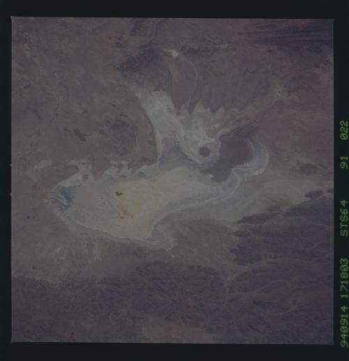
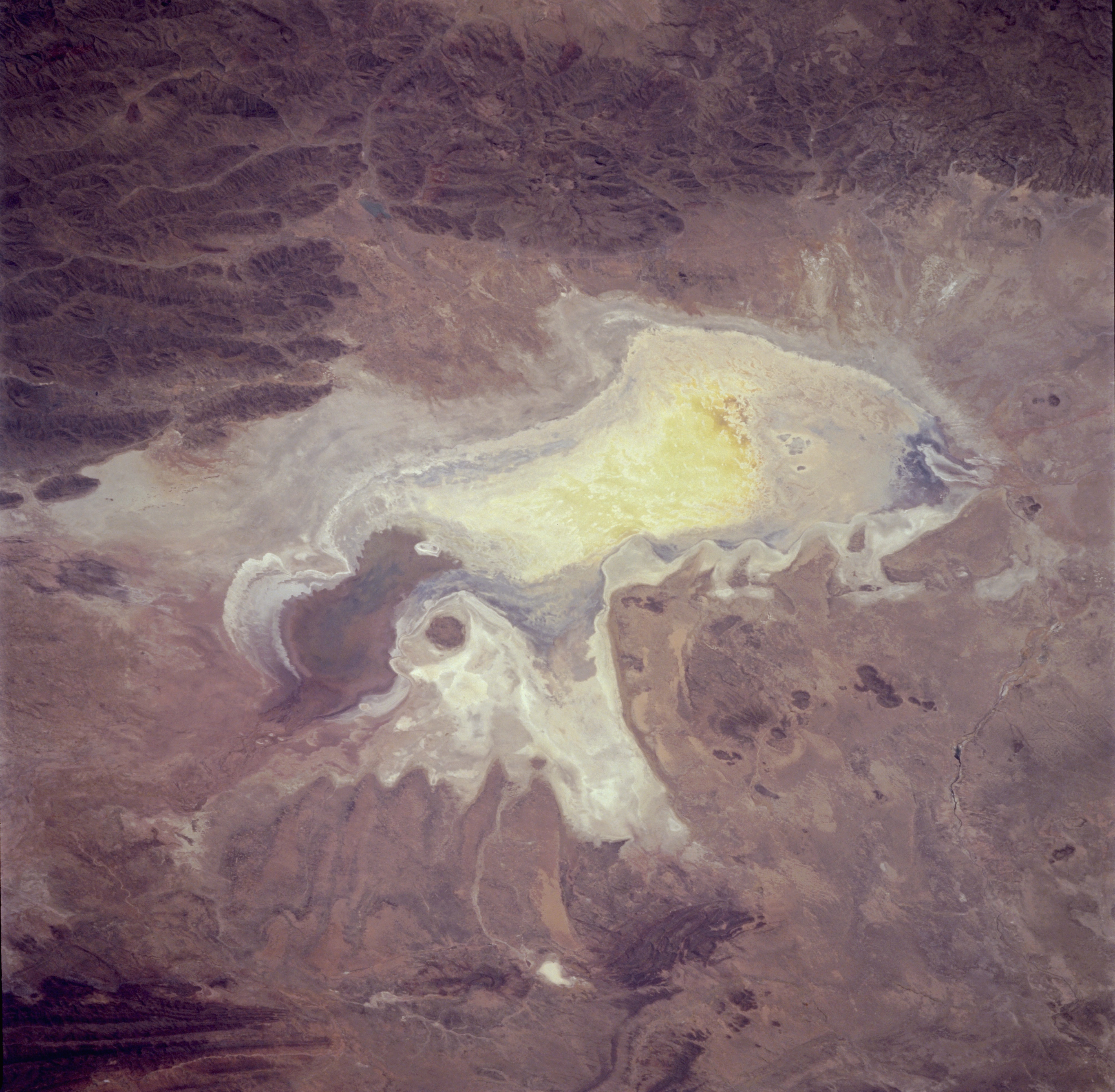
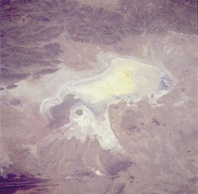
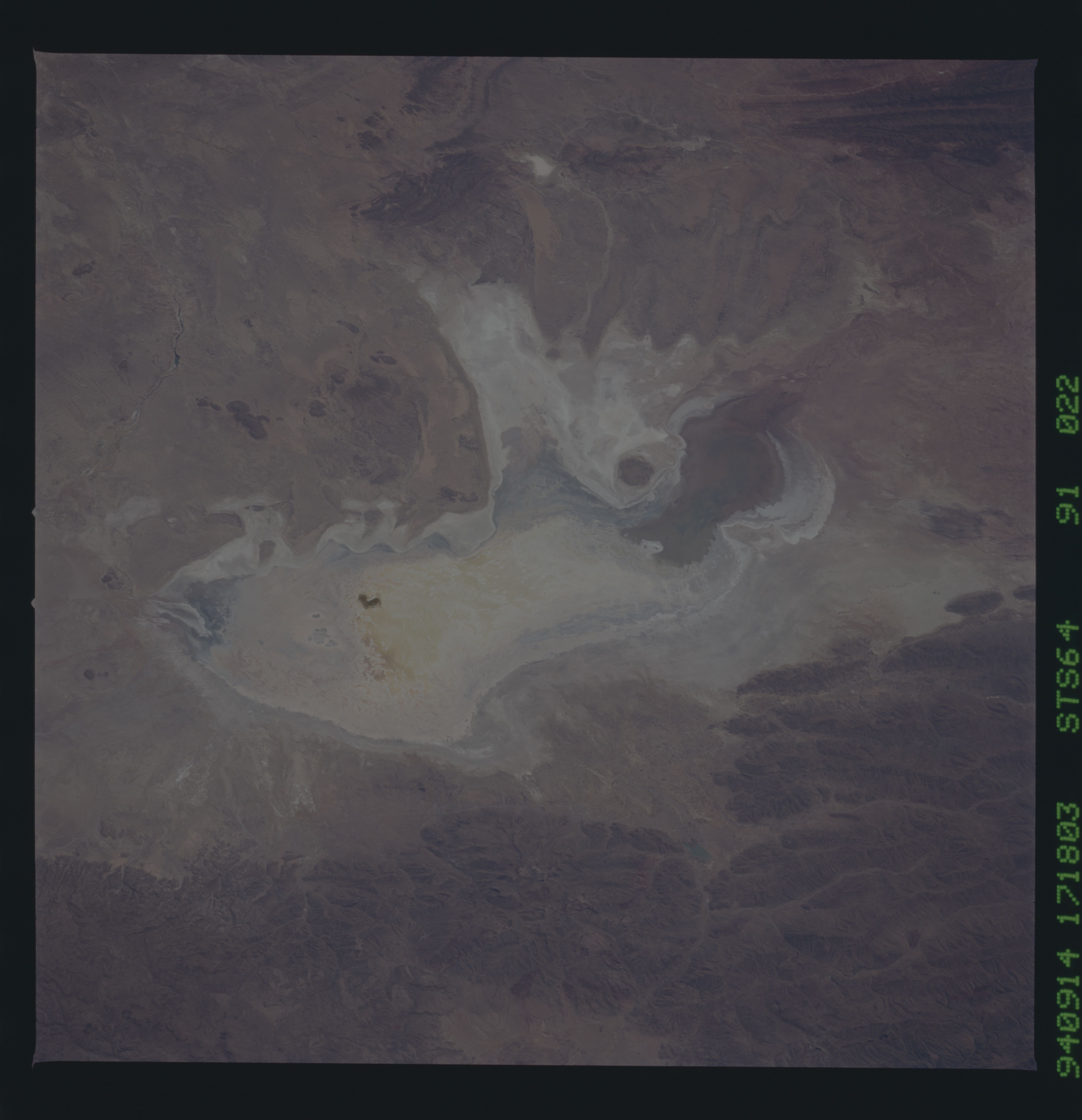
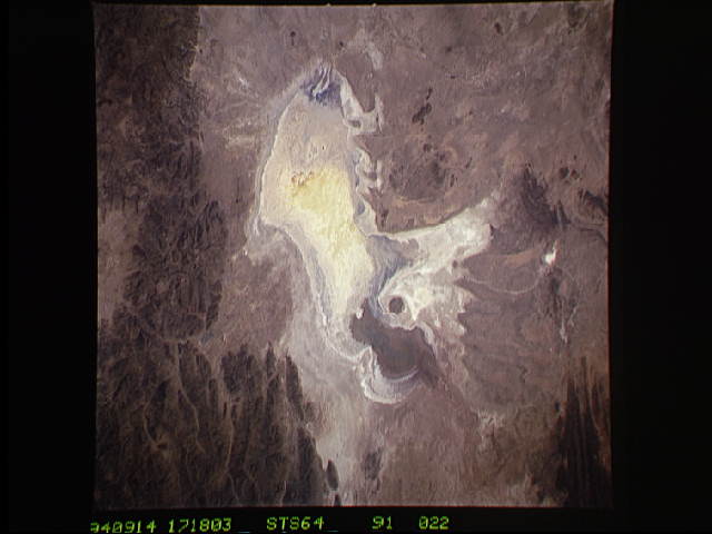
Image Caption: STS064-091-022 Lake Poopó, Bolivia September 1994
An almost dried-up Lake Poopo (also called Lake Aullagas) is visible in this low-oblique, west-looking photograph. Lake waters have been receding since 1990 (refer to STS-048-072-049, September 1991), and the inflow of the Desaguadero River at the lake's north end (brown) has slowed to a trickle. At the south end of the lake is a small river that drains Lake Poopo and follows a westward course until it finally drains into Salar de Coipasa (not visible in the photograph). Without years of near-normal or above-normal precipitation in the region, the lake will continue to dry because of evaporation resulting from intense sunshine and strong winds. A small light blue lake is visible east of Lake Poopo near the town of Challapata (grayish smudge at the base of the mountains south of the small lake). With the carrying capacity of Lake Poopo becoming inadequate, migratory wading birds from North America will need to find other area lakes for their wintering grounds.
An almost dried-up Lake Poopo (also called Lake Aullagas) is visible in this low-oblique, west-looking photograph. Lake waters have been receding since 1990 (refer to STS-048-072-049, September 1991), and the inflow of the Desaguadero River at the lake's north end (brown) has slowed to a trickle. At the south end of the lake is a small river that drains Lake Poopo and follows a westward course until it finally drains into Salar de Coipasa (not visible in the photograph). Without years of near-normal or above-normal precipitation in the region, the lake will continue to dry because of evaporation resulting from intense sunshine and strong winds. A small light blue lake is visible east of Lake Poopo near the town of Challapata (grayish smudge at the base of the mountains south of the small lake). With the carrying capacity of Lake Poopo becoming inadequate, migratory wading birds from North America will need to find other area lakes for their wintering grounds.
