STS064-80-87
| NASA Photo ID | STS064-80-87 |
| Focal Length | 250mm |
| Date taken | 1994.09.14 |
| Time taken | 13:07:30 GMT |
Resolutions offered for this image:
5265 x 5265 pixels 639 x 639 pixels 5700 x 5900 pixels 500 x 518 pixels 640 x 480 pixels
5265 x 5265 pixels 639 x 639 pixels 5700 x 5900 pixels 500 x 518 pixels 640 x 480 pixels

Cloud masks available for this image:
Spacecraft nadir point: 40.0° N, 45.5° E
Photo center point: 39.5° N, 44.5° E
Photo center point by machine learning:
Photo center point: 39.5° N, 44.5° E
Photo center point by machine learning:
Nadir to Photo Center: Southwest
Spacecraft Altitude: 139 nautical miles (257km)
Camera: | Hasselblad |
Focal Length: | 250mm |
Camera Tilt: | 26 degrees |
Format: | 5046: Kodak, natural color positive, Lumiere 100/5046, ASA 100, standard base |
Film Exposure: | Normal |
| Additional Information | |
| Width | Height | Annotated | Cropped | Purpose | Links |
|---|---|---|---|---|---|
| 5265 pixels | 5265 pixels | No | No | Earth From Space collection | Download Image |
| 639 pixels | 639 pixels | No | No | Earth From Space collection | Download Image |
| 5700 pixels | 5900 pixels | No | No | Download Image | |
| 500 pixels | 518 pixels | No | No | Download Image | |
| 640 pixels | 480 pixels | No | No | Download Image |
Download Packaged File
Download a Google Earth KML for this Image
View photo footprint information
Download a GeoTIFF for this photo
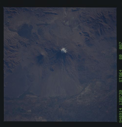
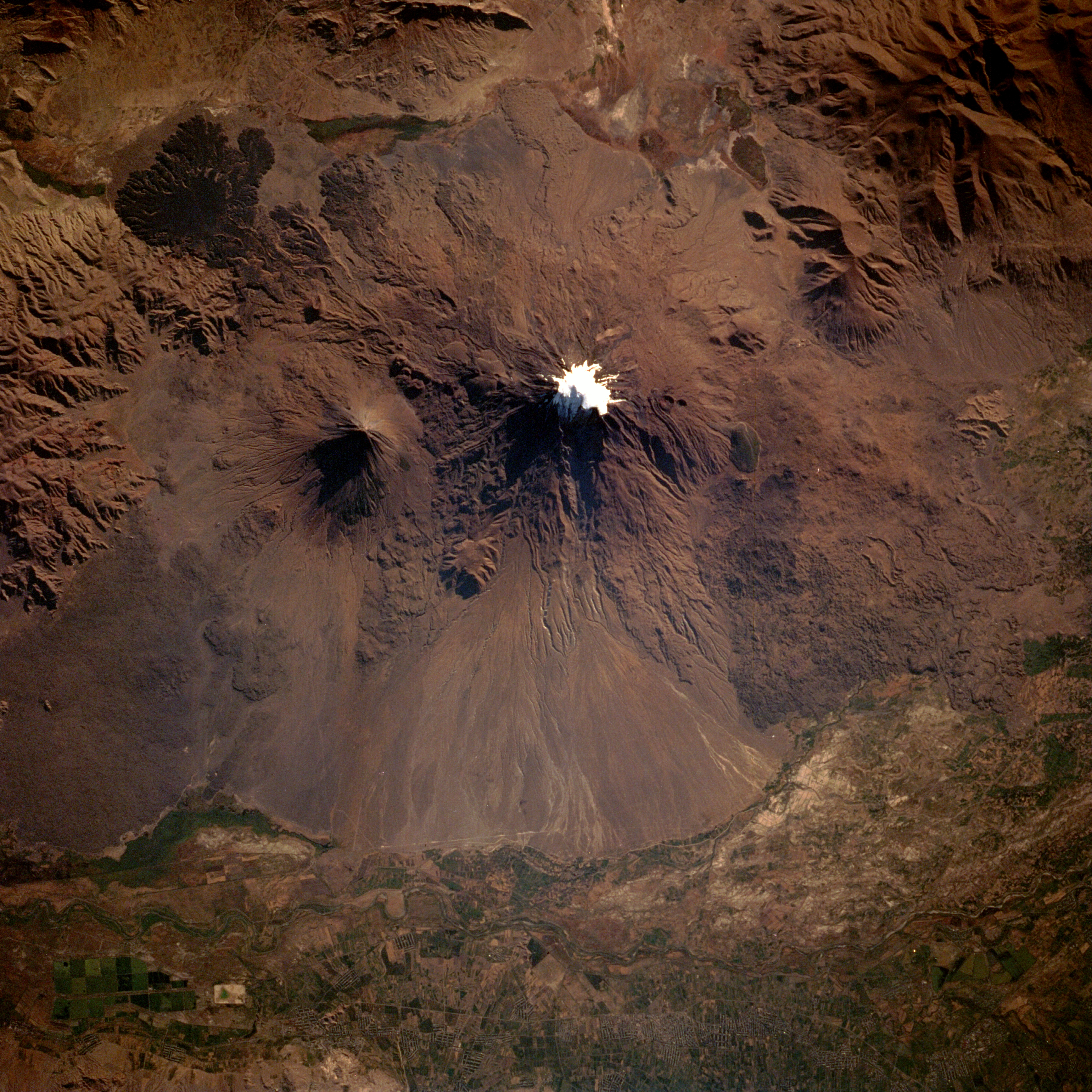
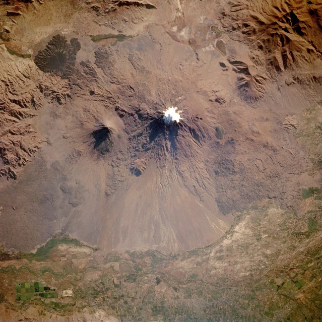
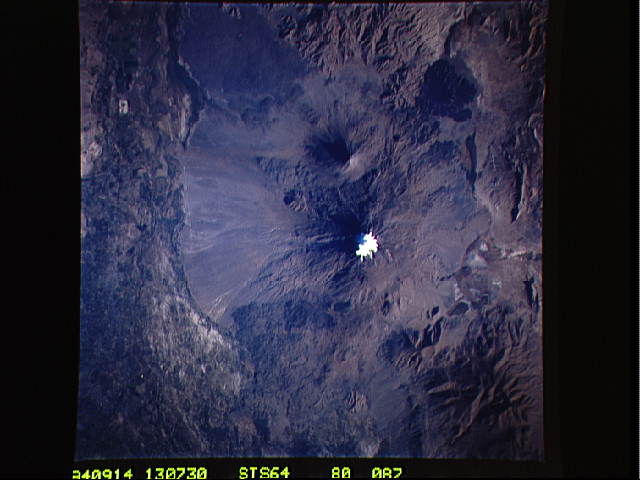
Image Caption: STS064-080-087 Mount Ararat Massif, Turkey September 1994
This spectacular, near-vertical photograph features the Mount Ararat Massif in eastern Turkey. Snow-capped Great Ararat (visible near the center of the photograph), the traditional resting place of Noah's Ark, reaches an altitude of 16 946 feet (5169 meters) above sea level; 7 miles (11 km) southeast, Little Ararat is 12 877 feet (3928 meters) above sea level. Both are symmetrical, cone-shaped volcanoes composed of alternating layers of lava and ash. The widespread ash forms andesitic tuff, a grayish-white rock. Most of Great Ararat formed about 2 million years ago atop a block of uplifted rock during the Holocene Period; Little Ararat formed shortly thereafter. No eruptions have been recorded for either volcano. Nine glacial tongues escape downslope of Great Ararat from the permanent ice field, meet the snow line, melt, and produce streams. The rather high snow line [15 420 feet (4700 meters)] for a mountain this far north results from the dry surrounding region. Because of the lack of water, the area is relatively barren and uninhabited. From medieval accounts, the Ararat region was a beautiful, forest-clad mountain with many human settlements and abundant wildlife; however, deforestation, overgrazing, and a destructive earthquake in 1840 have severely impacted the area. Because of fears of further earthquake activity and the very dry conditions, many inhabitants left the region and settled elsewhere.
This spectacular, near-vertical photograph features the Mount Ararat Massif in eastern Turkey. Snow-capped Great Ararat (visible near the center of the photograph), the traditional resting place of Noah's Ark, reaches an altitude of 16 946 feet (5169 meters) above sea level; 7 miles (11 km) southeast, Little Ararat is 12 877 feet (3928 meters) above sea level. Both are symmetrical, cone-shaped volcanoes composed of alternating layers of lava and ash. The widespread ash forms andesitic tuff, a grayish-white rock. Most of Great Ararat formed about 2 million years ago atop a block of uplifted rock during the Holocene Period; Little Ararat formed shortly thereafter. No eruptions have been recorded for either volcano. Nine glacial tongues escape downslope of Great Ararat from the permanent ice field, meet the snow line, melt, and produce streams. The rather high snow line [15 420 feet (4700 meters)] for a mountain this far north results from the dry surrounding region. Because of the lack of water, the area is relatively barren and uninhabited. From medieval accounts, the Ararat region was a beautiful, forest-clad mountain with many human settlements and abundant wildlife; however, deforestation, overgrazing, and a destructive earthquake in 1840 have severely impacted the area. Because of fears of further earthquake activity and the very dry conditions, many inhabitants left the region and settled elsewhere.
