STS064-80-21
| NASA Photo ID | STS064-80-21 |
| Focal Length | 250mm |
| Date taken | 1994.09.13 |
| Time taken | 23:37:53 GMT |
Resolutions offered for this image:
3904 x 3872 pixels 639 x 634 pixels 5700 x 5900 pixels 500 x 518 pixels 640 x 480 pixels
3904 x 3872 pixels 639 x 634 pixels 5700 x 5900 pixels 500 x 518 pixels 640 x 480 pixels


Cloud masks available for this image:
Spacecraft nadir point: 32.1° N, 117.8° W
Photo center point: 32.5° N, 117.0° W
Photo center point by machine learning:
Photo center point: 32.5° N, 117.0° W
Photo center point by machine learning:
Nadir to Photo Center: Northeast
Spacecraft Altitude: 140 nautical miles (259km)
Country or Geographic Name: | USA-CALIFORNIA |
Features: | SAN DIEGO AREA |
| Features Found Using Machine Learning: | |
Cloud Cover Percentage: | 0 (no clouds present) |
Sun Elevation Angle: | 29° |
Sun Azimuth: | 255° |
Camera: | Hasselblad |
Focal Length: | 250mm |
Camera Tilt: | 21 degrees |
Format: | 5046: Kodak, natural color positive, Lumiere 100/5046, ASA 100, standard base |
Film Exposure: | Normal |
| Additional Information | |
| Width | Height | Annotated | Cropped | Purpose | Links |
|---|---|---|---|---|---|
| 3904 pixels | 3872 pixels | No | No | Earth From Space collection | Download Image |
| 639 pixels | 634 pixels | No | No | Earth From Space collection | Download Image |
| 5700 pixels | 5900 pixels | No | No | Download Image | |
| 500 pixels | 518 pixels | No | No | Download Image | |
| 640 pixels | 480 pixels | No | No | Download Image |
Download Packaged File
Download a Google Earth KML for this Image
View photo footprint information
Download a GeoTIFF for this photo
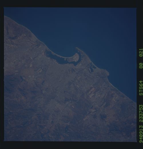
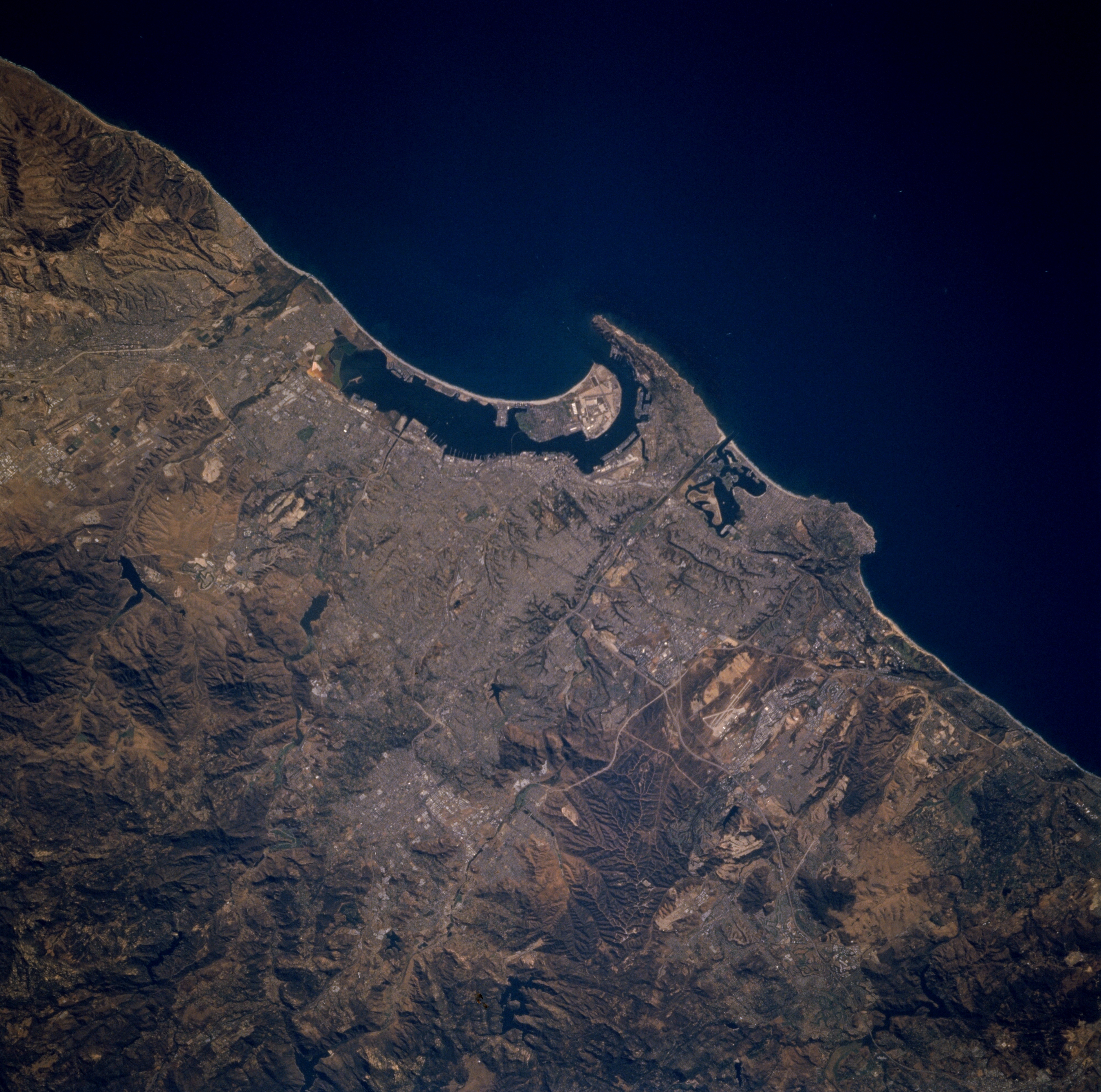
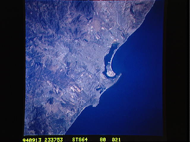
Image Caption: STS064-080-021 San Diego, California, U.S.A. September 1994
This near-vertical photograph features San Diego, once a quiet Navy town and now the nation's sixth largest city, whose economy is built on aerospace, scientific research, and tourism. Discernible are the runways of North Island Naval Air Station at the north end of the Coronado Peninsula; Point Loma to the west; and the extrusion into the Pacific Ocean of Soledad Mountain (the location of La Jolla) to the north. A section of the Coast Range is visible in the lower left corner of the image, and Tijuana, Mexico, can be seen near the top left corner of the image.
This near-vertical photograph features San Diego, once a quiet Navy town and now the nation's sixth largest city, whose economy is built on aerospace, scientific research, and tourism. Discernible are the runways of North Island Naval Air Station at the north end of the Coronado Peninsula; Point Loma to the west; and the extrusion into the Pacific Ocean of Soledad Mountain (the location of La Jolla) to the north. A section of the Coast Range is visible in the lower left corner of the image, and Tijuana, Mexico, can be seen near the top left corner of the image.
