STS064-73-97
| NASA Photo ID | STS064-73-97 |
| Focal Length | 250mm |
| Date taken | 1994.09.11 |
| Time taken | 01:07:16 GMT |
Resolutions offered for this image:
4096 x 4096 pixels 640 x 640 pixels 5700 x 5900 pixels 500 x 518 pixels 640 x 480 pixels 3165 x 2967 pixels 530 x 512 pixels 635 x 567 pixels
4096 x 4096 pixels 640 x 640 pixels 5700 x 5900 pixels 500 x 518 pixels 640 x 480 pixels 3165 x 2967 pixels 530 x 512 pixels 635 x 567 pixels


Cloud masks available for this image:
Spacecraft nadir point: 20.6° S, 161.3° W
Photo center point: 21.0° S, 160.0° W
Photo center point by machine learning:
Photo center point: 21.0° S, 160.0° W
Photo center point by machine learning:
Nadir to Photo Center: East
Spacecraft Altitude: 140 nautical miles (259km)
Country or Geographic Name: | COOK ISLANDS |
Features: | RAROTONGA I., MTS., CORAL |
| Features Found Using Machine Learning: | |
Cloud Cover Percentage: | 10 (1-10)% |
Sun Elevation Angle: | 46° |
Sun Azimuth: | 301° |
Camera: | Hasselblad |
Focal Length: | 250mm |
Camera Tilt: | 30 degrees |
Format: | 5046: Kodak, natural color positive, Lumiere 100/5046, ASA 100, standard base |
Film Exposure: | Normal |
| Additional Information | |
| Width | Height | Annotated | Cropped | Purpose | Links |
|---|---|---|---|---|---|
| 4096 pixels | 4096 pixels | No | No | Earth From Space collection | Download Image |
| 640 pixels | 640 pixels | No | No | Earth From Space collection | Download Image |
| 5700 pixels | 5900 pixels | No | No | Download Image | |
| 500 pixels | 518 pixels | No | No | Download Image | |
| 640 pixels | 480 pixels | No | No | Download Image | |
| 3165 pixels | 2967 pixels | No | Yes | Download Image | |
| 530 pixels | 512 pixels | Download Image | |||
| 635 pixels | 567 pixels | No | Yes | Download Image |
Download Packaged File
Download a Google Earth KML for this Image
View photo footprint information
Download a GeoTIFF for this photo
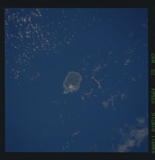
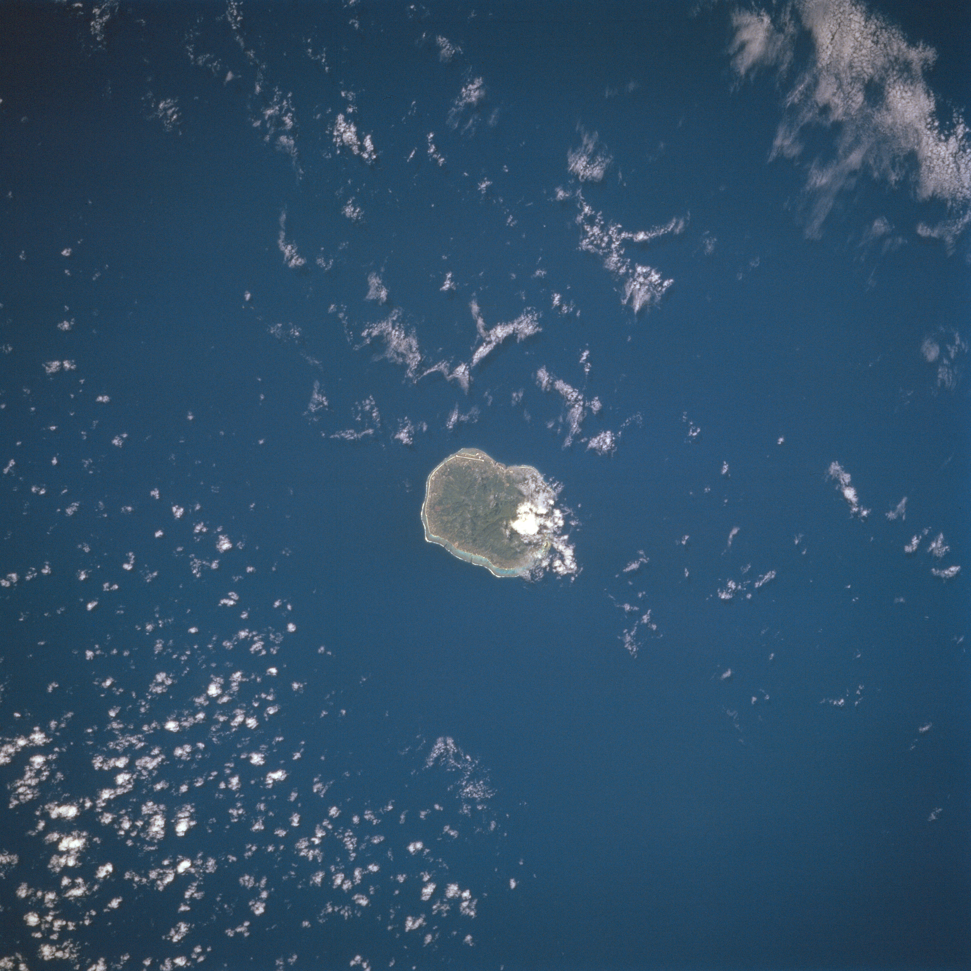
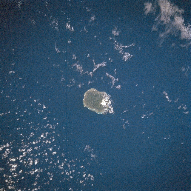
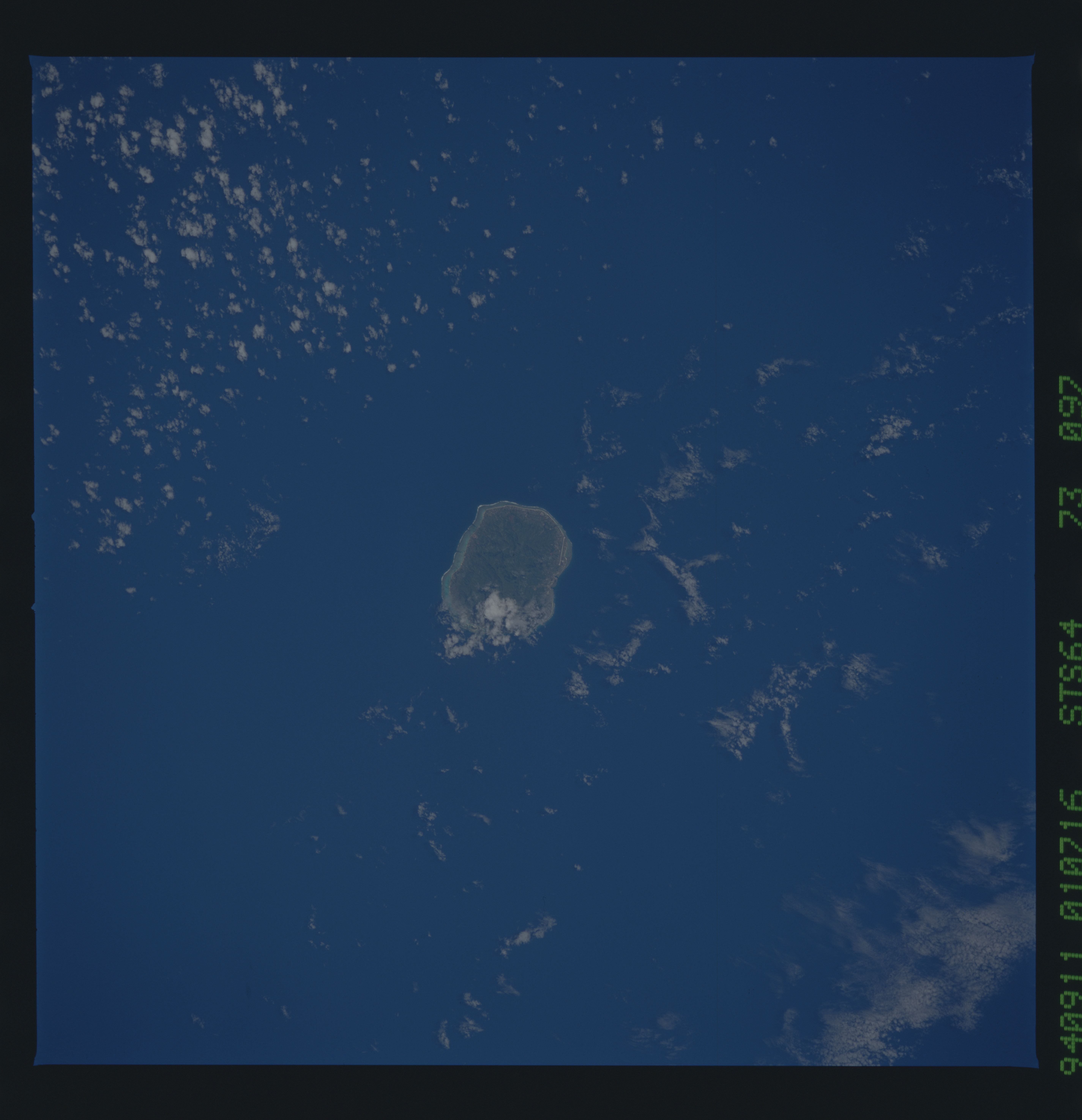
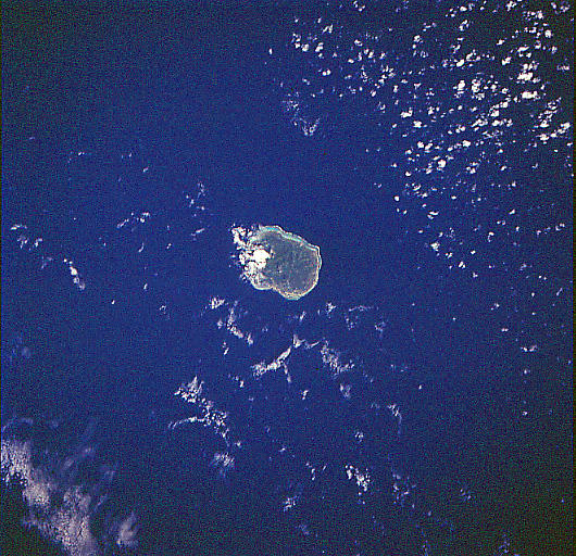
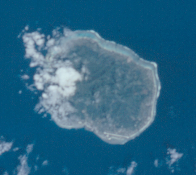
Image Caption: STS064-073-097 Rarotonga Island, Cook Islands September 1994
The youngest island within the Cook Islands southern group, the volcanic island of Rarotonga can be seen in this northwest-looking view. The capital and largest of the Cook Islands, Rarotonga's central massif is the eroded remains of a volcanic pyramid whose eroded crags now form sawtooth peaks and razorback ridges covered with tropical jungle. Rarotonga Island stands 14750 feet (4500 meters) above the ocean floor. The island is 20 miles (32 km) in circumference. At a depth of 13000 feet (4000 meters), the volcano is nearly 31 miles (50 km) in diameter. The highest peak on the island above sea level is 2140 feet (658 meters). The island is surrounded by a lagoon, which extends several hundred yards (meters) to the reef, which then slopes steeply to deep water. Agricultural terraces, flats, and swamps surround the central mountain area. Based on evidence collected, archaeologists have estimated that there was human life on Rarotonga Island about 5000 years ago.
The youngest island within the Cook Islands southern group, the volcanic island of Rarotonga can be seen in this northwest-looking view. The capital and largest of the Cook Islands, Rarotonga's central massif is the eroded remains of a volcanic pyramid whose eroded crags now form sawtooth peaks and razorback ridges covered with tropical jungle. Rarotonga Island stands 14750 feet (4500 meters) above the ocean floor. The island is 20 miles (32 km) in circumference. At a depth of 13000 feet (4000 meters), the volcano is nearly 31 miles (50 km) in diameter. The highest peak on the island above sea level is 2140 feet (658 meters). The island is surrounded by a lagoon, which extends several hundred yards (meters) to the reef, which then slopes steeply to deep water. Agricultural terraces, flats, and swamps surround the central mountain area. Based on evidence collected, archaeologists have estimated that there was human life on Rarotonga Island about 5000 years ago.
