STS064-215-28
| NASA Photo ID | STS064-215-28 |
| Focal Length | 250mm |
| Date taken | 1994.09.18 |
| Time taken | 12:31:55 GMT |
Resolutions offered for this image:
3072 x 3061 pixels 639 x 637 pixels 5700 x 5900 pixels 500 x 518 pixels 640 x 480 pixels
3072 x 3061 pixels 639 x 637 pixels 5700 x 5900 pixels 500 x 518 pixels 640 x 480 pixels

Cloud masks available for this image:
Spacecraft nadir point: 46.3° N, 41.3° E
Photo center point: 47.0° N, 40.5° E
Photo center point by machine learning:
Photo center point: 47.0° N, 40.5° E
Photo center point by machine learning:
Nadir to Photo Center: Northwest
Spacecraft Altitude: 129 nautical miles (239km)
Camera: | Hasselblad |
Focal Length: | 250mm |
Camera Tilt: | 26 degrees |
Format: | 5048: Kodak, natural color positive, Lumiere 100x/5048, ASA 100x, standard base |
Film Exposure: | Normal |
| Additional Information | |
| Width | Height | Annotated | Cropped | Purpose | Links |
|---|---|---|---|---|---|
| 3072 pixels | 3061 pixels | No | No | Earth From Space collection | Download Image |
| 639 pixels | 637 pixels | No | No | Earth From Space collection | Download Image |
| 5700 pixels | 5900 pixels | No | No | Download Image | |
| 500 pixels | 518 pixels | No | No | Download Image | |
| 640 pixels | 480 pixels | No | No | Download Image |
Download Packaged File
Download a Google Earth KML for this Image
View photo footprint information
Download a GeoTIFF for this photo
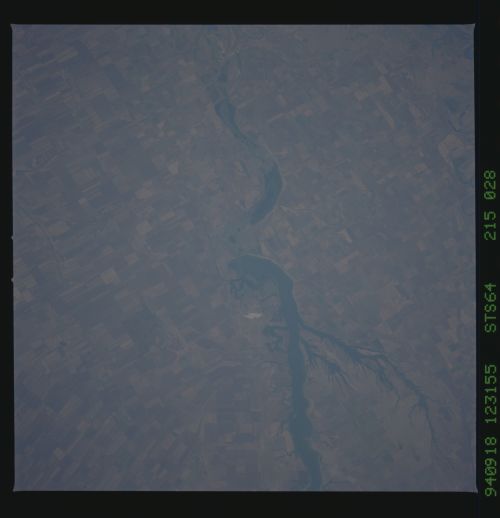
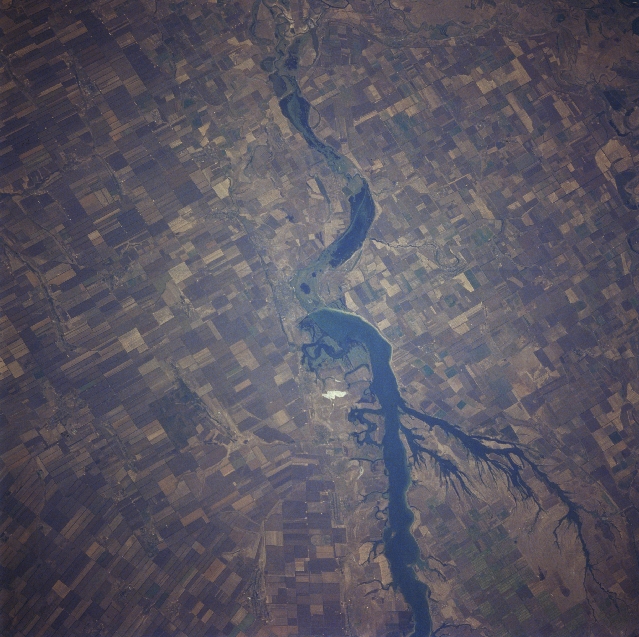
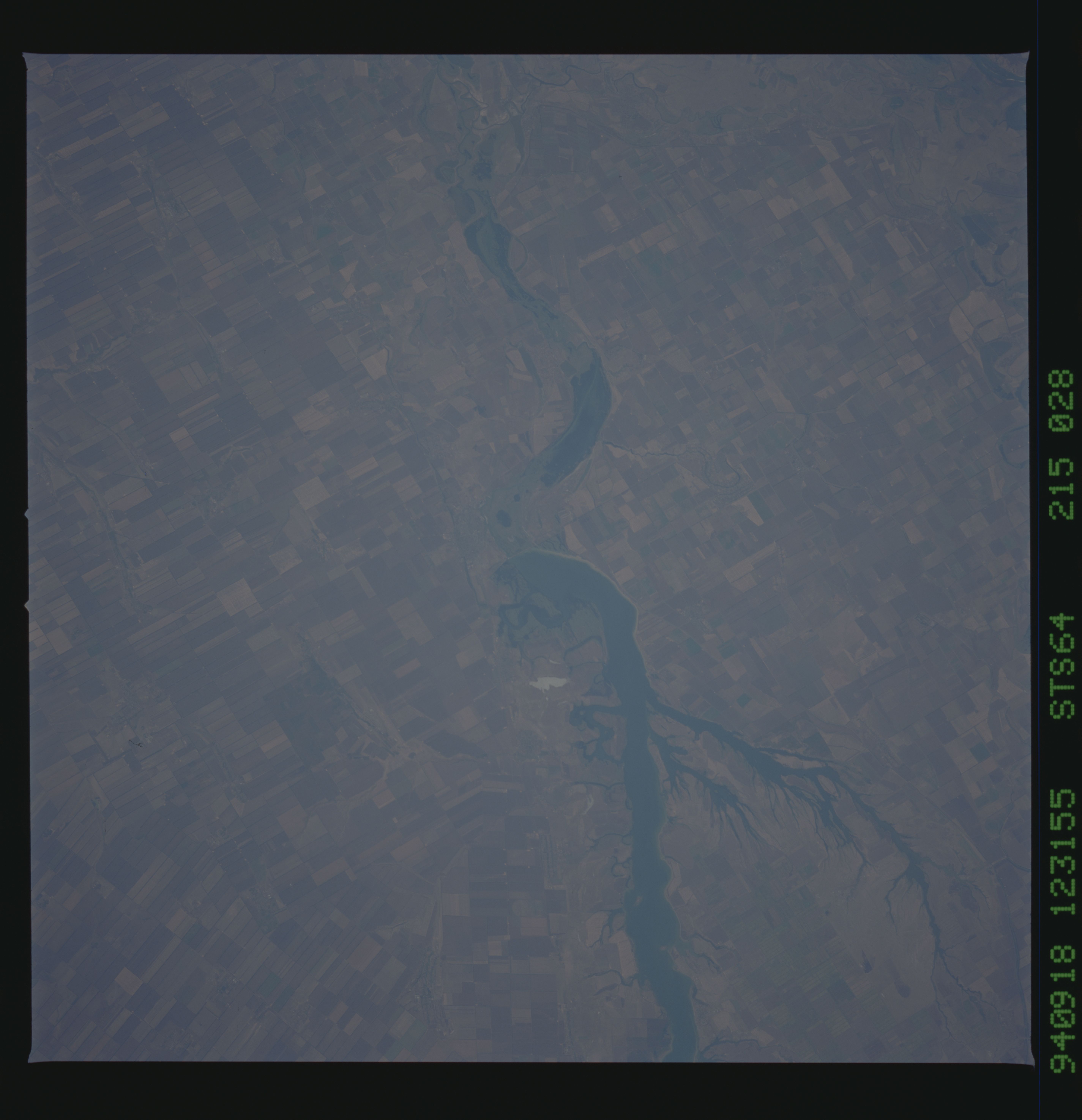
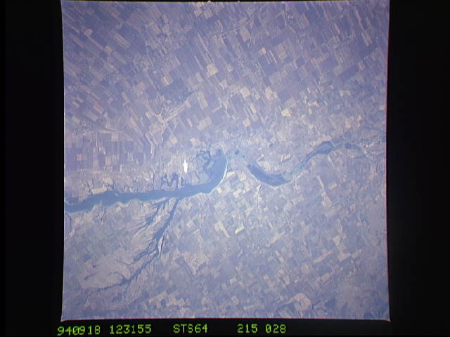
Image Caption: STS064-215-028 Agriculture, Rostov Oblast, Russia September 1994
A series of interconnected lakes (dark, winding features extending vertically through the center of the image) drain generally northwest toward the city of Rostov-na-Donv in southwest Russia. While the city is not in this picture (just off of the top center), the northwest-looking view provides a synoptic view of a landscape that is used extensively for agriculture (large, angular field patterns). The scene shows part of the vast steppe country (semi arid climate) that is very productive in grain crops throughout this region of southwestern Russia. A very small part of the Don River floodplain (no distinguishable field patterns) is visible in the upper right corner of the image.
A series of interconnected lakes (dark, winding features extending vertically through the center of the image) drain generally northwest toward the city of Rostov-na-Donv in southwest Russia. While the city is not in this picture (just off of the top center), the northwest-looking view provides a synoptic view of a landscape that is used extensively for agriculture (large, angular field patterns). The scene shows part of the vast steppe country (semi arid climate) that is very productive in grain crops throughout this region of southwestern Russia. A very small part of the Don River floodplain (no distinguishable field patterns) is visible in the upper right corner of the image.
