STS064-214-23
| NASA Photo ID | STS064-214-23 |
| Focal Length | 250mm |
| Date taken | 1994.09.17 |
| Time taken | 23:06:19 GMT |
Resolutions offered for this image:
3904 x 3936 pixels 634 x 639 pixels 5700 x 5900 pixels 500 x 518 pixels 640 x 480 pixels
3904 x 3936 pixels 634 x 639 pixels 5700 x 5900 pixels 500 x 518 pixels 640 x 480 pixels
Cloud masks available for this image:
Spacecraft nadir point: 40.6° N, 123.0° W
Photo center point: 40.5° N, 122.5° W
Photo center point by machine learning:
Photo center point: 40.5° N, 122.5° W
Photo center point by machine learning:
Nadir to Photo Center: East
Spacecraft Altitude: 129 nautical miles (239km)
Country or Geographic Name: | USA-CALIFORNIA |
Features: | REDDING, SHASTA LAKE, MTS |
| Features Found Using Machine Learning: | |
Cloud Cover Percentage: | 0 (no clouds present) |
Sun Elevation Angle: | 34° |
Sun Azimuth: | 239° |
Camera: | Hasselblad |
Focal Length: | 250mm |
Camera Tilt: | 13 degrees |
Format: | 5048: Kodak, natural color positive, Lumiere 100x/5048, ASA 100x, standard base |
Film Exposure: | Normal |
| Additional Information | |
| Width | Height | Annotated | Cropped | Purpose | Links |
|---|---|---|---|---|---|
| 3904 pixels | 3936 pixels | No | No | Earth From Space collection | Download Image |
| 634 pixels | 639 pixels | No | No | Earth From Space collection | Download Image |
| 5700 pixels | 5900 pixels | No | No | Download Image | |
| 500 pixels | 518 pixels | No | No | Download Image | |
| 640 pixels | 480 pixels | No | No | Download Image |
Download Packaged File
Download a Google Earth KML for this Image
View photo footprint information
Download a GeoTIFF for this photo
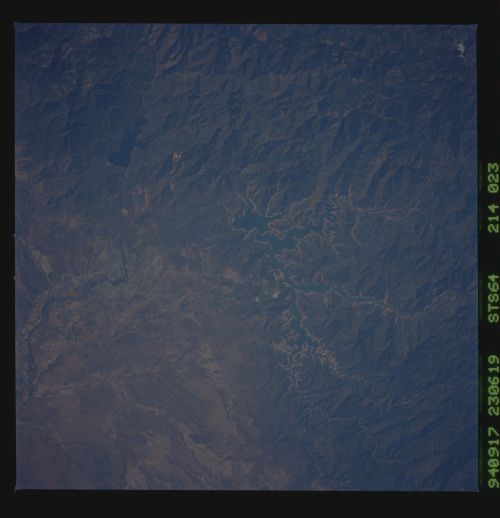
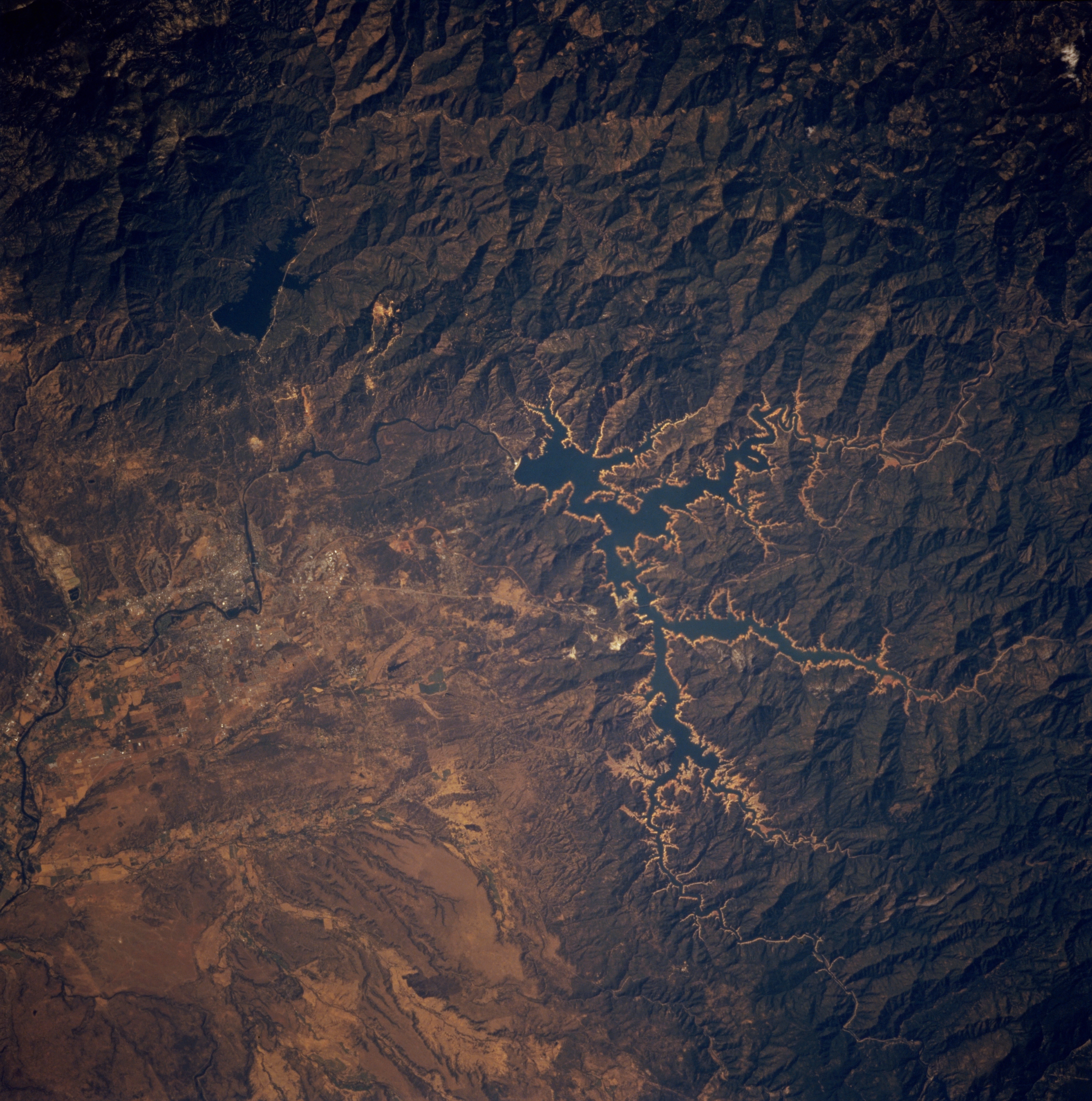
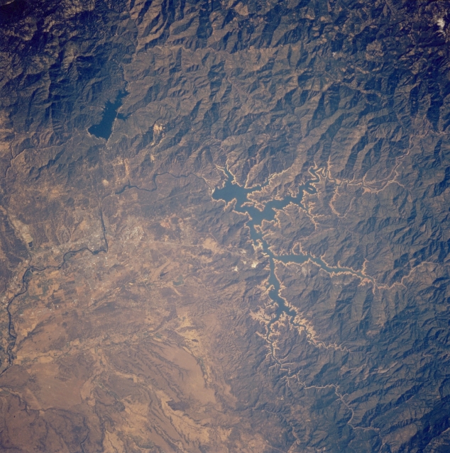
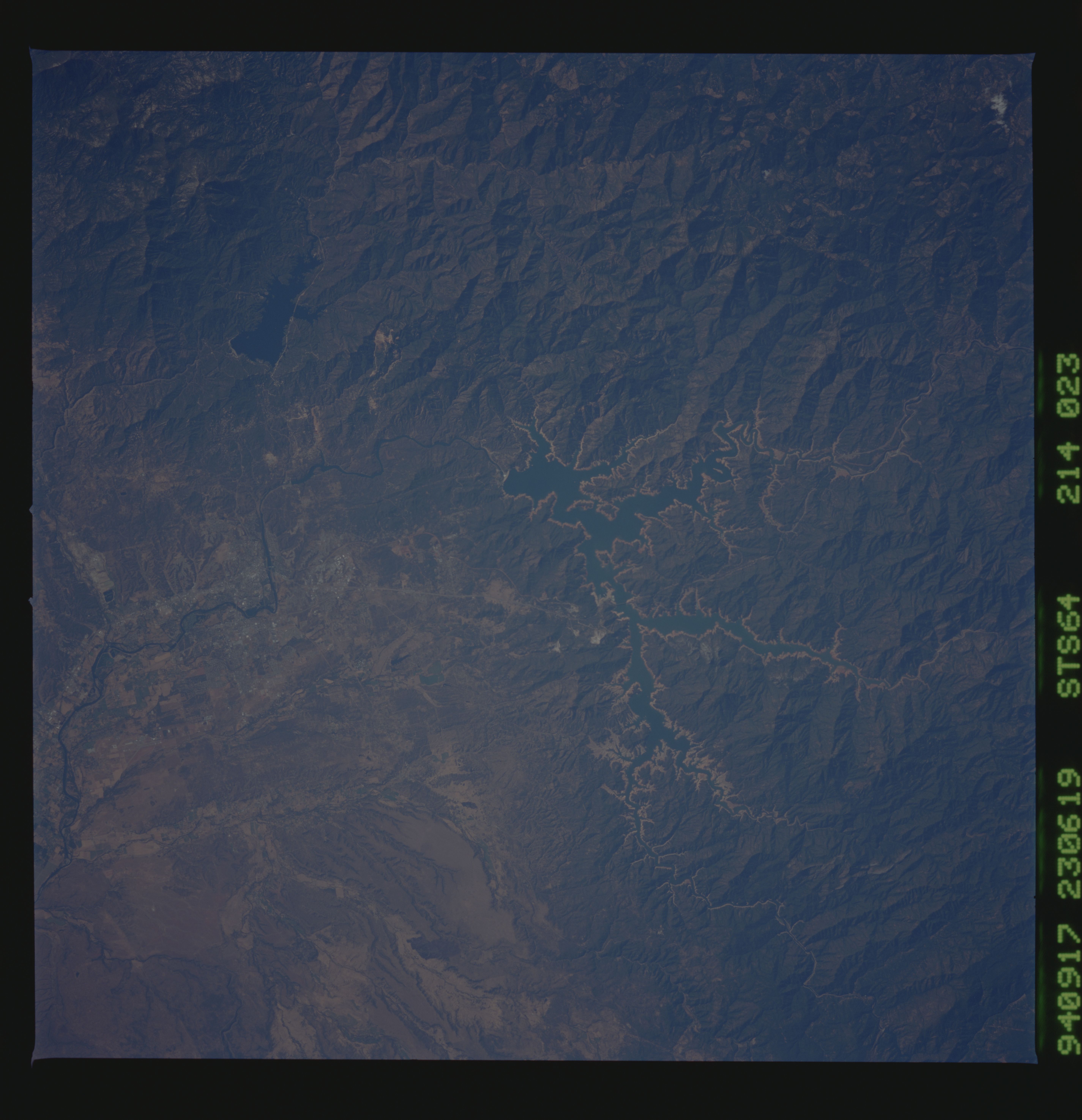
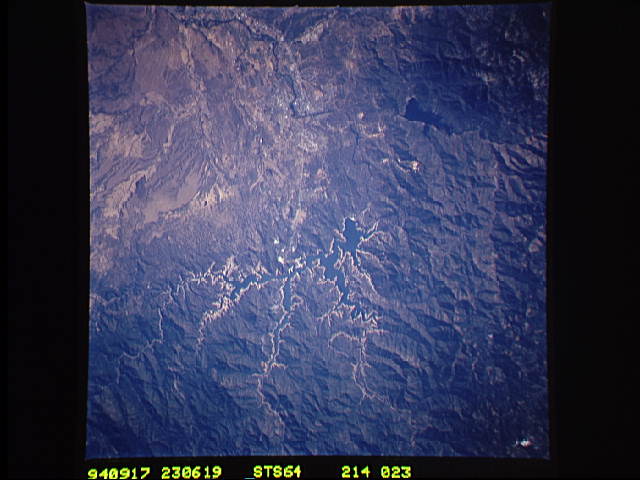
Image Caption: STS064-214-023 Shasta Lake, California, U.S.A. September 1994
Light blue Shasta Lake, part of the Whiskeytown-Shasta-Trinity National Recreation Area, is featured in this near-vertical photograph. Surrounded by Shasta-Trinity National Forest, Shasta Lake is drained by the Sacramento River, which is visible near the center of the photograph and extends to the lower left. The darker blue waters of Whiskeytown Lake and parts of Redding are apparent west of Shasta Lake.
Light blue Shasta Lake, part of the Whiskeytown-Shasta-Trinity National Recreation Area, is featured in this near-vertical photograph. Surrounded by Shasta-Trinity National Forest, Shasta Lake is drained by the Sacramento River, which is visible near the center of the photograph and extends to the lower left. The darker blue waters of Whiskeytown Lake and parts of Redding are apparent west of Shasta Lake.
