STS064-213-73
| NASA Photo ID | STS064-213-73 |
| Focal Length | 250mm |
| Date taken | 1994.09.18 |
| Time taken | 21:22:52 GMT |
Resolutions offered for this image:
3904 x 3904 pixels 639 x 639 pixels 5700 x 5900 pixels 500 x 518 pixels 640 x 480 pixels
3904 x 3904 pixels 639 x 639 pixels 5700 x 5900 pixels 500 x 518 pixels 640 x 480 pixels

Cloud masks available for this image:
Spacecraft nadir point: 33.0° N, 111.3° W
Photo center point: 33.5° N, 112.0° W
Photo center point by machine learning:
Photo center point: 33.5° N, 112.0° W
Photo center point by machine learning:
Nadir to Photo Center: Northwest
Spacecraft Altitude: 129 nautical miles (239km)
Country or Geographic Name: | USA-ARIZONA |
Features: | PHOENIX, LAKE PLEASANT |
| Features Found Using Machine Learning: | |
Cloud Cover Percentage: | 10 (1-10)% |
Sun Elevation Angle: | 47° |
Sun Azimuth: | 229° |
Camera: | Hasselblad |
Focal Length: | 250mm |
Camera Tilt: | 22 degrees |
Format: | 5048: Kodak, natural color positive, Lumiere 100x/5048, ASA 100x, standard base |
Film Exposure: | Normal |
| Additional Information | |
| Width | Height | Annotated | Cropped | Purpose | Links |
|---|---|---|---|---|---|
| 3904 pixels | 3904 pixels | No | No | Earth From Space collection | Download Image |
| 639 pixels | 639 pixels | No | No | Earth From Space collection | Download Image |
| 5700 pixels | 5900 pixels | No | No | Download Image | |
| 500 pixels | 518 pixels | No | No | Download Image | |
| 640 pixels | 480 pixels | No | No | Download Image |
Download Packaged File
Download a Google Earth KML for this Image
View photo footprint information
Download a GeoTIFF for this photo
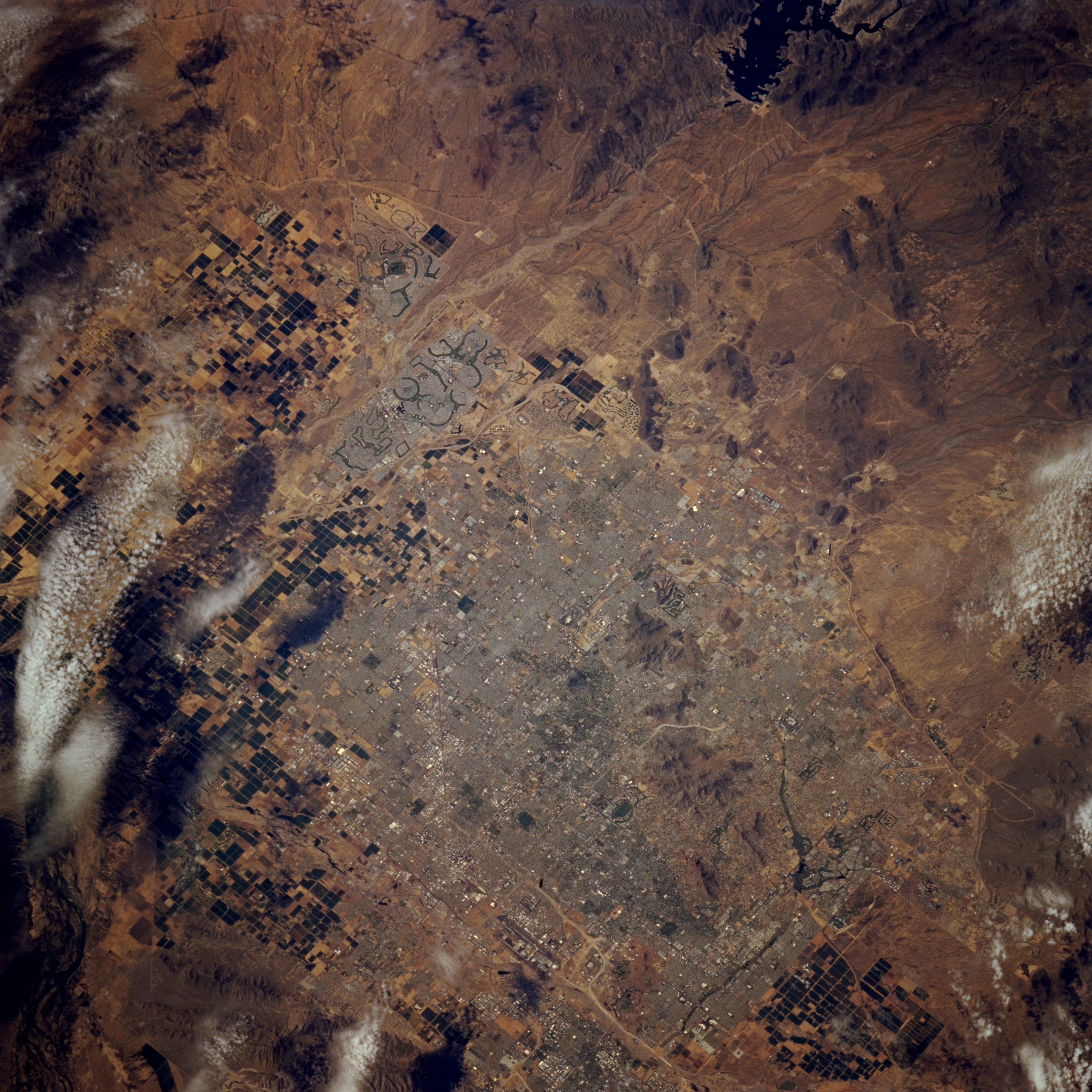
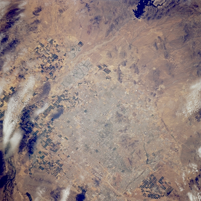
Image Caption: STS064-213-073 Phoenix Area, Arizona, U.S.A. September 1994
Clouds and shadows obscure part of the dark, rectangular, irrigated field patterns west, southwest, and east of urban Phoenix. Residential, commercial, and industrial concentrations are hard to distinguish; however, Sun City, a retirement community northwest of Phoenix, is easily recognized because of its darker, circular features (golf courses, reservoirs, and parks). U.S. Highway 60 (Grand Avenue) traverses Sun City and the west side of Phoenix in a generally northwest-southeast direction. Lake Pleasant and its dam are clearly visible, and the Agua Fria River flows almost due south from Lake Pleasant, west of Phoenix, to the Gila River. Small South Mountain, south of Phoenix, and other hills and low mountains appear as various shades of brown.
Clouds and shadows obscure part of the dark, rectangular, irrigated field patterns west, southwest, and east of urban Phoenix. Residential, commercial, and industrial concentrations are hard to distinguish; however, Sun City, a retirement community northwest of Phoenix, is easily recognized because of its darker, circular features (golf courses, reservoirs, and parks). U.S. Highway 60 (Grand Avenue) traverses Sun City and the west side of Phoenix in a generally northwest-southeast direction. Lake Pleasant and its dam are clearly visible, and the Agua Fria River flows almost due south from Lake Pleasant, west of Phoenix, to the Gila River. Small South Mountain, south of Phoenix, and other hills and low mountains appear as various shades of brown.
