STS064-110-88
| NASA Photo ID | STS064-110-88 |
| Focal Length | 250mm |
| Date taken | 1994.09.15 |
| Time taken | 23:28:02 GMT |
Resolutions offered for this image:
3904 x 3872 pixels 639 x 634 pixels 5700 x 5900 pixels 500 x 518 pixels 640 x 480 pixels
3904 x 3872 pixels 639 x 634 pixels 5700 x 5900 pixels 500 x 518 pixels 640 x 480 pixels
Cloud masks available for this image:
Spacecraft nadir point: 37.4° N, 120.9° W
Photo center point: 37.5° N, 122.5° W
Photo center point by machine learning:
Photo center point: 37.5° N, 122.5° W
Photo center point by machine learning:
Nadir to Photo Center: West
Spacecraft Altitude: 131 nautical miles (243km)
Country or Geographic Name: | USA-CALIFORNIA |
Features: | SAN FRANCISCO BAY AREA |
| Features Found Using Machine Learning: | |
Cloud Cover Percentage: | 0 (no clouds present) |
Sun Elevation Angle: | 31° |
Sun Azimuth: | 247° |
Camera: | Hasselblad |
Focal Length: | 250mm |
Camera Tilt: | 36 degrees |
Format: | VELVI: Fuji, natural color positive, Velvia 50, CS 135-36, ASA 32, standard base |
Film Exposure: | Out of Focus |
| Additional Information | |
| Width | Height | Annotated | Cropped | Purpose | Links |
|---|---|---|---|---|---|
| 3904 pixels | 3872 pixels | No | No | Earth From Space collection | Download Image |
| 639 pixels | 634 pixels | No | No | Earth From Space collection | Download Image |
| 5700 pixels | 5900 pixels | No | No | Download Image | |
| 500 pixels | 518 pixels | No | No | Download Image | |
| 640 pixels | 480 pixels | No | No | Download Image |
Download Packaged File
Download a Google Earth KML for this Image
View photo footprint information
Download a GeoTIFF for this photo
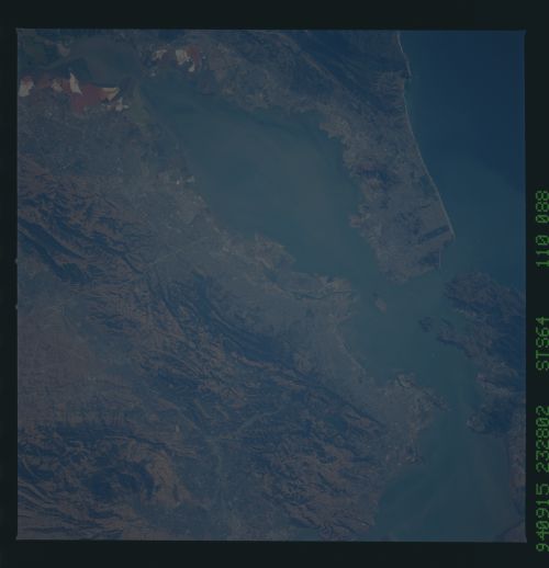
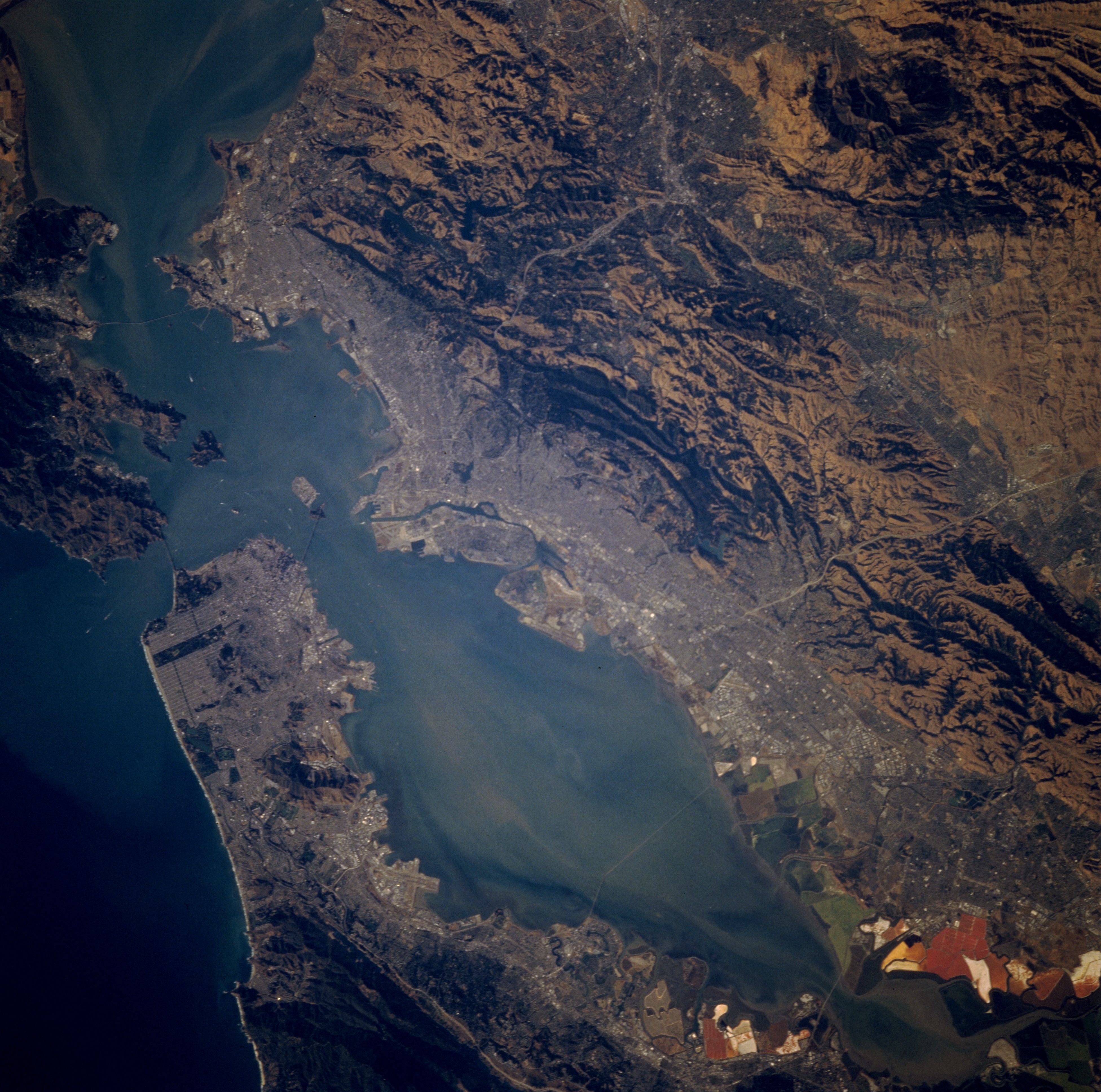
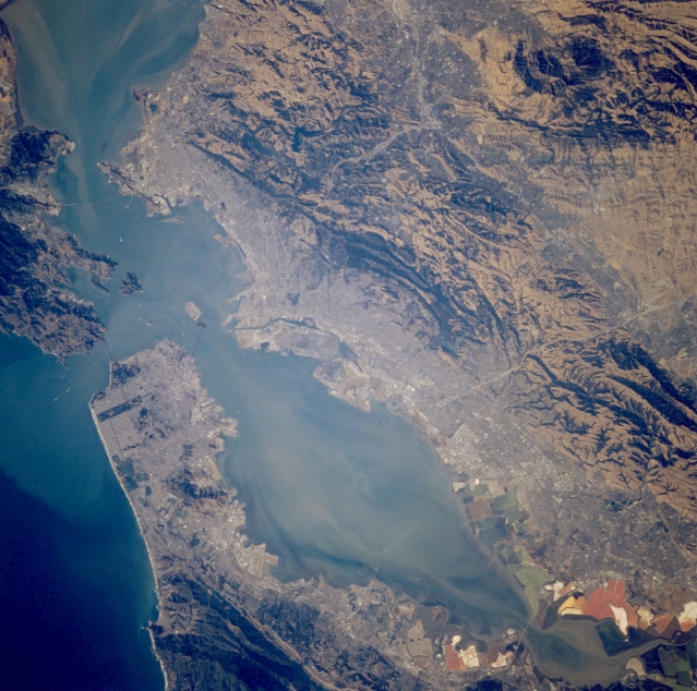
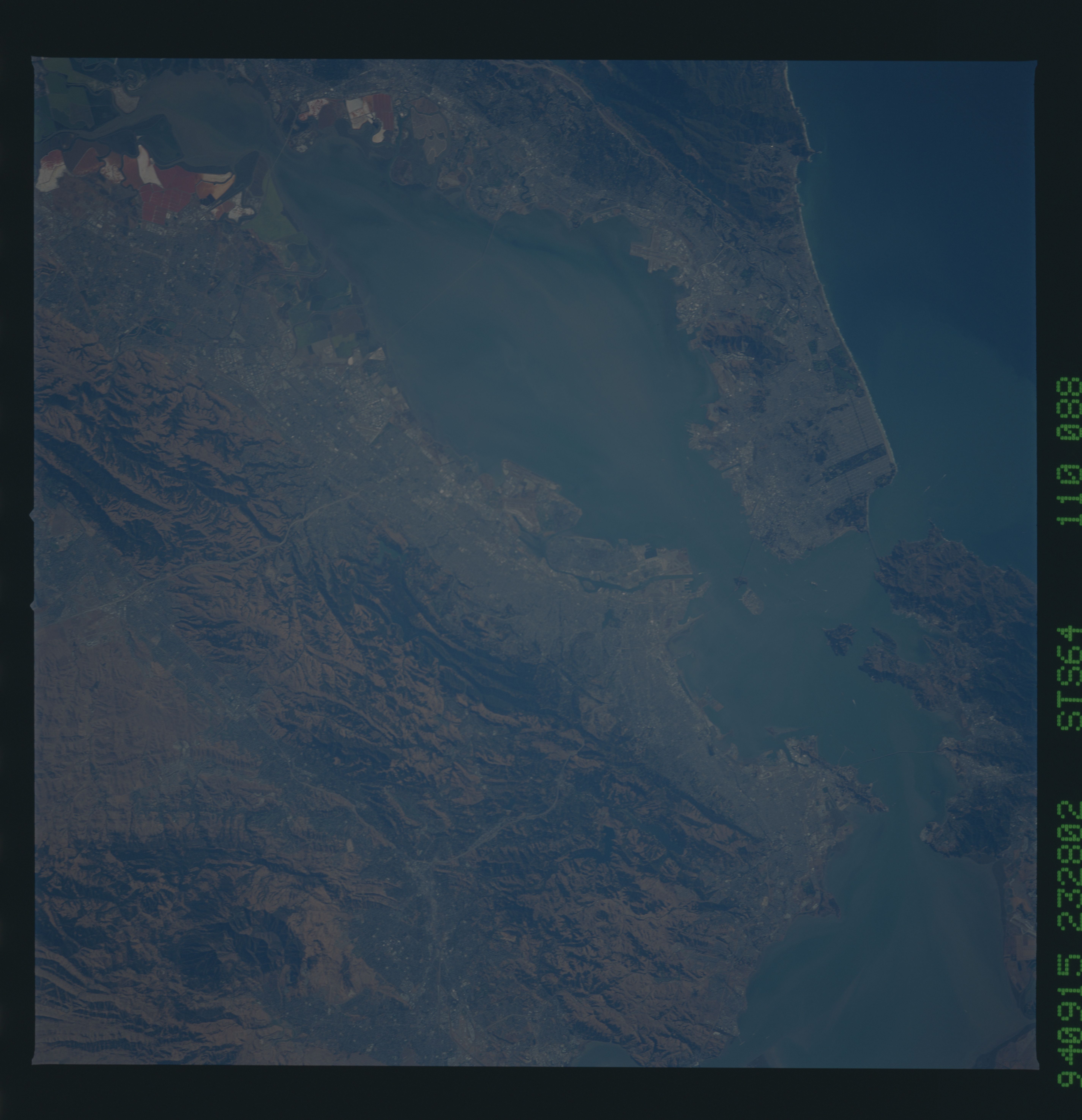
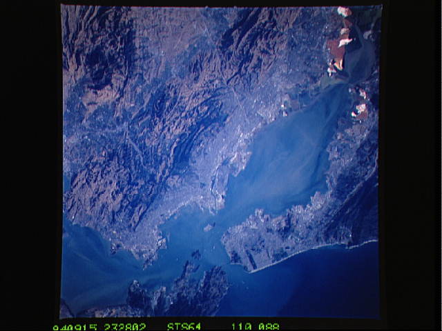
Image Caption: STS064-110-088 San Francisco Bay Area, California, U.S.A. September 1994
The gray urban area in this near-vertical, synoptic photograph contrasts with the dark ridges and hills to the east. Two east-west-oriented highways traverse the ridges and hills, connecting the densely populated Bay Area with the valley to the east. The whites, browns, and greens at the southern end of San Francisco Bay are large salt settling ponds where salt is extracted from the brackish water.
The gray urban area in this near-vertical, synoptic photograph contrasts with the dark ridges and hills to the east. Two east-west-oriented highways traverse the ridges and hills, connecting the densely populated Bay Area with the valley to the east. The whites, browns, and greens at the southern end of San Francisco Bay are large salt settling ponds where salt is extracted from the brackish water.
