STS064-101-28
| NASA Photo ID | STS064-101-28 |
| Focal Length | 250mm |
| Date taken | 1994.09.__ |
| Time taken | GMT |
Resolutions offered for this image:
5700 x 5900 pixels 500 x 518 pixels 640 x 480 pixels 2597 x 2558 pixels 1299 x 1279 pixels 900 x 888 pixels
5700 x 5900 pixels 500 x 518 pixels 640 x 480 pixels 2597 x 2558 pixels 1299 x 1279 pixels 900 x 888 pixels


Cloud masks available for this image:
Spacecraft nadir point:
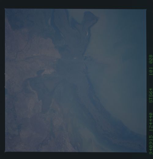
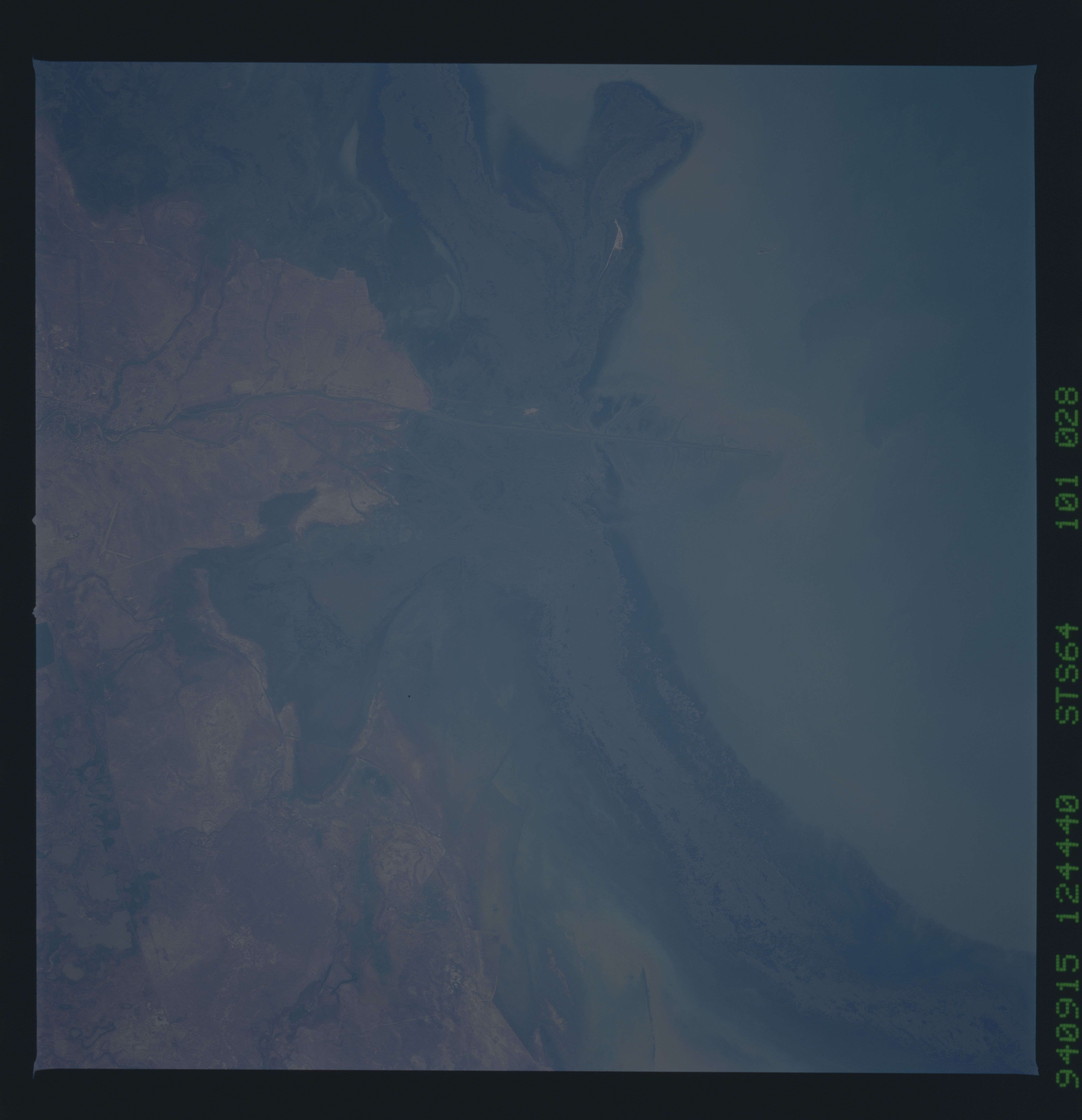
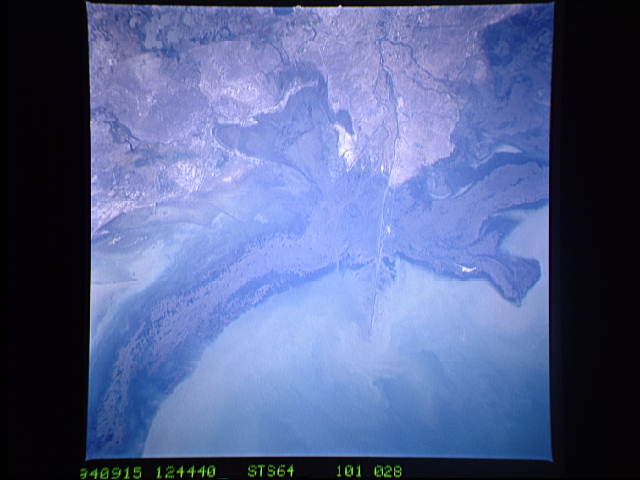
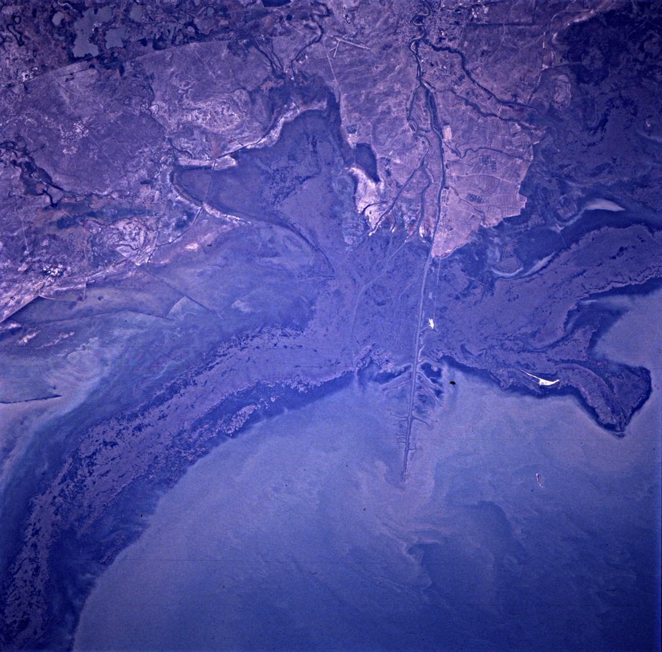
Photo center point: 47.0° N, 51.5° E
Photo center point by machine learning:
Photo center point: 47.0° N, 51.5° E
Photo center point by machine learning:
Nadir to Photo Center: Northeast
Spacecraft Altitude: nautical miles (0km)
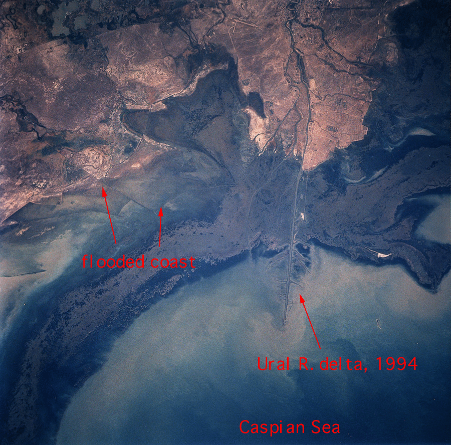
Country or Geographic Name: | KAZAKHSTAN |
Features: | URAL RIVER DELTA |
| Features Found Using Machine Learning: | |
Cloud Cover Percentage: | 0 (no clouds present) |
Sun Elevation Angle: | ° |
Sun Azimuth: | ° |
Camera: | Hasselblad |
Focal Length: | 250mm |
Camera Tilt: | Low Oblique |
Format: | 5046: Kodak, natural color positive, Lumiere 100/5046, ASA 100, standard base |
Film Exposure: | Normal |
| Additional Information | |
| Width | Height | Annotated | Cropped | Purpose | Links |
|---|---|---|---|---|---|
| 5700 pixels | 5900 pixels | No | No | Download Image | |
| 500 pixels | 518 pixels | No | No | Download Image | |
| 640 pixels | 480 pixels | No | No | Download Image | |
| 2597 pixels | 2558 pixels | Earth From Space phase 2 | Download Image | ||
| 1299 pixels | 1279 pixels | Download Image | |||
| 900 pixels | 888 pixels | Yes | No | Download Image |
Download Packaged File
Download a Google Earth KML for this Image
View photo footprint information
Download a GeoTIFF for this photo
Image Caption: none
