STS063-705-22
| NASA Photo ID | STS063-705-22 |
| Focal Length | 100mm |
| Date taken | 1995.02.04 |
| Time taken | 11:08:22 GMT |

Cloud masks available for this image:
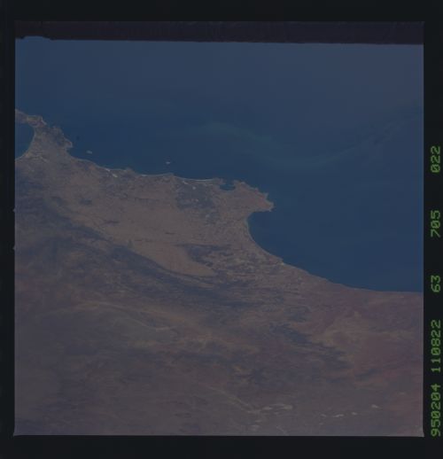
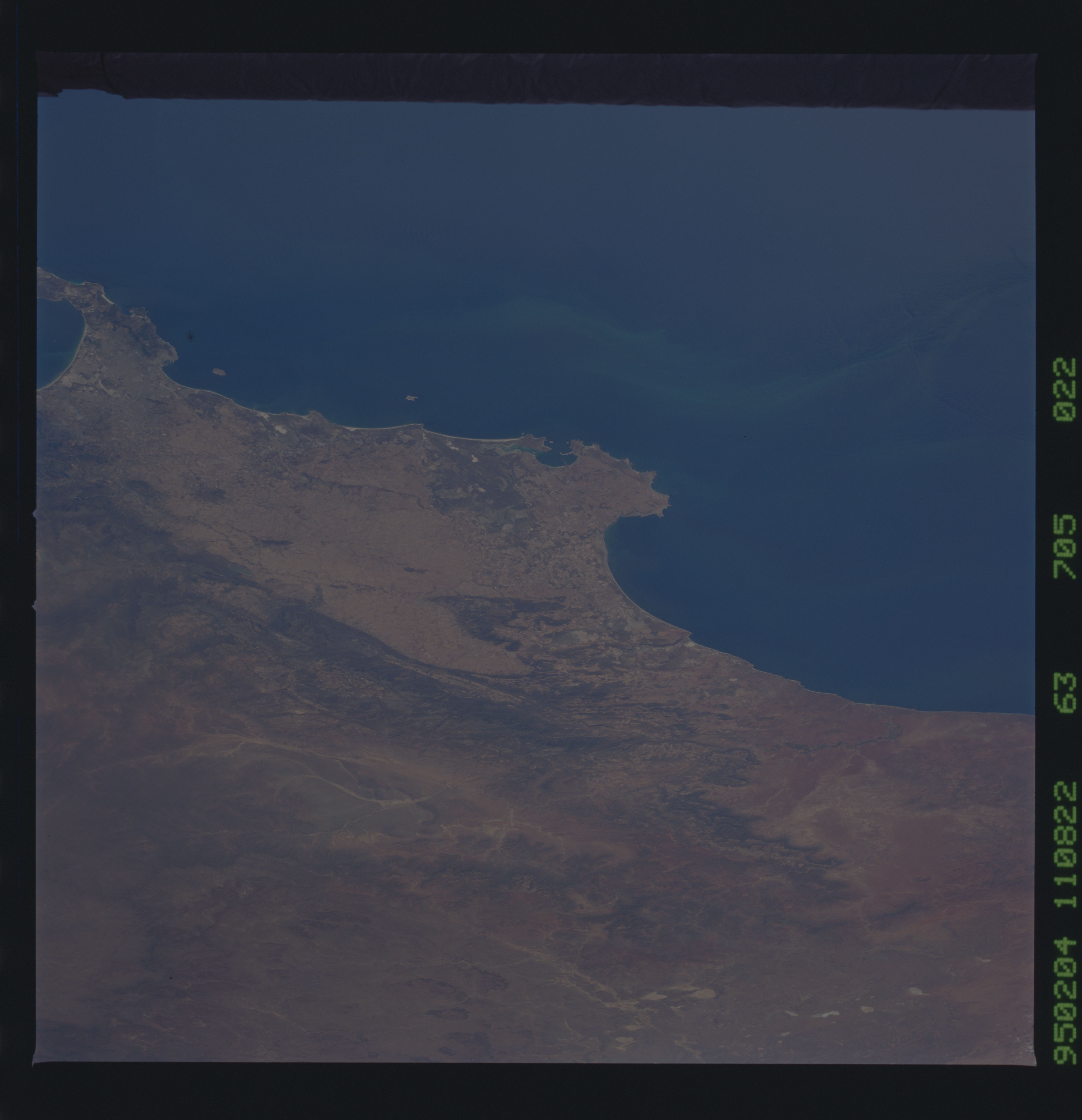
Spacecraft nadir point: 34.9° S, 15.2° E
Photo center point: 33.0° S, 19.0° E
Photo center point by machine learning:
Photo center point: 33.0° S, 19.0° E
Photo center point by machine learning:
Nadir to Photo Center: Northeast
Spacecraft Altitude: 185 nautical miles (343km)
Country or Geographic Name: | REPUBLIC SOUTH AFRICA |
Features: | SALDANHA BAY, MOUNTAIN RA |
| Features Found Using Machine Learning: | |
Cloud Cover Percentage: | 0 (no clouds present) |
Sun Elevation Angle: | 71° |
Sun Azimuth: | 4° |
Camera: | Hasselblad |
Focal Length: | 100mm |
Camera Tilt: | 54 degrees |
Format: | 5046: Kodak, natural color positive, Lumiere 100/5046, ASA 100, standard base |
Film Exposure: | Normal |
| Additional Information | |
| Width | Height | Annotated | Cropped | Purpose | Links |
|---|---|---|---|---|---|
| 5700 pixels | 5900 pixels | No | No | Download Image | |
| 500 pixels | 518 pixels | No | No | Download Image | |
| 640 pixels | 480 pixels | No | No | Download Image |
Download Packaged File
Download a Google Earth KML for this Image
View photo footprint information
Download a GeoTIFF for this photo
Image Caption: The southwest coast of southern Africa from St. Helena Bay (large bay at center), to Table Bay at Cape Town (bottom, with Robben Island near entrance). The pier at the naval base and fishing port of Saldhanaha Bay can be seen in the small bay (center). False Bay is cut off by the bottom edge of the frame. What NASA scientists think to be a phytoplankton bloom appears offshore in the cold upwelled water off the Atlantic coast. Farmland, especially that used for wine growing, is found near the coast occupying the Mediterranian-like climate of the Southwest Cape Province; but inland of the mountains of the Karroo Desert is home to sheep farmers and little agriculture.
