STS062-98-97
| NASA Photo ID | STS062-98-97 |
| Focal Length | 250mm |
| Date taken | 1994.03.06 |
| Time taken | 15:45:56 GMT |
Resolutions offered for this image:
3904 x 3904 pixels 639 x 639 pixels 5700 x 5900 pixels 500 x 518 pixels 640 x 480 pixels
3904 x 3904 pixels 639 x 639 pixels 5700 x 5900 pixels 500 x 518 pixels 640 x 480 pixels


Cloud masks available for this image:
Spacecraft nadir point: 35.9° N, 102.7° W
Photo center point: 35.5° N, 105.5° W
Photo center point by machine learning:
Photo center point: 35.5° N, 105.5° W
Photo center point by machine learning:
Nadir to Photo Center: West
Spacecraft Altitude: 161 nautical miles (298km)
Camera: | Hasselblad |
Focal Length: | 250mm |
Camera Tilt: | 47 degrees |
Format: | 5048: Kodak, natural color positive, Lumiere 100x/5048, ASA 100x, standard base |
Film Exposure: | Normal |
| Additional Information | |
| Width | Height | Annotated | Cropped | Purpose | Links |
|---|---|---|---|---|---|
| 3904 pixels | 3904 pixels | No | No | Earth From Space collection | Download Image |
| 639 pixels | 639 pixels | No | No | Earth From Space collection | Download Image |
| 5700 pixels | 5900 pixels | No | No | Download Image | |
| 500 pixels | 518 pixels | No | No | Download Image | |
| 640 pixels | 480 pixels | No | No | Download Image |
Download Packaged File
Download a Google Earth KML for this Image
View photo footprint information
Download a GeoTIFF for this photo
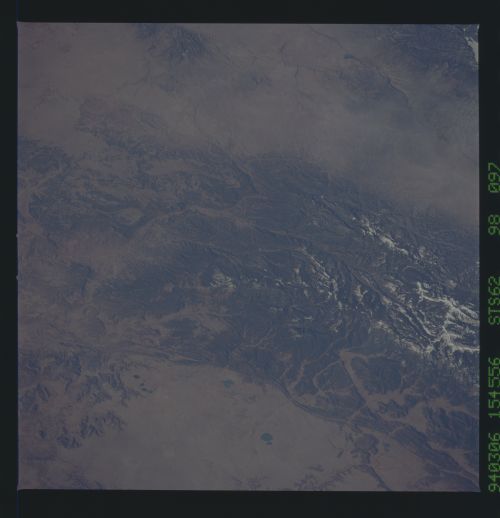
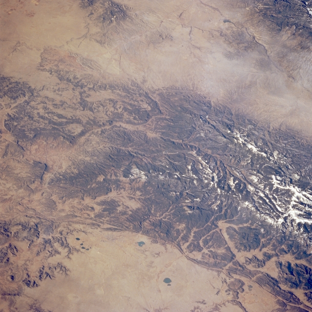
Image Caption: STS062-098-097 Santa Fe Trail, New Mexico, U.S.A. March 1994
The southern tip of the forested and partially snow-covered Sangre de Cristo Mountains occupies much of this low-oblique, southwest-looking photograph. The two roughly oval, dark lakes and reservoirs (bottom center of the photograph) pinpoint Las Vegas, while Santa Fe appears to the west along the southwestern edge of the Sangre de Cristo Mountains. Interstate Highway 25, formerly known as the Santa Fe Trail, connects these two cities as it winds along the southern tip of the mountains. The north-south aligned canyon in the middle of the mountains is the headwater area of the Pecos River. A small section of the Rio Grande and its rift system are visible (upper right corner).
The southern tip of the forested and partially snow-covered Sangre de Cristo Mountains occupies much of this low-oblique, southwest-looking photograph. The two roughly oval, dark lakes and reservoirs (bottom center of the photograph) pinpoint Las Vegas, while Santa Fe appears to the west along the southwestern edge of the Sangre de Cristo Mountains. Interstate Highway 25, formerly known as the Santa Fe Trail, connects these two cities as it winds along the southern tip of the mountains. The north-south aligned canyon in the middle of the mountains is the headwater area of the Pecos River. A small section of the Rio Grande and its rift system are visible (upper right corner).
